
What is the Nepean River
What is the Nepean River?
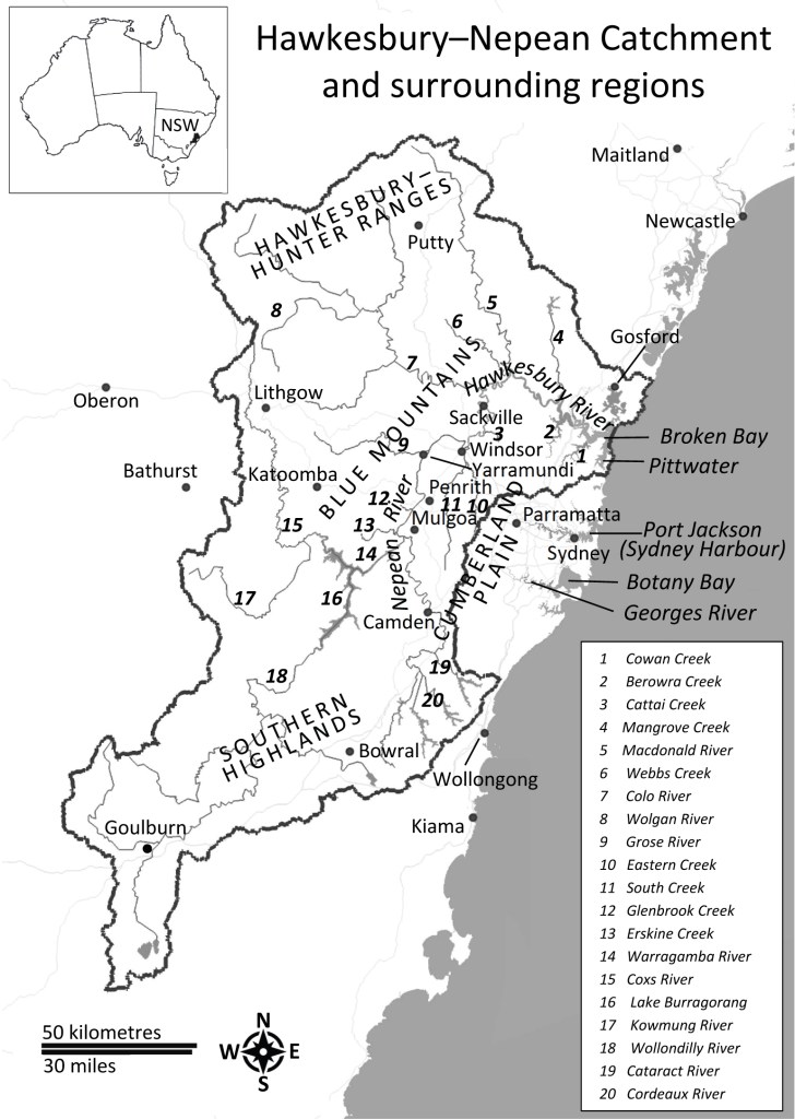
The Nepean River is the upper catchment of the larger Hawkesbury-Nepean River system, which extends from Robertson in the east, south to Goulburn, west into the Blue Mountains and north to Broken Bay.
The Nepean River is the section of the catchment upstream of the junction with the Grose River at Yarramundi.

Captain Watkin Tench named the Nepean River on June 27th, 1789, during an expedition west from Rose Hill (Parramatta), noting its broad expanse and depth, and naming it after Evan Nepean, the Home Office Under-Secretary who organised the First Fleet.
Governor Arthur Phillip named the Hawkesbury River in 1789, specifically during an expedition in June of that year, honouring Charles Jenkinson, the Baron Hawkesbury, who was a British statesman and President of the Board of Trade. Phillip explored the river’s mouth earlier in March 1788 but formally named it on his second, more extensive voyage in June 1789.
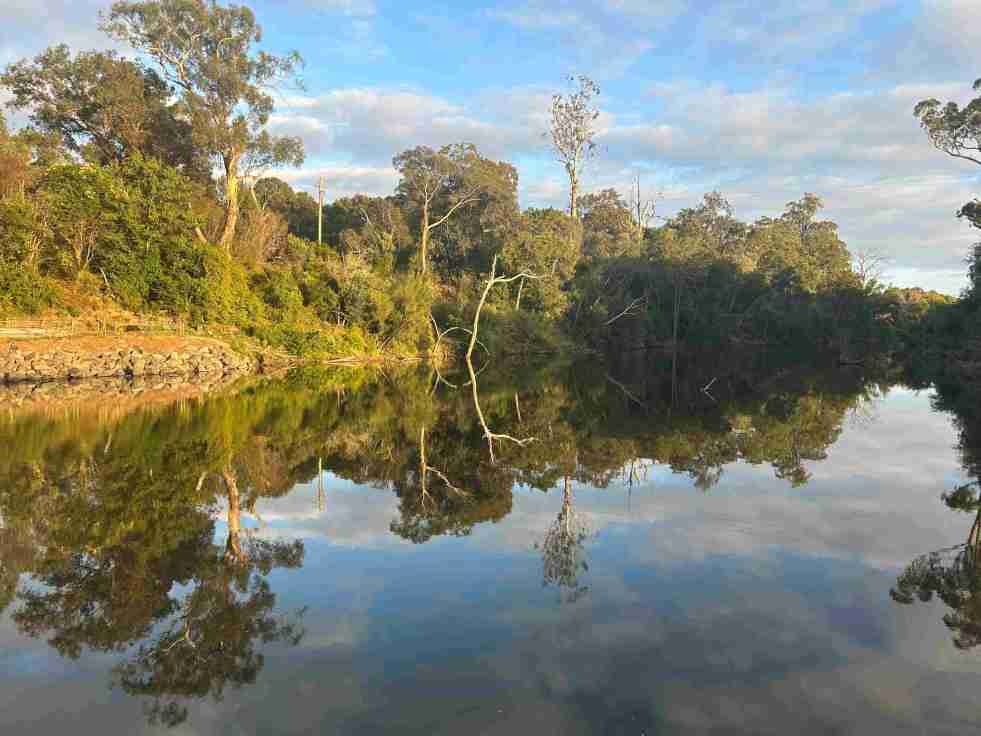
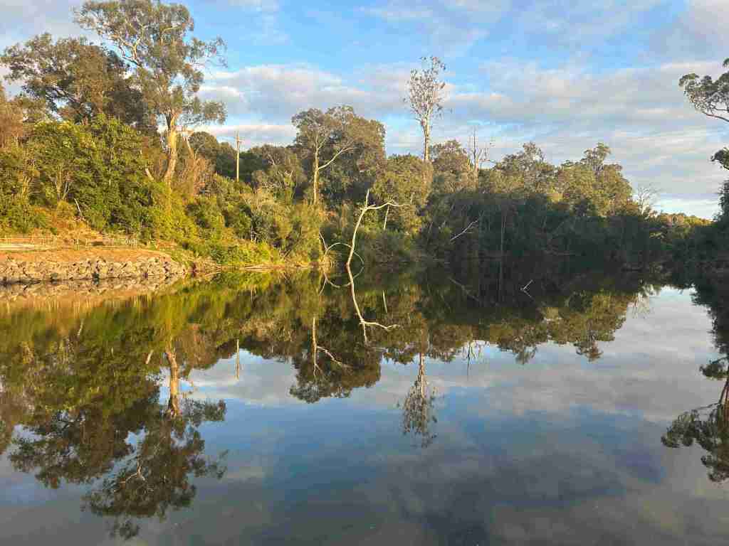
Upper Nepean River
Discussion in this project will be restricted to the Nepean River upstream of the Bents Basin sandstone gorge. For convenience, I will call this catchment area the Upper Nepean River.

Complex history
The Upper Nepean River, which will be discussed on this blog, has a complex history with many interconnecting stories and layers that few people really understand, and there is little or no overview or integration.
The river is the dominant geographic feature of the settlements along the Upper Nepean and has shaped the response of communities, Indigenous and European, to their location.
Floods and droughts have been the driving factors shaping daily lives, events, and culture since people occupied the river basin.
The main European settlements are Camden, Narellan, Cobbitty, Menangle, Mount Hunter, The Oaks, Oakdale, Picton, Wilton, Douglas Park, Thirlmere and Bargo.
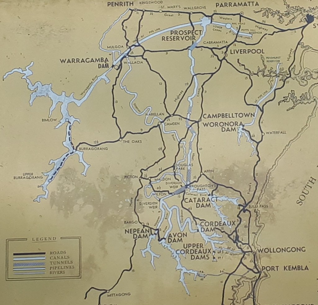
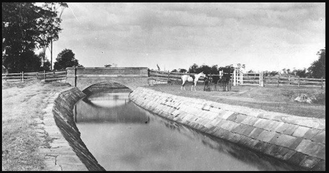
The most important engineering works in the Upper Nepean River catchment was the Upper Nepean Water Supply Scheme of the late 19th and early 20th century.
Reflection
The Upper Nepean River is the most important natural feature of this geographic area, and human activity has had significant cultural impacts on it.
Indigenous peoples and Europeans have both had to respond to the area’s landform, dominated by the river and its behaviour.
The cultural landscape has been shaped by these factors for Indigenous people and Europeans.
The river has shaped the construction of a sense of place and community identity.
Resources
Karskins, Grace 2020, Dyarubbin: Mapping Aboriginal history, culture and stories of the Hawkesbury River, New South Wales. Dept of Customer Services, NSW Government, Sydney. Online at https://portal.spatial.nsw.gov.au/portal/apps/MapSeries/index.html?appid=82ae77e1d24140e48a1bc06f70f74269# (Viewed 28 December 2025)
Brainwood, Meredith & Burgin, Shelley & Byrne, Maria. (2008). The role of geomorphology in substratum patch selection by freshwater mussels in the Hawkesbury-Nepan River (New South Wales), Australia. Aquatic Conservation: Marine and Freshwater Ecosystems. 18. 1285 – 1301. 10.1002/aqc.949.
Discover more from Camden History Notes
Subscribe to get the latest posts sent to your email.

