
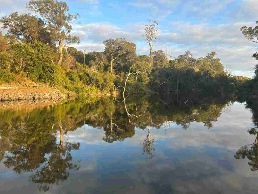
The Upper Nepean River is the upper catchment of the Hawkesbury-Nepean system, extending over 470 km from Goulburn to the Hunter Valley. Named in 1789, it has a complex history shaped by floods, droughts, and the settlements of Indigenous peoples and Europeans, significantly influencing the region's culture and land use.
Category: Cobbitty

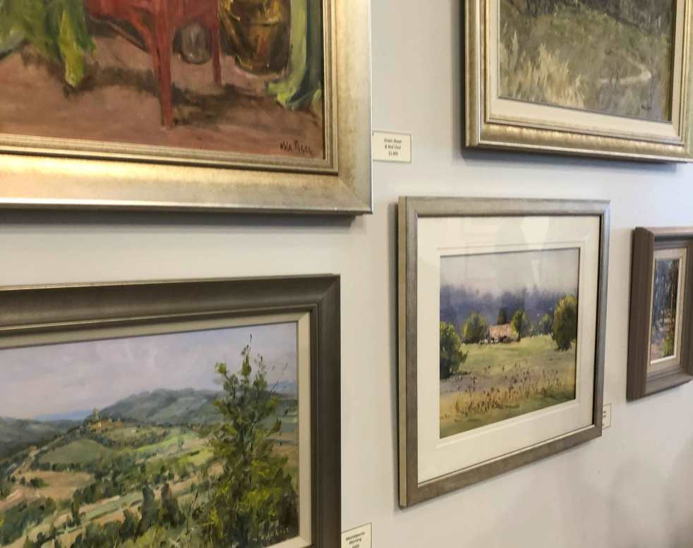
Exploring ‘Just the Two of Us’ at Tegel Gallery 581
The Tegel Gallery 581 in Cobbitty, NSW, launched the exhibition 'Just the Two of Us' featuring 100 paintings by local artists Nola Tegel and Patricia Johnston. This collection reflects their artistic journeys and love for the Camden countryside and their travels. The exhibition runs until 27 October 2024, excluding certain dates.
Share this:

Share this:
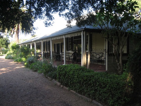
Denbigh Open Days: Exploring Historic Colonial Farm
Denbigh, a significant colonial farming complex in Australia, recently opened its gardens to the public for a rare charity viewing. The property, with a dark history of conflict and anxiety, reveals layers of history from dispossession of Aboriginal lands to dairying and urban invasion. Denbigh's fortified structures reflect the fear and violence of the Cowpastures frontier.
Share this:

Share this:
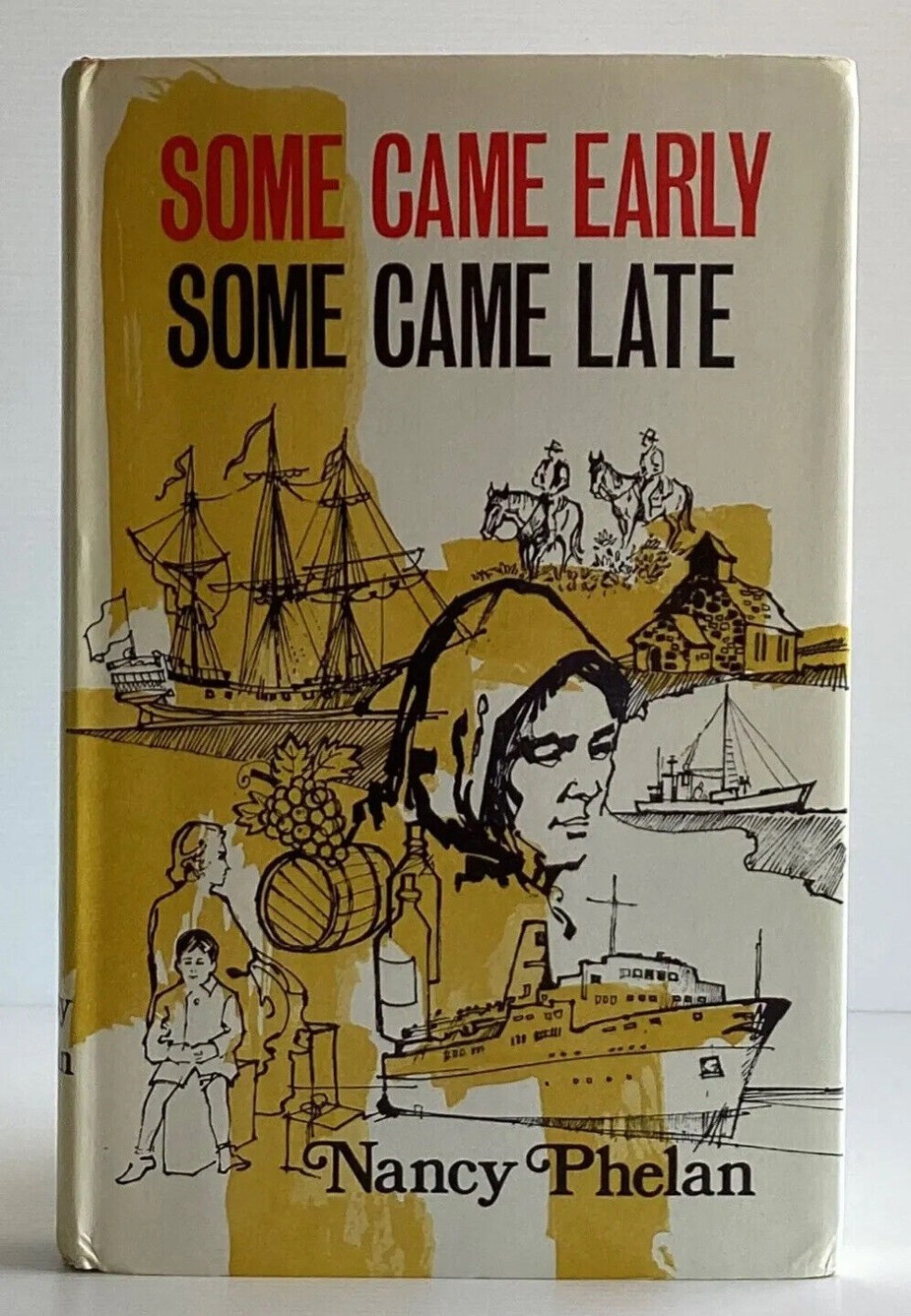
Nancy Phelan’s Reflections on the English Resemblance of Cobbitty, NSW
Australian writer Nancy Phelan's "Some Came Early Some Came Late" (1970) explores the historical significance of the Cobbitty region in New South Wales, focusing on the efforts of early colonial English immigrants to recreate a 'little England'. Phelan's unique perspective, influenced by her own experiences and observations, offers a fresh and captivating view of the region's history, accentuating the deep emotional ties and cultural significance.
Share this:

Share this:

The Camden district, 1840-1973, a field of dreams
The Camden district was historically significant, serving as a social and economic center for over a century. It integrated farming, mining, and community life, shaped by Aboriginal heritage and European settlement. However, modern developments and infrastructural changes led to its decline, transitioning to a regional identity tied to Macarthur area governance and branding.
Share this:

Share this:
The Cowpastures’ English-styled-gentry and their private villages
A certain type of self-styled-English gentry created a landscape in their own vision in the Cowpastures.
Share this:

Share this:
Camden, the best preserved country town on the Cumberland Plain
The historic town of Camden is hailed by architect Hector Abrahams as the best-preserved country town on the Cumberland Plain. Established in 1840, it offers a glimpse of Victorian and early 20th-century charm. Visitors can explore its heritage precinct, rural landscapes, historic villages, and even relive the town's aviation history.
Share this:

Share this:
The Roy Dowle collection and old photographs
Old photographs are a glimpse into the past and capture many memories of another time. The Roy Dowle Glass Plate collection at The Oaks Historical Society is a source of many local images.
Share this:

Share this:

Camden Heritage Conservation Area – an English-style village in the Cowpastures
The Macarthur private village of Camden was located in the English style countryside of the Cowpastures countryside with its gentry estates and villages. Founded in 1840 it was all part the British imperial imperative and the settler colonial project that came with it.
Share this:

Share this:
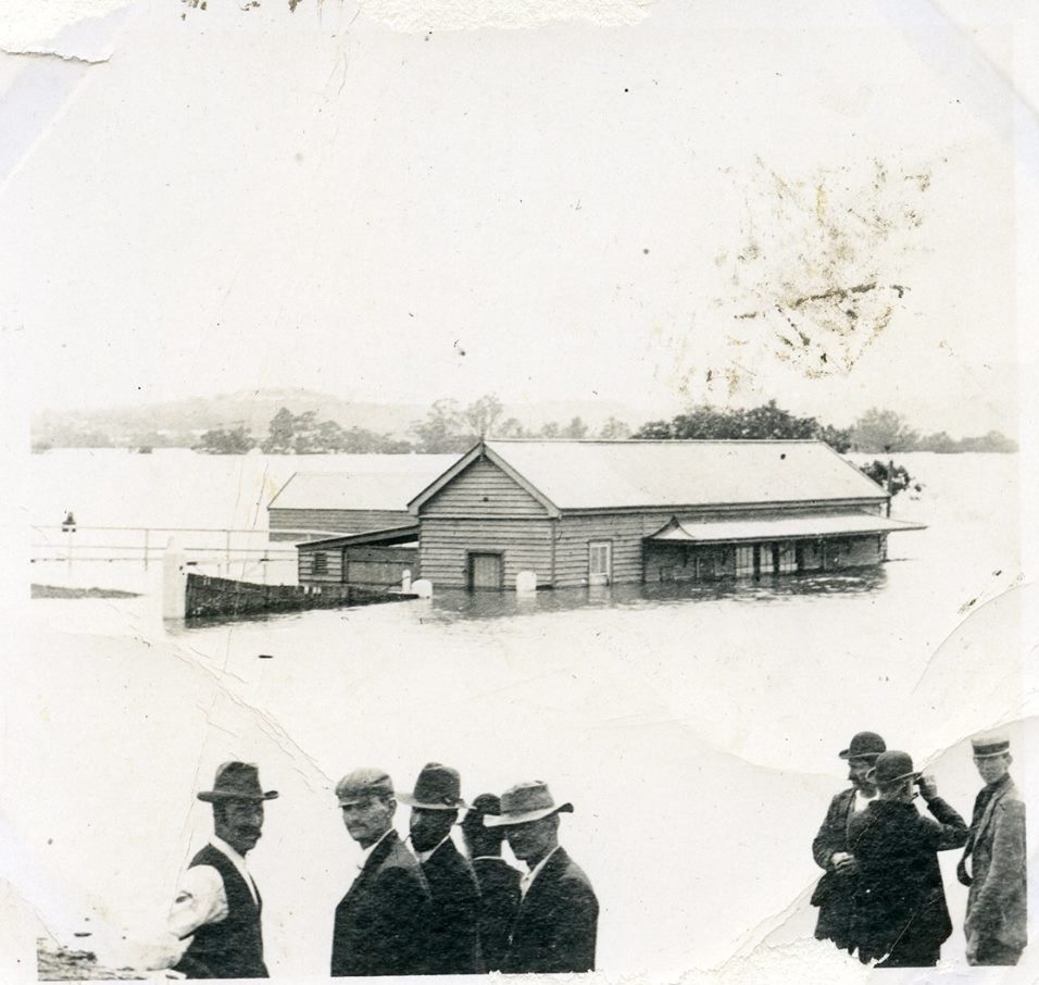
The hidden dangers of Camden’s bathtub effect
The Nepean River's 'bathtub effect' refers to the unique flooding impact created by the river's landform. The Hawkesbury-Nepean River's four gorges result in localized floodplains, causing a 'bathtub effect' during periods of high rainfall. These characteristics make the area susceptible to significant flood risk, impacting local communities.

