
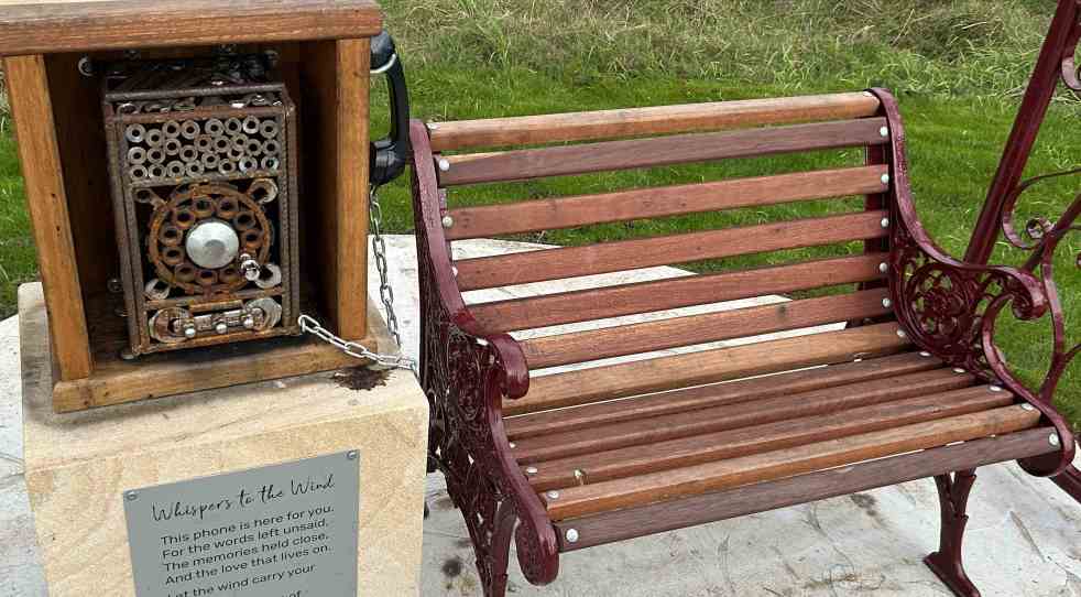
A new art installation, "Whispering in the Wind," has been unveiled along the Nepean River Trail in Camden, NSW. Created by artist Quinton Laws using recycled materials, the wind phone provides a space for reflection and connection for those grieving. Inspired by global installations, it encourages open expression of emotions.
Category: Community identity

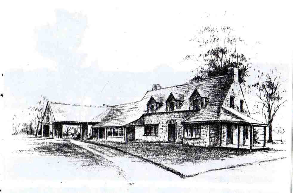
Camden’s Unique Interwar Tudor Revival Milk Bar
The Camden Vale Inn Milk Bar, opened in 1939, was created to promote disease-free milk from Camden Park Estate during a period of health awareness. Designed in an 'Old English' style by architect Cyril Ruwald, it featured drive-through service and supported the Red Cross during WWII. It later evolved into a restaurant and hotel.
Share this:

Share this:

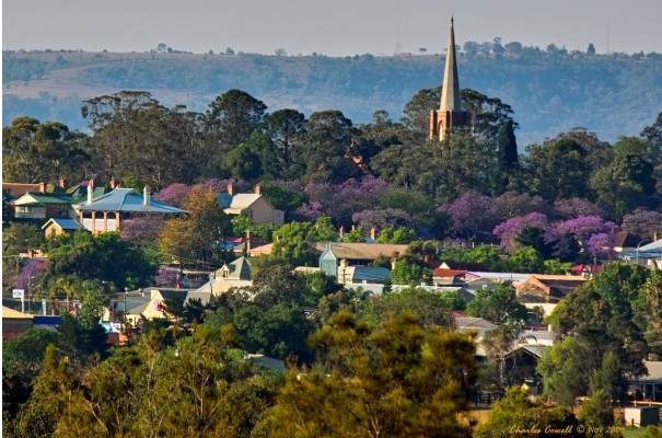
Exploring Opportunities for Macarthur’s Visitor Economy
The 'Macarthur Together' forum brought together tourism operators, businesses, and local government to collaborate on promoting the Macarthur region. Held at the Australian Botanic Garden Mount Annan, the event focused on enhancing visitor experiences through cooperation, showcasing local authenticity, and leveraging social media. The potential impact of Western Sydney International Airport on tourism was also discussed.
Share this:

Share this:

Jet into the Weekend with Western Sydney International (Nancy-Bird Walton) Airport
Western Sydney International Airport offers a gateway to diverse weekend getaways, from local adventures to international travel. Its design integrates natural elements, reflecting Australian culture and providing a calming atmosphere. With 24/7 operations and various airline partnerships, it simplifies travel, encouraging exploration of the surrounding regions and unique experiences.
Share this:

Share this:
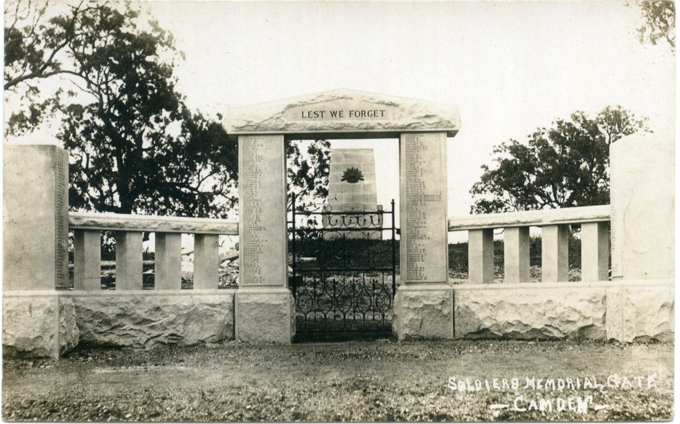
Camden’s Anzac Precinct: A Historical Reflection
Camden’s World War One Anzac precinct, located in Macarthur Park, features a cenotaph, memorial gates, and war trophy guns that commemorate local soldiers' sacrifices. The memorials were completed in 1922 amid mixed community support. Over time, the precinct has become a sacred site, reflecting shifting attitudes toward remembrance and honouring the war dead.
Share this:

Share this:
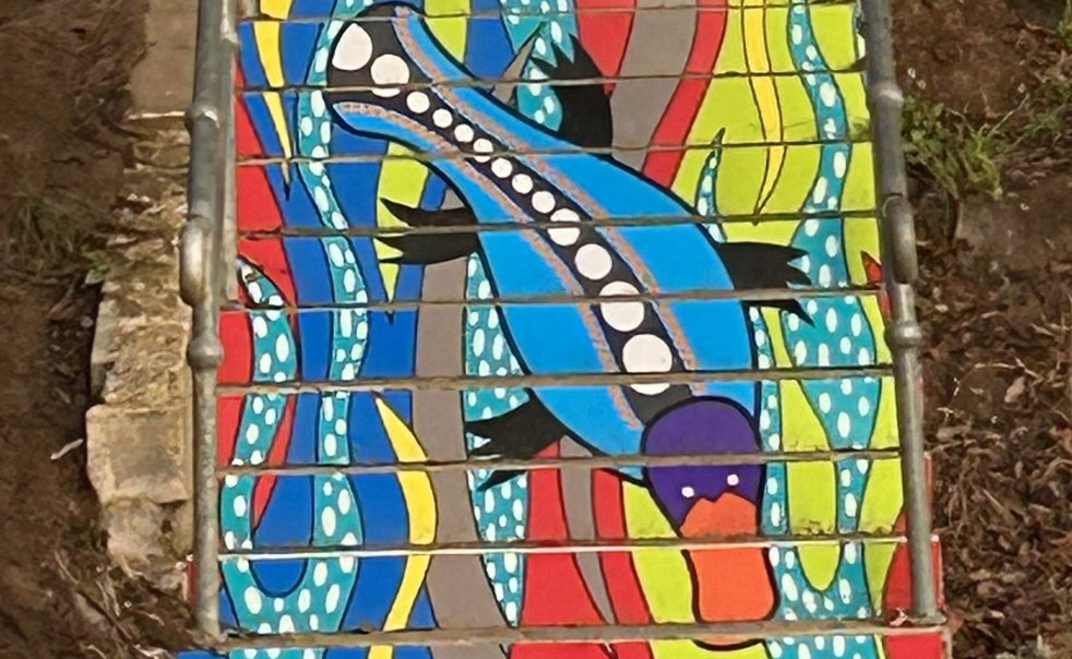
Exploring ‘By the River’: A Public Art Installation in Camden
Danielle Mate's art installation, "By the River," adorning the stairs between Chellaston Reserve and Little Sandy footbridge, features a platypus motif that reflects local Indigenous heritage. Commissioned by Camden Council and developed with community input, it enhances the area while celebrating its rich cultural history and ecology.
Share this:

Share this:

Exploring Little Sandy: Camden’s Hidden Gem
Little Sandy, a cherished location on the Nepean River in Camden, is celebrated for its rich community history and the memories it holds for locals. Enhanced by the Camden Weir, it features a modern footbridge and Aboriginal-inspired artwork, symbolizing its cultural significance as a site of gatherings, swimming, and personal milestones.
Share this:

Share this:

Exploring the Camden story through collective memory and community history
The Camden story represents a rich tapestry of community history, emphasizing narratives from marginalized voices. It highlights how cultural memory, shaped through oral traditions and historical artifacts, fosters shared identity. Essential sites like museums and monuments facilitate the transmission of collective memories, preserving the community's past and influencing its identity.
Share this:

Share this:

Balancing Heritage and Development in Australia
The Centre for Independent Studies argues that NSW heritage laws exacerbate the housing affordability crisis by preserving unremarkable buildings, thus restricting development. It critiques a narrow economic view of heritage that neglects community values, highlighting that a broader understanding of heritage's social and economic benefits is essential for sustainable urban planning.
Share this:

Share this:
HERITAGE STUDY CAMDEN NEW SOUTH WALES Documentary Evidence addressing criteria for statutory heritage listing
The Camden Township Heritage Study highlights Camden's unique historical and cultural significance, being an unofficial town established in 1836. Its intact colonial architecture, exceptional planning, and connection to influential figures like John Macarthur contribute to its character. The study emphasizes the need to protect Camden's heritage from inappropriate development for economic and cultural sustainability. In 2023 the Camden Residents Action Group prepared a document to assist is application to address the criteria for heritage listing in New South Wales, authored by Glenda Davis.

