
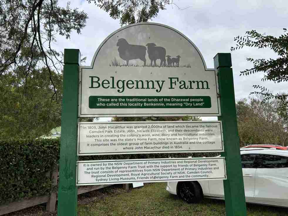
The Belgenny Farm Pioneer Farm Day successfully engaged visitors with Australia’s oldest farming complex, showcasing historical trades, games, and tours despite overcast weather. Families enjoyed activities like croquet and scavenger hunts, emphasizing the site's rich agricultural history and cultural significance. The event highlighted community involvement and fostered appreciation for heritage.
Category: Technology


Jet into the Weekend with Western Sydney International (Nancy-Bird Walton) Airport
Western Sydney International Airport offers a gateway to diverse weekend getaways, from local adventures to international travel. Its design integrates natural elements, reflecting Australian culture and providing a calming atmosphere. With 24/7 operations and various airline partnerships, it simplifies travel, encouraging exploration of the surrounding regions and unique experiences.
Share this:

Share this:

Exploring the Penrith Museum of Printing
The Penrith Museum of Printing, part of History Week 2018 in New South Wales, showcases operational printing presses from 1860 to 1970. Visitors learn about traditional printing techniques through live demonstrations. Established in 2001, the museum highlights the evolution of local newspapers and the significant role of printers and compositors.
Share this:

Share this:

AI Transforming History Education: Opportunities & Challenges
The integration of AI into history education is transforming teaching methods and enhancing access to resources, promoting critical thinking among students. However, educators face challenges like increased anxiety and the risks of AI inaccuracies. The American Historical Association recommends guidelines to effectively incorporate AI while maintaining traditional pedagogical practices.
Share this:

Share this:
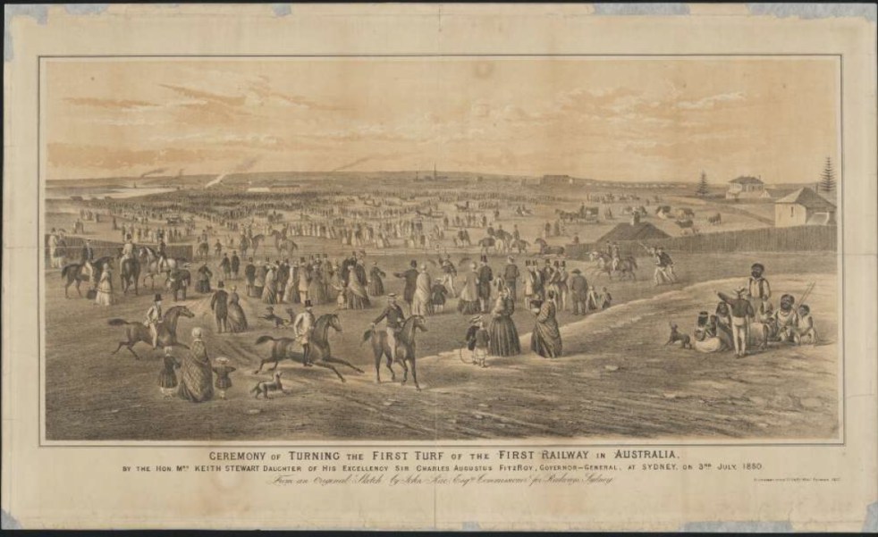
A Camden connection to the first railway line in New South Wales
26 September 1855 A forgotten anniversary of Sydney’s Central Railway Station On 26 September 1855, the first train left the Sydney terminus, a ‘tin shed’, with great pomp and ceremony and thus began the great railways of New South Wales. The ‘tin shed’ was replaced by two further buildings, one opened in 1874, and the current grand Victorian edifice of brick and sandstone in 1906.
Share this:

Share this:
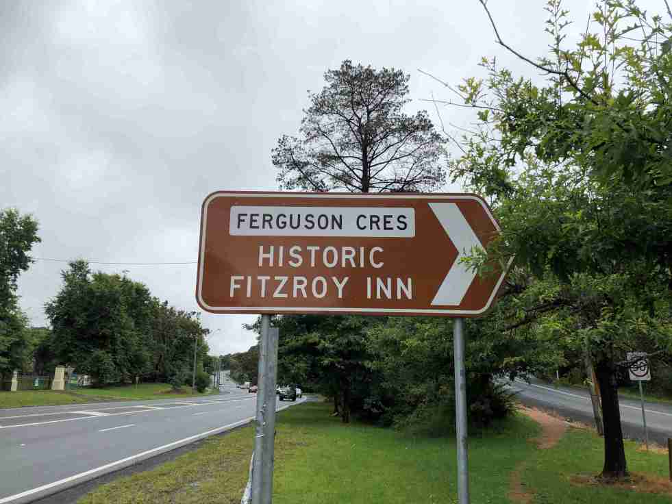
Ferguson’s Nursery, the post-war years
During the post-war years, Ferguson's Nurseries continued to be located on Sydney’s urban fringe as the metropolitan area expanded into the rural surrounds.
Share this:

Share this:
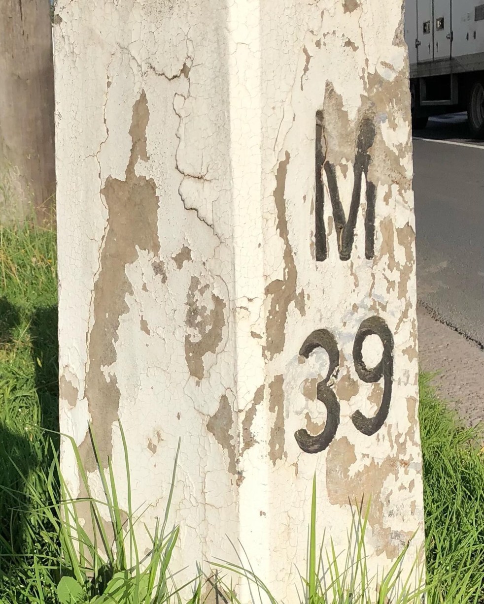
Mileposts captured the distance of the past
The white concrete mileposts in Camden, remnants of the Hume Highway, mark distances to destinations like Sydney and Mittagong. Originating from Roman times, these posts were part of a 1934 initiative to standardize road markers in NSW, aiding both travelers and road maintenance. They reflect Camden's cultural and engineering heritage.
Share this:

Share this:

Mundane objects tell an interesting story
Utility covers are mundane objects that tell interesting stories about the past in an area. Others consider then to be a form of street art and street aesthetic.
Share this:

Share this:
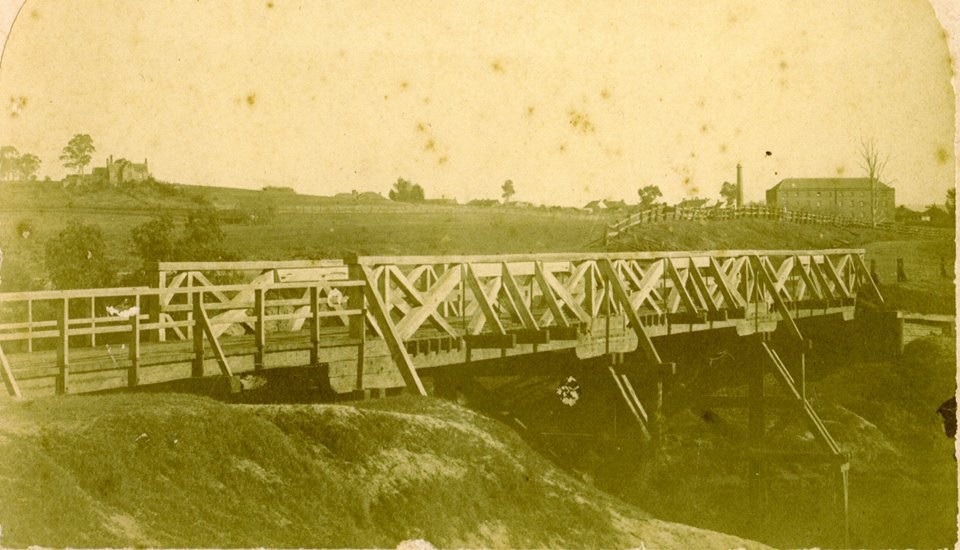
The Cowpastures bridge at the Nepean River crossing
Access across the Nepean River has been an issue since European settlement. The problem was solved by building a bridge with the first in 1826, the next in 1860 followed by 1900 and 1976.
Share this:

Share this:
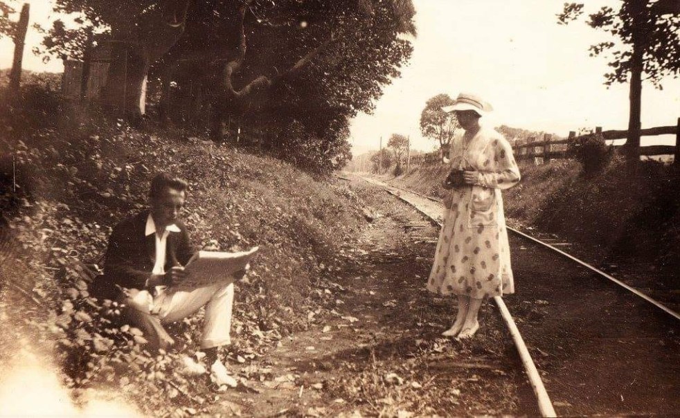
The mysteries of a photograph
How the mysteries of a pretty picture from yesteryear allows you to peel back the layers of the past. Each layer has a meaning and a story that is told by the historian. The stories provide context for the photograph and give it greater meaning.

