
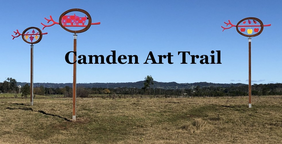
The Camden Public Art Trail, officially opened in June 2024, connects the Nepean River to Camden Town Farm and features stunning artwork installations across a 4.2-kilometer walkway. Funded by the NSW Government, the trail celebrates local heritage and ecology while providing an accessible outdoor experience for visitors, though dogs are not permitted.
Category: Floods

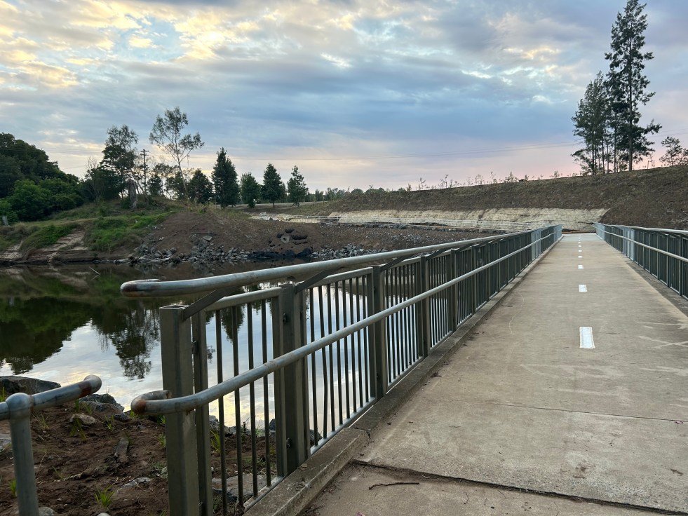
Little Sandy Footbridge Reopens: A Community Treasure
The Little Sandy Footbridge in Camden has reopened, restoring an essential link in the Nepean River Trail after extensive flood-related repairs. Originally constructed during WWII, the bridge has been a beloved community feature, supporting recreational activities for over a century. The project was funded by government sources, totaling $3.7 million.
Share this:

Share this:

Exploring Historical Themes: Pictorial History Camden & District Presentation Summary
This presentation examined the role of the historian and researcher and presented the importance of history and the role of a historian. Dr Ian Willis discussed the significance of historical consciousness and collective memory, emphasising the role of a historian as a researcher, analyst, interpreter, and storyteller. The presentation also highlighted "Pictorial History Camden & District," a book by Kingsclear Books, and covered aspects such as structure, select bibliography, index of names, and district maps. Additionally, various related sources and themes, such as the Whiteman and Macarthur families, were explored. The presentation concluded with suggestions for experiencing the past through community festivals, local studies, and living libraries.
Share this:

Share this:

The Camden district, 1840-1973, a field of dreams
The Camden district was historically significant, serving as a social and economic center for over a century. It integrated farming, mining, and community life, shaped by Aboriginal heritage and European settlement. However, modern developments and infrastructural changes led to its decline, transitioning to a regional identity tied to Macarthur area governance and branding.
Share this:

Share this:

Camden, a Macarthur family venture
The establishment of Camden, New South Wales, the town in 1840, was a private venture of James and William Macarthur, sons of colonial patriarch John Macarthur, at the Nepean River crossing on the northern edge of the family’s pastoral property of Camden Park. The town’s site was enclosed on three sides by a sweeping bend in the Nepean River and has regularly flooded the surrounding farmland and lower parts of the town.
Share this:

Share this:
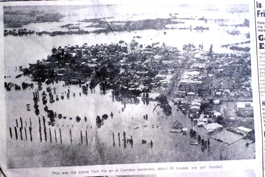
Flooding in the Hawkesbury-Nepean River Valley
The latest heavy rain in the area has sparked concerns about potential flooding, bringing back memories of past events. The Hawkesbury-Nepean River valley's unique landform features contribute to fast-rising and dangerous floods. This situation has led to considerable anxiety and trauma, prompting the need for emotional and trauma support in the affected communities.
Share this:

Share this:
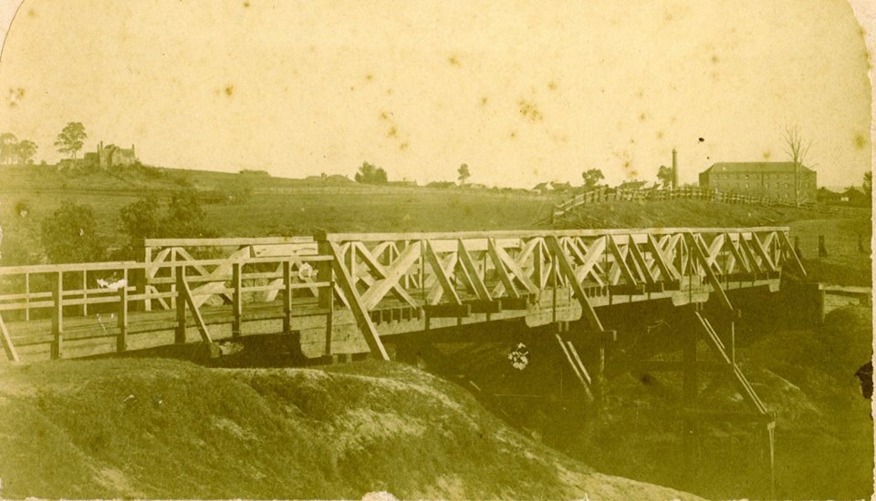
The Cowpastures bridge at the Nepean River crossing
Access across the Nepean River has been an issue since European settlement. The problem was solved by building a bridge with the first in 1826, the next in 1860 followed by 1900 and 1976.
Share this:

Share this:
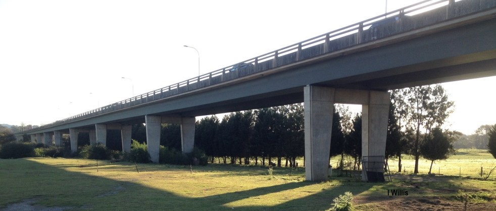
Macarthur Bridge
The Macarthur Bridge across the Nepean River at Camden NSW is an important engineering heritage item.
Share this:

Share this:
Camden, the best preserved country town on the Cumberland Plain
The historic town of Camden is hailed by architect Hector Abrahams as the best-preserved country town on the Cumberland Plain. Established in 1840, it offers a glimpse of Victorian and early 20th-century charm. Visitors can explore its heritage precinct, rural landscapes, historic villages, and even relive the town's aviation history.
Share this:

Share this:
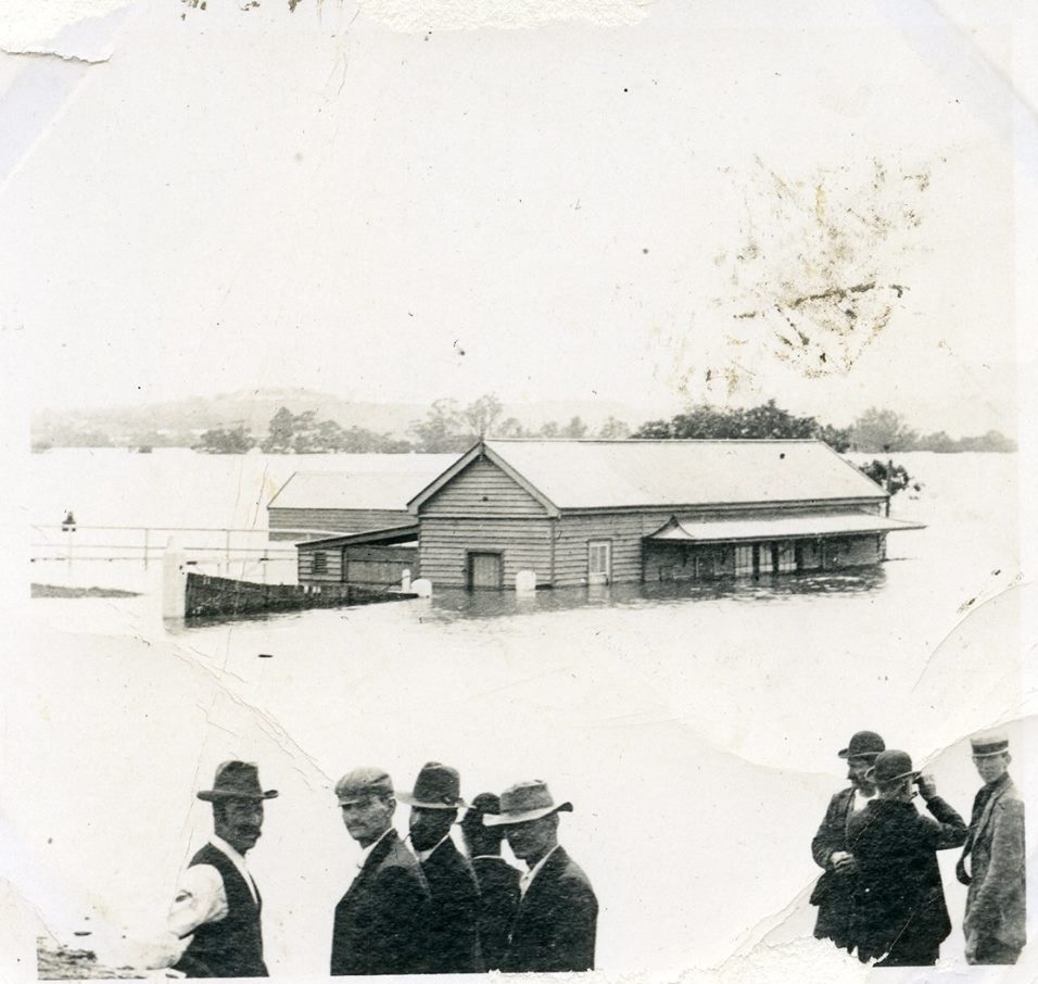
The hidden dangers of Camden’s bathtub effect
The Nepean River's 'bathtub effect' refers to the unique flooding impact created by the river's landform. The Hawkesbury-Nepean River's four gorges result in localized floodplains, causing a 'bathtub effect' during periods of high rainfall. These characteristics make the area susceptible to significant flood risk, impacting local communities.

