

The Macarthur Bridge across the Nepean River
The Macarthur Bridge across the Nepean River is one of the most critical parts of the economic and social infrastructure in the Macarthur area on Sydney’s south-western rural-urban fringe.
The bridge can also be regarded as one of the most items of engineering heritage in the Camden Local Government Area. The bridge provides a high-level flood-free crossing of the Nepean River which can isolate the township of Camden when the numerous low-level bridges in the area are flooded.
The low-level bridges are the Cowpasture Bridge (Camden), the Cobbitty Bridge and the Menangle Bridge.
History and Description
The Macarthur Bridge is named after one of the Camden district’s first land grantees John Macarthur and their pastoral holding of Camden Park, which the family still occupy. There are many descendants of the Macarthur family in the Camden district.
The naming of the bridge coincided with establishing the Macarthur Growth Centre as part of the Askin Government’s 1968 Sydney Region Outline Plan and The New Cities of Campbelltown Camden Appin Structure Plan. These plans were supported by the Australian Government’s own Growth Centres program.
These were exciting plans that were never fully realized by the planners. The New Cities Plan turned into a developer’s dream and hastened Sydney’s urban sprawl into the southern reaches of the Cumberland Plain. The Macarthur Region is one of those legacies.
![The New Cities Plan 1973[1]](https://camdenhistorynotes.com/wp-content/uploads/2016/07/the-new-cities-plan-19731.jpg)
The Macarthur bridge guaranteed flood free access from the Burragorang Valley coalfields to the Main Southern Railway at Glenlee for American shipping magnate Daniel Ludwig’s Clutha Development Corporation.
This development was considered important given the defeat of the Askin Liberal Government’s support for a proposal by Clutha for a rail link between the Burragorang coalfields and the Illawarra coastline. The Askin government passed special enabling legislation, which turned into one of the first environmental disputes in the Sydney basin in the early 1970s.
The high-level Macarthur Bridge allowed the diversion of coal trucks from the Burragorang Valley coalfields away from Camden’s main street, passing across the low-level Cowpasture Bridge from 1973. Coal trucks then travelled along Druitt Lane and over the Macarthur Bridge to the Glenlee Washery at Spring Farm.
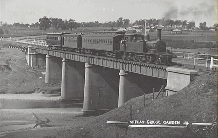
The flooding by the Nepean River of the road access to the township of Camden at the low-level Cowpasture Bridge had been a perennial problem since the town’s foundation in 1840.
In 2002 the NSW Minister for Transport replied to a question in parliament from Dr Elizabeth Kernohan, Member for Camden, about the bridge. The Minister stated
I am advised that Macarthur Bridge was built in the early 1970’s on the basis that most of the long distance traffic would use the F5. I am advised that the primary function of the Macarthur Bridge was for use as a flood relief route. It was built parallel to the Cowpasture Bridge at Camden to take the full traffic load when the Cowpasture Bridge is impassable.
I am advised by the Roads and Traffic Authority (RTA) that the bridge referred to was not specifically designed to be widened at a later date. (NSW Parliament, 8 May 2002)
Specifications
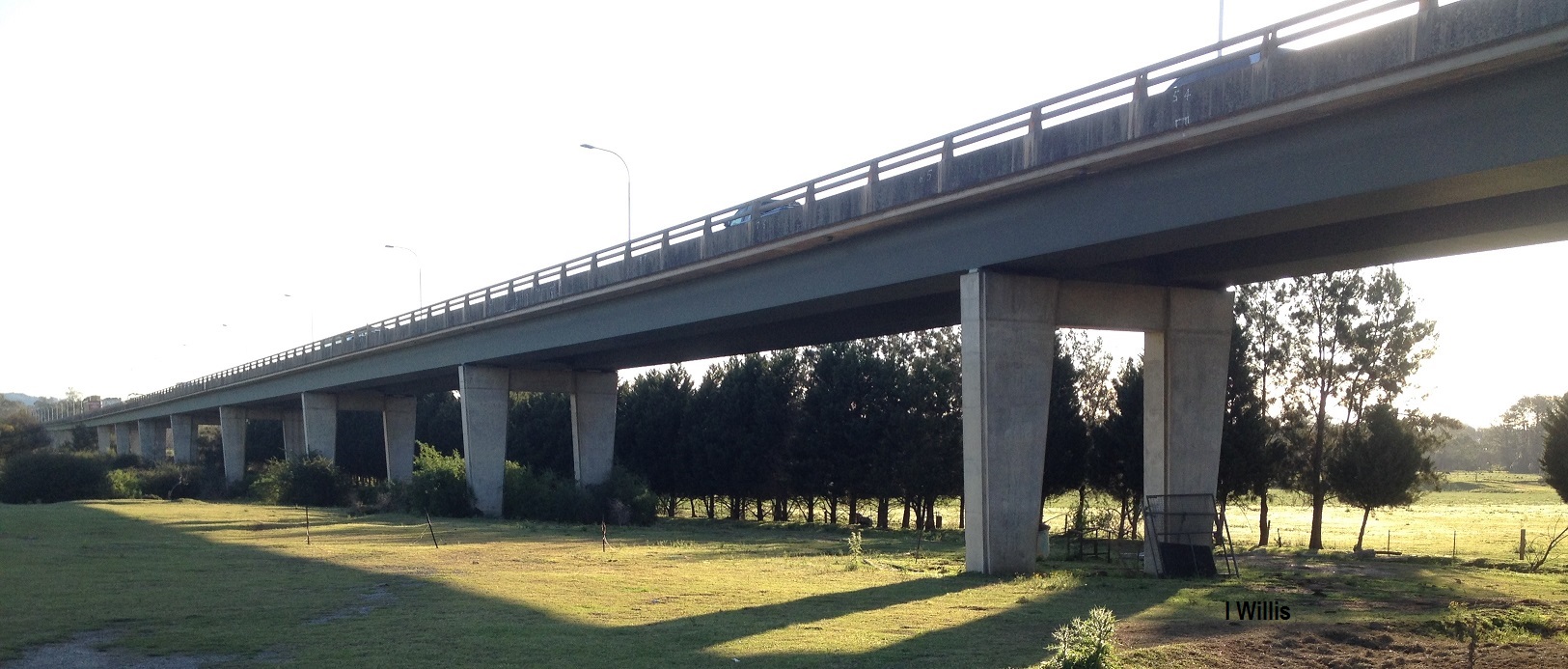
The Macarthur Bridge is a 26-span, 3380 feet (approximately 1.12 km) long concrete structure that carries the Camden Bypass across the Nepean River and its flood plain. The bridge was built between 1971 and 1973, originally to carry Hume Highway traffic, on a flood-free alignment around Camden.
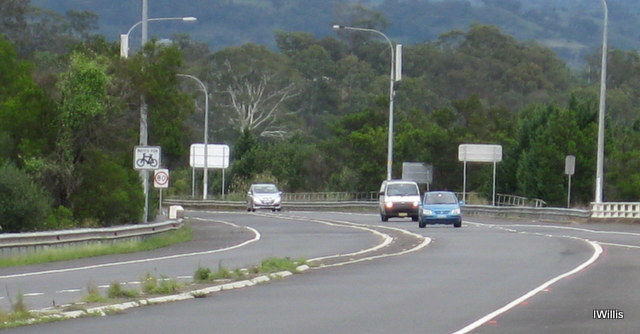
The Camden Bypass
The Camden Bypass is the former Hume Highway alignment between the localities of Cross Roads and Camden. It is marked as State Route 89. The proper route is from Cross Roads, skirting Camden via the Camden Bypass and ending at Remembrance Drive, another part of the former Hume Highway near Camden South.
The Camden Bypass was in turn bypassed in December 1980 when the section of what was then called the South Western Freeway (route F5) from Campbelltown to Yerrinbool was opened. It has grown in importance as a major arterial road linking the Hume Motorway, WestLink M7 and M5 South Western Motorway interchange at Prestons, near Liverpool, with Camden.
Open to traffic and construction details
The official plaque on the bridge states:
Macarthur Bridge.
The bridge was designed by the staff of the Department of Main Roads and is the longest structure built by the Department since its inception in 1925. Length (Overall) 3380 feet comprising 26 spans each of 130 feet long. Width between kerbs 30 feet with one footway 5 feet wide. Piled foundations (max 90 feet deep) were constructed by the Department’s Bridge construction organisation. Piers and superstructure by contact by John Holland (Constructions) Pty Ltd. Total cost of bridge £2,600,000.
RJS Thomas Commissioner for Main Roads
AF Schmids Assistant Commissioner for Main Roads
GV Fawkner Engineer-in-Chief
FC Cook Engineer (Bridges)
Department of Main Roads, New South Wales
Open to traffic on 26 March 1973
Memories
Facebook 30 June 2021
Annette DingleI remember the day it opened, the school ( Camden south) walked to it . I lived in the street under it ( it was a dead end back then ) we use to play in the “tunnels “ under the bridge. You could only go so far before there was no air . Fun times
Read more
State Route 89 on Ozroads Website Click here
State Route 12 on Paul Rands Website Click here
Updated 4 March 2022, 30 June 2021. Originally posted 6 January 2020
Discover more from Camden History Notes
Subscribe to get the latest posts sent to your email.


2 thoughts on “Macarthur Bridge”
Comments are closed.