
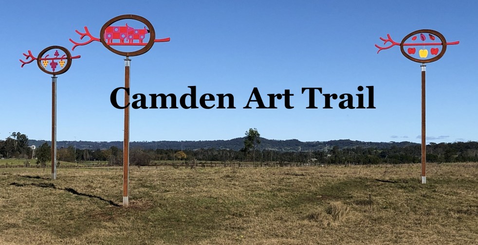
The Camden Public Art Trail, officially opened in June 2024, connects the Nepean River to Camden Town Farm and features stunning artwork installations across a 4.2-kilometer walkway. Funded by the NSW Government, the trail celebrates local heritage and ecology while providing an accessible outdoor experience for visitors, though dogs are not permitted.
Tag: Tourism

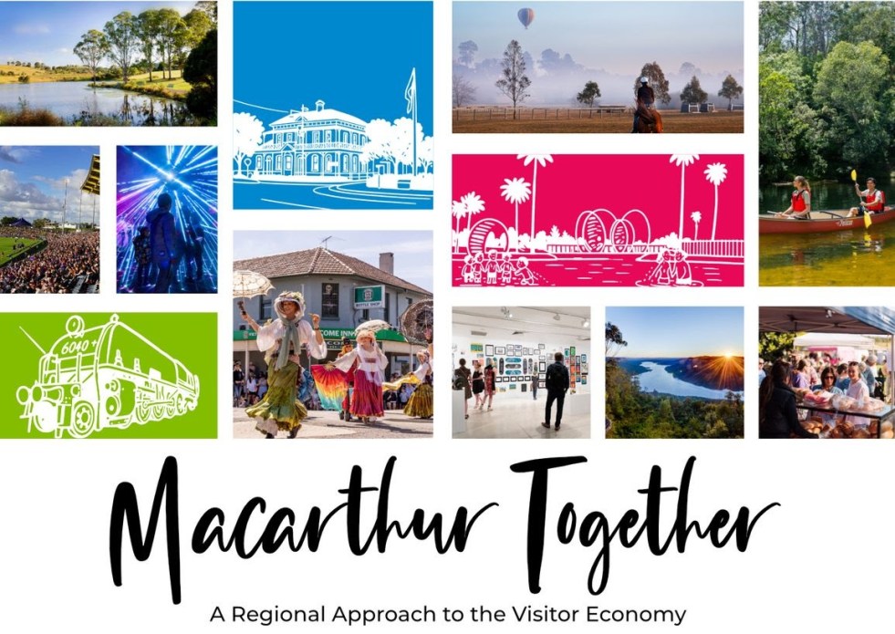
Exploring Opportunities for Macarthur’s Visitor Economy
The 'Macarthur Together' forum brought together tourism operators, businesses, and local government to collaborate on promoting the Macarthur region. Held at the Australian Botanic Garden Mount Annan, the event focused on enhancing visitor experiences through cooperation, showcasing local authenticity, and leveraging social media. The potential impact of Western Sydney International Airport on tourism was also discussed.
Share this:

Share this:

Jet into the Weekend with Western Sydney International (Nancy-Bird Walton) Airport
Western Sydney International Airport offers a gateway to diverse weekend getaways, from local adventures to international travel. Its design integrates natural elements, reflecting Australian culture and providing a calming atmosphere. With 24/7 operations and various airline partnerships, it simplifies travel, encouraging exploration of the surrounding regions and unique experiences.
Share this:

Share this:
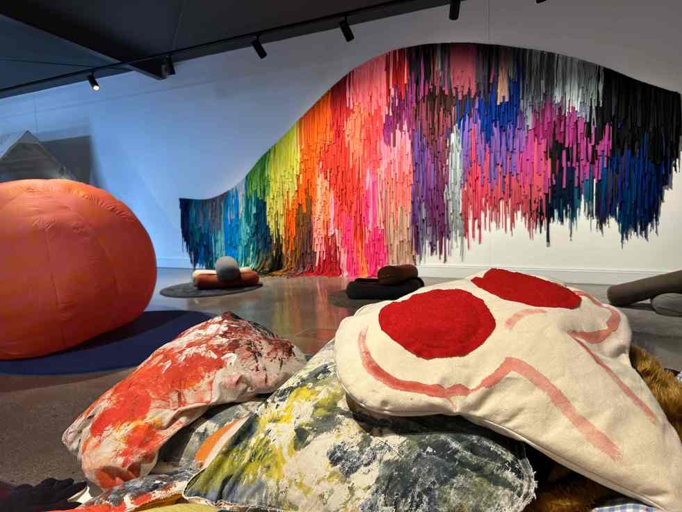
Uncover Artistic Gems in Regional and Suburban Australia
Across regional and suburban Australia, hidden art galleries offer vibrant cultural experiences often overlooked by tourists. These venues provide platforms for local artists and unique exhibitions, showcasing the rich artistic landscape of the country. Visiting these spaces fosters community connection and enriches local economies through art and tourism.
Share this:

Share this:
Exploring the Complexities of Western Sydney’s Identity
Western Sydney is a complex, diverse region with numerous communities, recognized by various government levels for planning and investment. Historically significant, it faces socio-economic disparities highlighted by the "Latte Line" and "Red Rooster Line." Recent developments, including the Western Sydney International airport, aim to enhance its identity and economic growth, fostering a sense of place.
Share this:

Share this:
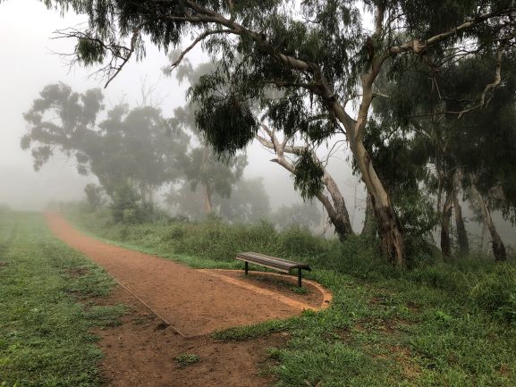
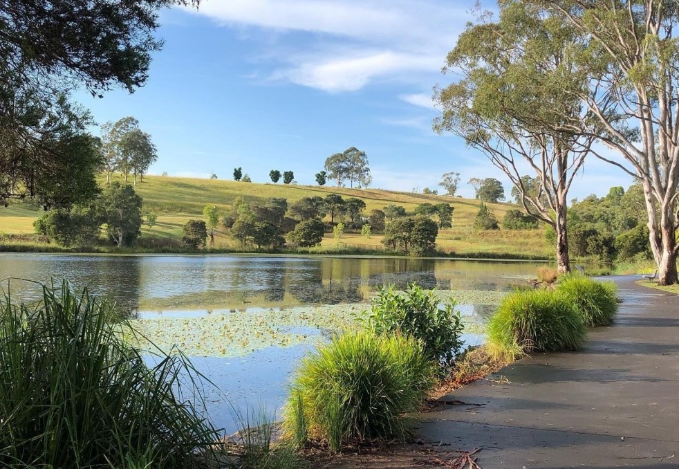
Top Walking Trails in Camden: Experience Walking the Cowpastures
Camden township, located in the historical Cow Pastures, features walking and cycling paths that reflect its Indigenous and colonial history. The Nepean River Trail, integrating various public artworks, enhances the area's historic character, while memorial walkways pay tribute to Australian service members. It's a site for both recreation and cultural immersion.
Share this:

Share this:
Exploring Your Hometown: Hidden Gems Await
Exploring your hometown can reveal hidden wonders and local history often overlooked. Resources like libraries and historical societies offer insights into the past, while nature provides adventurous experiences. Engaging with local culture, festivals, and unique culinary offerings can enhance your appreciation of familiar surroundings. Stay curious and discover the extraordinary in the ordinary.
Share this:

Share this:
Understanding the Camden Story: History, Community, and Identity
The Camden story encapsulates the rich tapestry of tales and histories that define the Camden community, including dreamtime legends and settler accounts. It offers insight into the community's values, identity, and resilience, serving as both a historical narrative and a tool for local businesses, fostering deeper connections among residents.
Share this:

Share this:

Camden Council vote on listing the Camden Township on the State Heritage Register
On 11 March 2025, Camden Council discussed a motion by Councillor Peter McLean to list Camden Township on the State Heritage Register, citing its significant historical and cultural value. Despite support from the Camden Historical Society and several councillors, the motion was ultimately defeated in a 6-3 vote, with concerns raised about its impact on businesses.
Share this:

Share this:
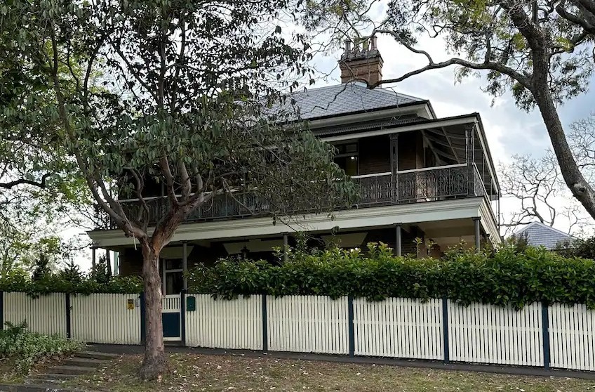
Dr Crookston’s Estate: A New Chapter in Camden’s Heritage
Dr Crookston's house and garden in Camden has been revitalized into an entertainment venue, preserving its rich history. New owners Shane and Rhiannon Smith manage this adaptive reuse, offering various activities that enhance heritage tourism. The estate now fosters local pride while contributing to economic growth, transforming the once-closed site into a vibrant community asset.

