
Camden, New South Wales, is recognized as the birthplace of Australian agriculture, boasting significant historical and contemporary agricultural sites. Despite rapid growth and new residents' limited awareness of its agricultural legacy, Camden remains a vital hub for agricultural research and education, blending rural lifestyle with community connections and open spaces.
Tag: rural-urban fringe

Narellan Town Centre Revitalization: a community-centric approach through placemaking
The redevelopment of Narellan Town Centre in 2017 enhanced its community space through placemaking, incorporating public art and amenities. Valued at $200 million, the extension nearly doubled its size, accommodating 100+ retailers and encouraging social interactions. The design reflects local history, fostering cultural identity and community engagement, achieving successful early usage by families.
Share this:

Share this:
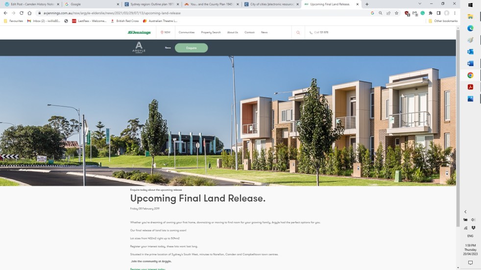
Elderslie land releases 2000-2023, the background and fancy estate names
The Elderslie area has been identified in Sydney’s strategic growth plans for land releases on the metropolitan rural-urban fringe. It is a valuable exercise to see how and when Elderslie was identified as part of Sydney’s planning framework.
Share this:

Share this:
Making Camden History
Making Camden History tells the story of how the history of the Camden District has been written from the 19th century. It is the history of the history of the local area.
Share this:

Share this:
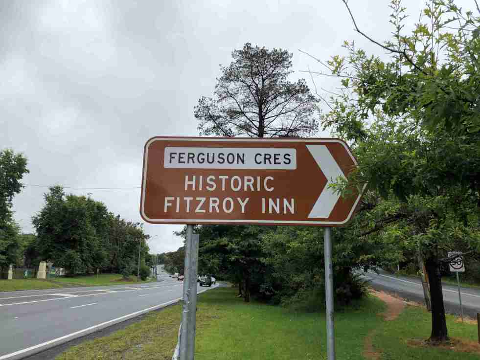
Ferguson’s Nursery, the post-war years
During the post-war years, Ferguson's Nurseries continued to be located on Sydney’s urban fringe as the metropolitan area expanded into the rural surrounds.
Share this:

Share this:
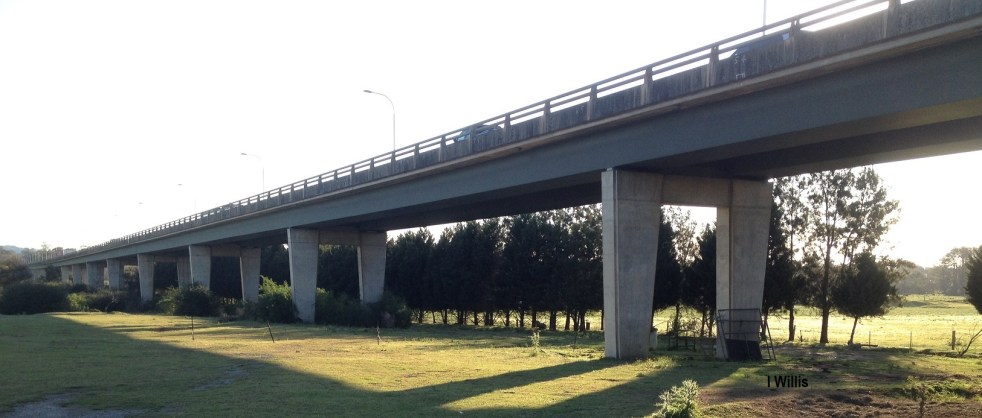
Macarthur Bridge
The Macarthur Bridge across the Nepean River at Camden NSW is an important engineering heritage item.
Share this:

Share this:
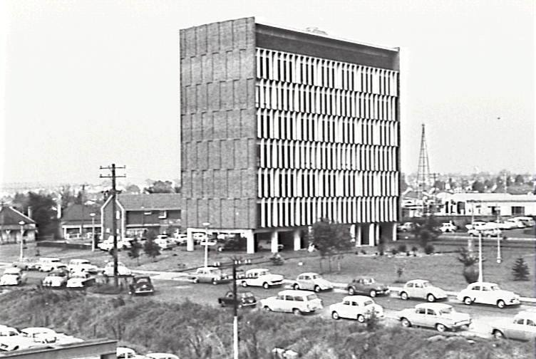
Exploring Campbelltown’s Mid-Century Modern Administration Building
The Campbelltown Council office building, completed in 1964, serves as an unrecognized icon of mid-century modernism, symbolizing the town's optimistic vision as a satellite city. Despite its structural significance and initial hopes for community development, later planning challenges undermined this vision, leaving the building's legacy complex and often overlooked.
Share this:

Share this:

The Camden district in 1939
The 1939 Camden district concept was developed in the 1990s by UOW historian Dr Ian Willis as part of his research on the effect of the Second World War on Camden township.
Share this:

Share this:
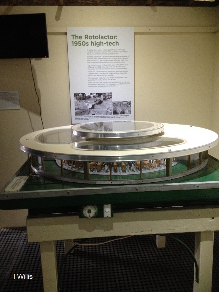
The Rotolactor, a Menangle milking marvel
The Rotolactor was Menangle's milking marvel. A rotating dairy that was a tourism attraction and an example of industrial modernism on the colonial property Camden Park estate.
Share this:

Share this:

Living history at a country festival
Living history was on display at a country show with the real sounds sights and smells of the farm

