
The content explores Camden's unique architectural and dairy history, focusing on a Tudor-style milk bar built in 1939 to promote Camden Vale special milk. It highlights the building's role in public health, its creative design by Cyril Ruwald, and its transformation into a boutique hotel, connecting local heritage with modern branding.
Category: Dairying

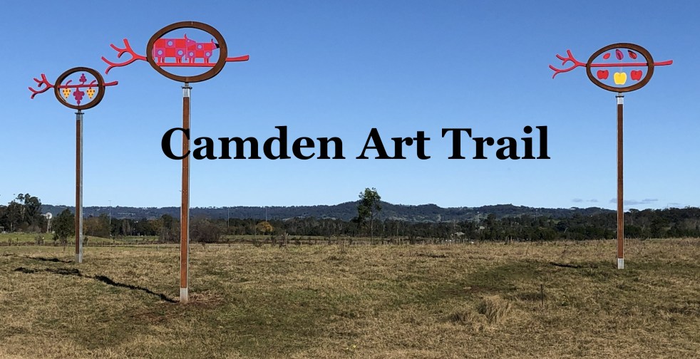
Explore the Camden Public Art Trail: A Scenic Journey
The Camden Public Art Trail, officially opened in June 2024, connects the Nepean River to Camden Town Farm and features stunning artwork installations across a 4.2-kilometer walkway. Funded by the NSW Government, the trail celebrates local heritage and ecology while providing an accessible outdoor experience for visitors, though dogs are not permitted.
Share this:

Share this:
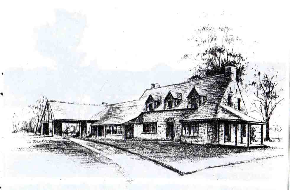
Camden’s Unique Interwar Tudor Revival Milk Bar
The Camden Vale Inn Milk Bar, opened in 1939, was created to promote disease-free milk from Camden Park Estate during a period of health awareness. Designed in an 'Old English' style by architect Cyril Ruwald, it featured drive-through service and supported the Red Cross during WWII. It later evolved into a restaurant and hotel.
Share this:

Share this:
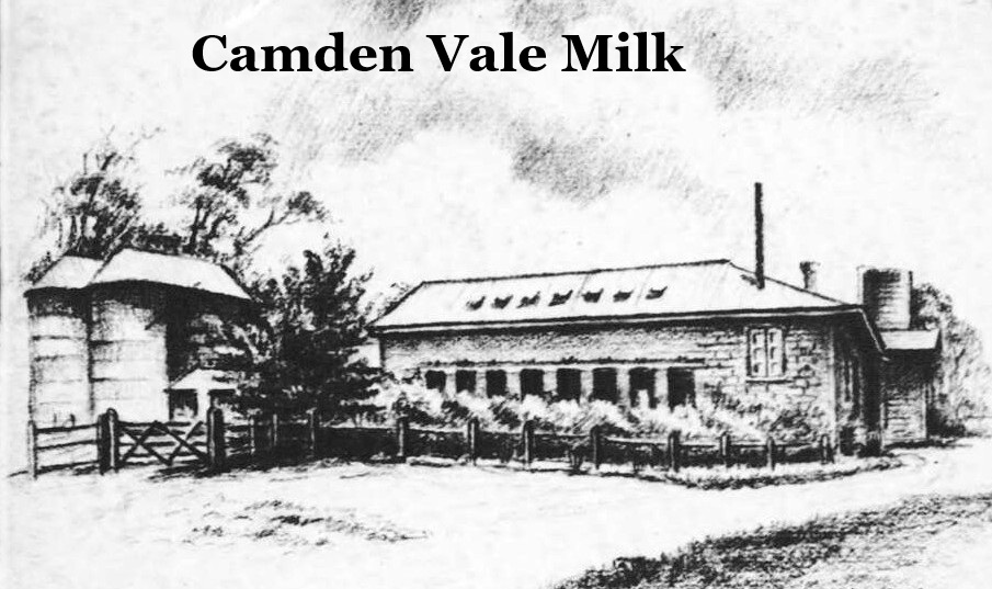
The History of Camden Vale Milk: A 20th Century Legacy
The Camden Museum features a poster detailing the significance of the Camden Vale special milk brand, which emerged from advancements in dairy farming in the area. Established in 1920, the brand was known for high-quality milk, emphasizing health benefits and innovative delivery methods, significantly impacting local agriculture and public health history.
Share this:

Share this:
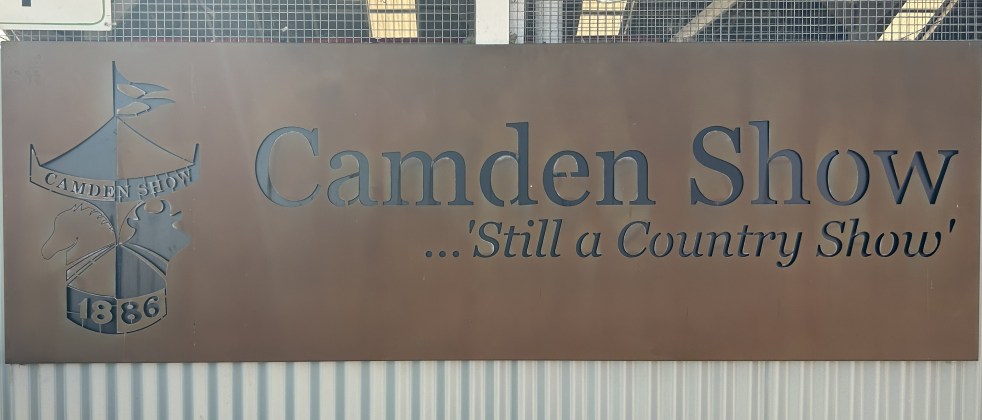
Camden Show 2026: Family Fun and Agricultural Excellence
The Camden Show, established in 1886, is an annual community festival celebrating agriculture, local talent, and heritage in the Macarthur region. Attracting over 48,000 visitors, it features livestock exhibitions, competitions, and entertainment. The event fosters community spirit, showcasing historical traditions and engaging volunteers dedicated to promoting agriculture and youth involvement.
Share this:

Share this:
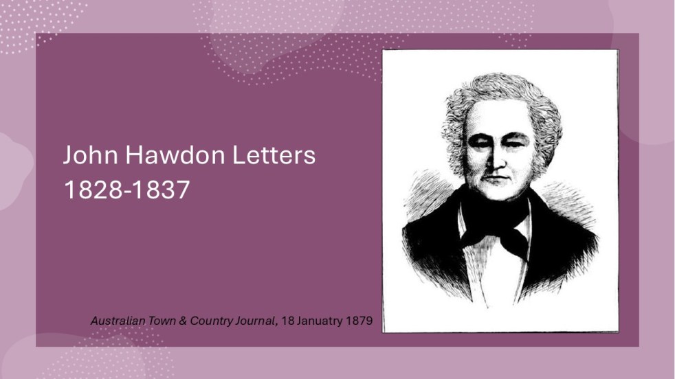
Insights from the Hawdon Letters: Colonial Life in NSW, Part 3, 1833-1837
The letters of John Hawdon and others from 1828 to 1837, preserved in the State Library of NSW, provide insights into colonial life in New South Wales. They highlight themes of isolation, communication challenges, economic struggles, and attitudes toward gender and Indigenous populations, alongside Hawdon's farming experiences and family connections.
Share this:

Share this:
Insights from the Hawdon Letters: Colonial Life in NSW, Part 2, 1831-1833
John Hawdon's letters from New South Wales (1831-1833) reveal colonial life, highlighting farming challenges, isolation from England, and the high costs of communication. These letters provide insights into market conditions, crop successes, and family updates, showcasing the Hawdons' experiences and adaptations in a new land, while retaining original spelling and structure.
Share this:

Share this:
Explore History with Friends of Belgenny Farm Events
On a cloudy day in late May 2025, the Friends of Belgenny Farm held an open day attracting over 285 visitors interested in early Australian history. The event featured various stalls, historical displays, and guided tours of the historic site, which holds national significance and showcases Australia's earliest colonial farm buildings.
Share this:

Share this:
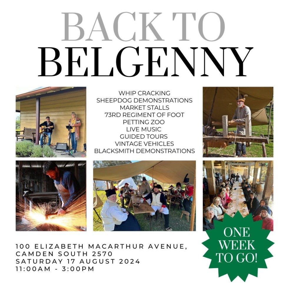
Explore Belgenny Farm: A Journey Through Time 2024
The 2024 Back to Belgenny festival showcased living history at Belgenny Farm, featuring reenactments, traditional trades, and various activities such as sheepdog trials and guided tours. The event included a demonstration by Governor Macquarie’s regiment and highlighted the farm's historical significance, providing visitors with an immersive glimpse into colonial agricultural life.
Share this:

Share this:
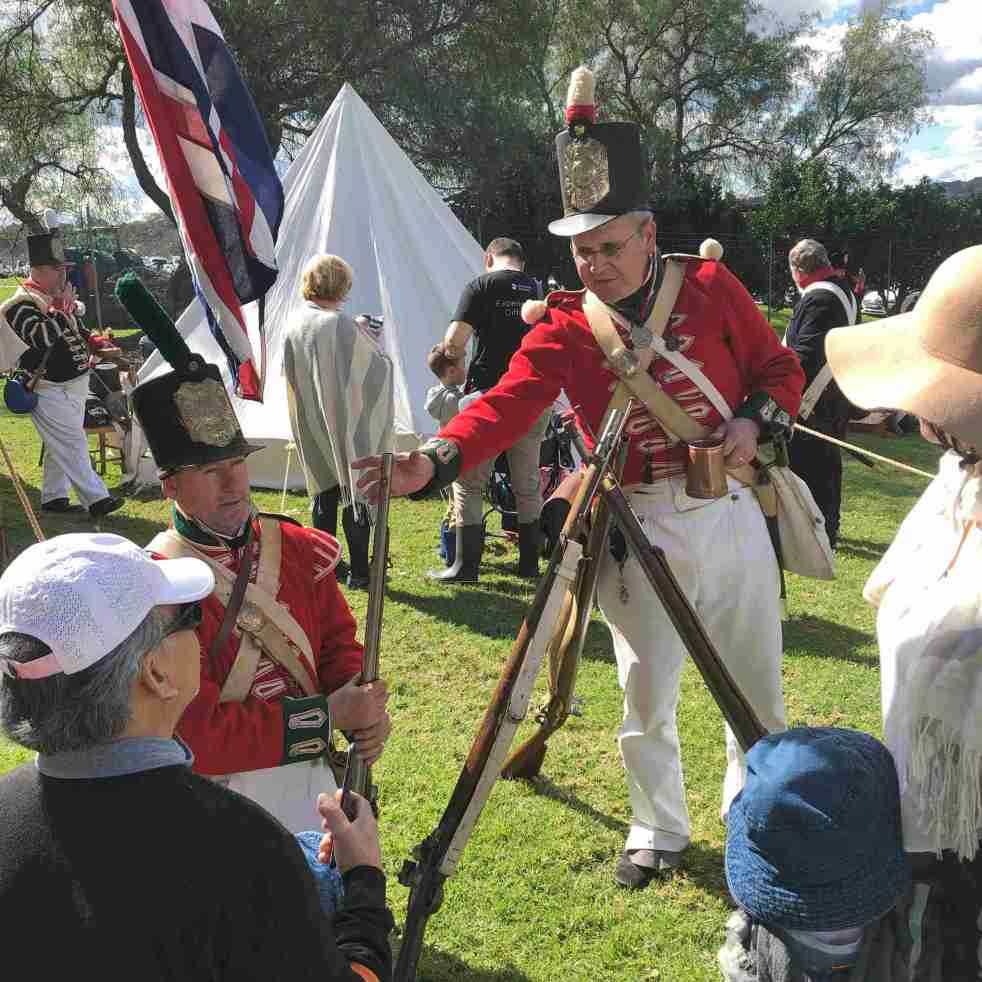
Back to Belgenny 2024, a festival of living history
The 2024 Back to Belgenny festival at Belgenny Farm in South Camden showcased living history with reenactments, traditional trades, and stalls selling arts and crafts of the past. Activities included sheepdog trials, live music, vintage cars, and guided history tours of the site. The farm represents the settler society through the generations of the Macarthur family and their workers.

