

The private English-style estate village of James and William Macarthur
The establishment of Camden, New South Wales, the town in 1840, was a private venture of James and William Macarthur, sons of colonial patriarch John Macarthur, at the Nepean River crossing on the northern edge of the family’s pastoral property of Camden Park. The town’s site was enclosed on three sides by a sweeping bend in the Nepean River and has regularly flooded the surrounding farmland and lower parts of the town.
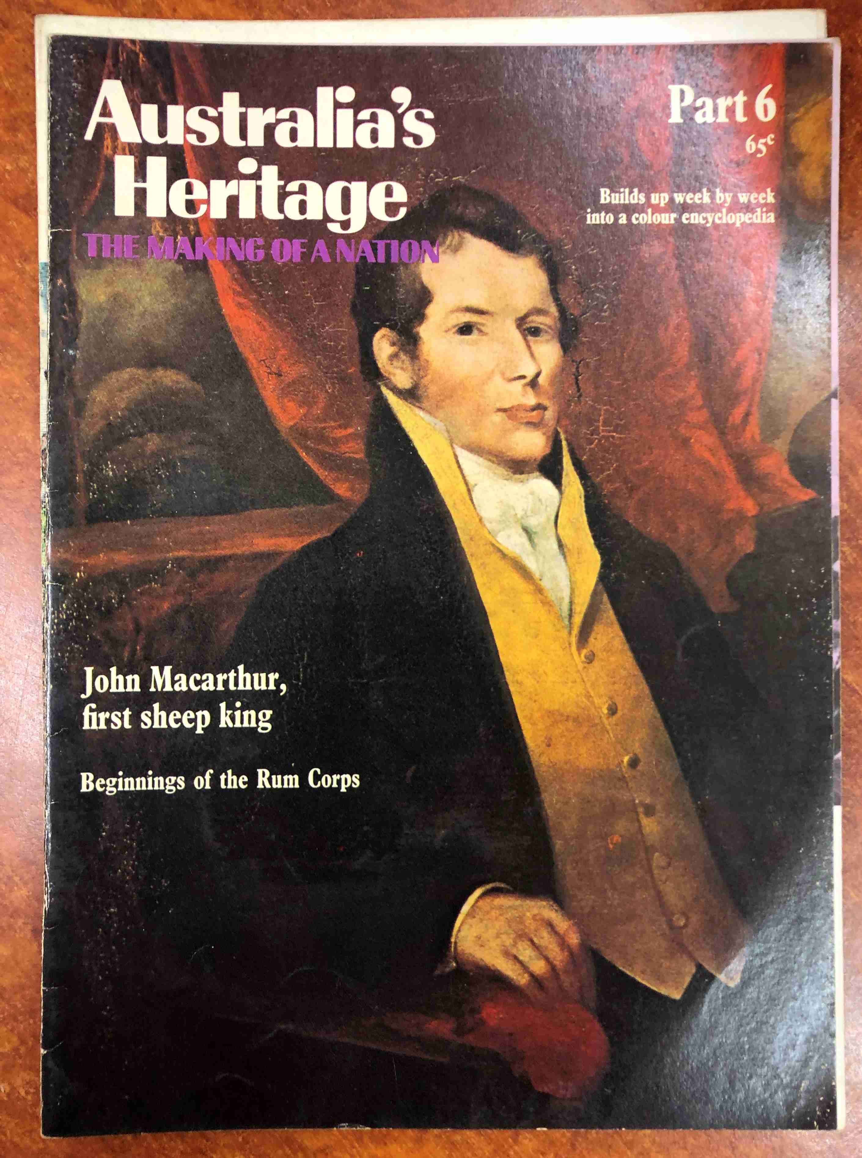
The site of Camden was within the 5000 acres granted to John Macarthur by the 2nd Earl Camden [3.2], the Secretary of State for War and the Colonies, in 1805, while Macarthur was in England on charges for duelling. Macarthur was a fractious quarrelsome self-promoter who arrived in NSW with his wife Elizabeth and family in 1790 as paymaster of the New South Wales Corps. The Corps (sometimes called The Rum Corps) was formed in England in 1789 as a permanent regiment of the British Army to relieve the New South Wales Marine Corps, which had accompanied the First Fleet to Australia in 1788 to fortify the colony of NSW.
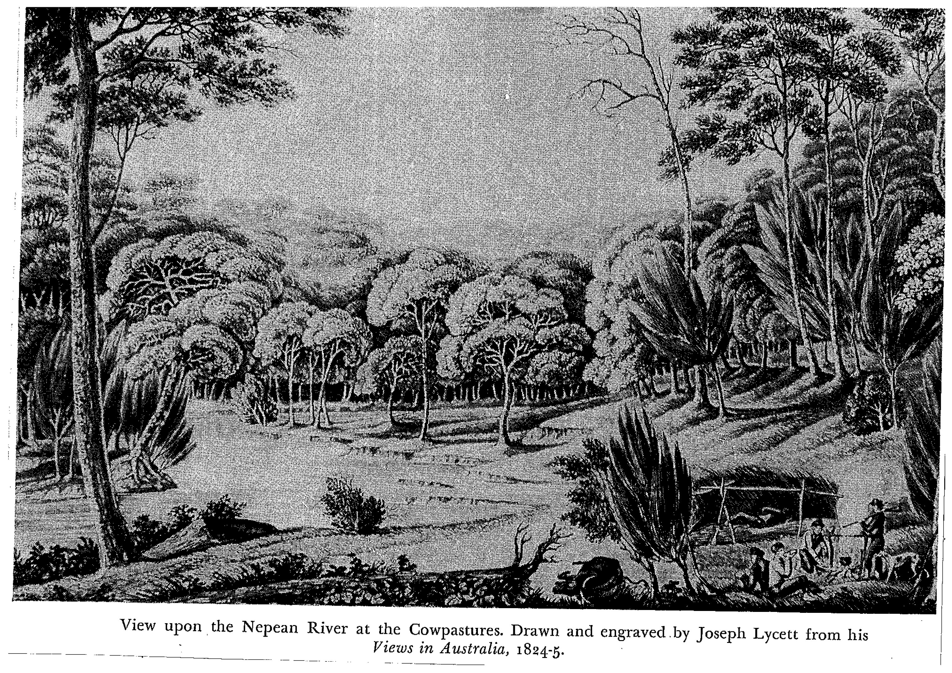
The town’s site, as part of the Macarthur grants, was located on some of the finest farming country in the colony in the government Cowpastures reserve on the colonial frontier. The grants were part of the dispossession of traditional lands of the Dharawal people by the British settler colonial project and inevitably led to conflict and violence. Macarthur claimed that the town’s establishment threatened the security of his landholdings at Camden Park and opposed it during his lifetime. On his death in 1834, his sons had a different worldview and moved to establish an English-style estate village dominated by a church.
A fine Gothic-style church
The ridge-top location of St John’s Church (1840) on the southern end of the town meant that it towered over the town centre and had a clear line of sight to the Macarthur family’s Georgian mansion at Camden Park 2.6 miles to the southwest. The fine English Gothic-style church was funded mainly by the Macarthur family and has been the basis of the town’s iconic imagery. There were a number of large gentry estates built on convict labour in the surrounding farmland, the largest being the Macarthur family’s Camden Park of over 28,000 acres.

Many immigrant families came to the area under Governor Bourke’s 1835 plan and settled on the gentry estates as tenant farmers, some establishing businesses in Camden. The first land sales in the village occurred in 1841, which stifled the growth of the existing European settlements in the area. The population of Camden grew from 242 in 1846 to 458 in 1856, although the gentry’s estates still dominated the village. Camden Park, for example, had a population of 900 in 1850.
English-style gentry
The English-style gentry practised philanthropy in Camden to maintain its moral tone. Elizabeth Macarthur Onslow, John Macarthur’s granddaughter, encouraged the maintenance of the proprieties of life, moral order and good works, as well as memorialising her family by donating a clock and bells to St John’s Church in 1897. She also marked the memory of her late husband, Captain Onslow, by providing a public park in 1882 named after her husband (Onslow Park), which is now the Camden showground.
Transport hub
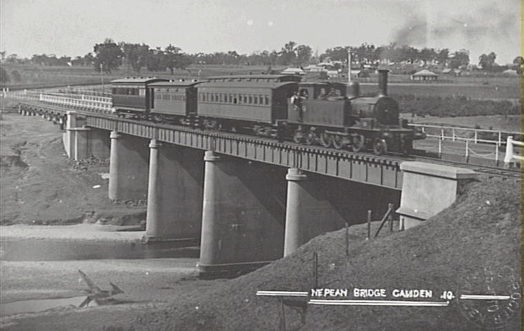
Camden became the district’s transport hub at the centre of the road network, primarily set by the pattern of land grants from the 1820s. The earliest villages in the district predated Camden and then looked to Camden for cultural and economic leadership as the district’s major centre. The arrival of the Camden tramway in 1882 meant that silver ore west of the district (1871) was shipped through the Camden railhead to the Main Southern Railway from Sydney.
Progress assured
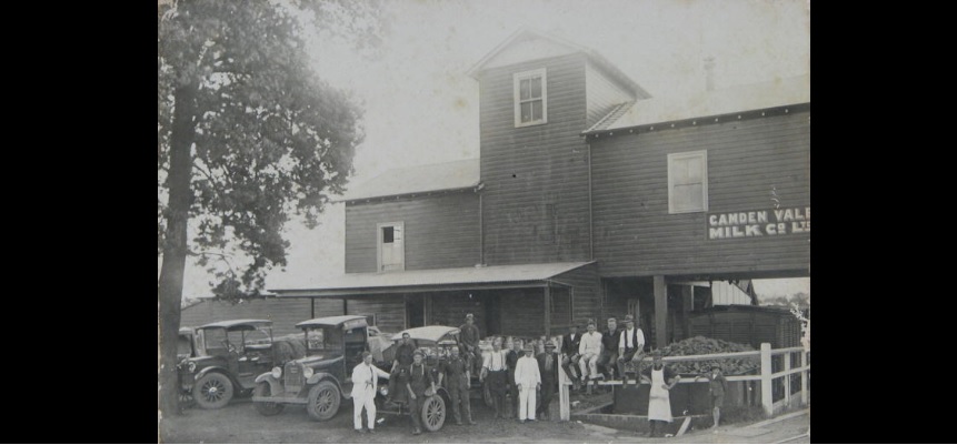
Combined with rail access to markets, the town’s prosperity was assured by a series of technical and institutional innovations that transformed the dairy industry in the 1890s. In the 1920s, the Macarthur family set up the Camden Vale Milk Company and built a milk processing plant at the eastern end of the main street adjacent to the rail line. Whole milk was railed to Sydney and bottled under its label until the mid-1920s. Milk was delivered daily to the factory by horse and cart until the 1940s from local dairy farms.
Camden’s progress saw the construction of a new bank (1878), the commencement of weekly stock sales (1883), the formation of the Camden Agricultural, Horticultural and Industrial Society and the first Camden Show (1886), a new post and telegraph office (1898), the foundation of two weekly newspapers (Camden Times, 1879, Camden News, 1880), a new cottage hospital (1898), the formation of a fire brigade (1900), the opening of a telephone exchange (1910), the installation of reticulated gas (1912), electricity (1929), town water (1899) and the replacement of gas street lighting with electric lights (1932), and a sewerage scheme (1939). By 1933 the population of the town had grown to 2394.
First local council
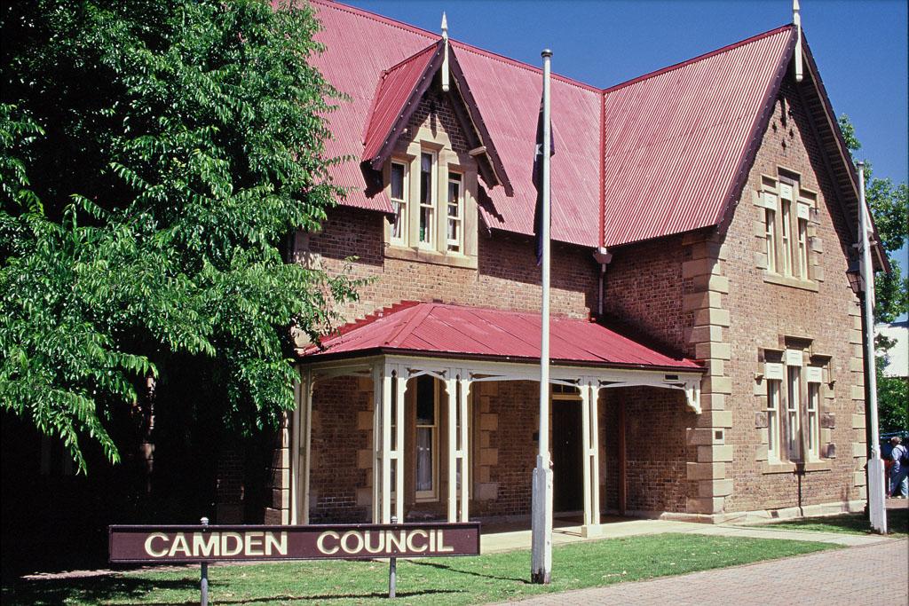
The first attempt at local government in 1843 was unsuccessful. A meeting of local notables formed the municipality of Camden at a public meeting in 1883. Still, it was not until 1889 that the municipality was proclaimed, covering 7,000 acres and including Camden and the neighbouring village of Elderslie. Nine townsmen were elected aldermen at the first election that year, and the first meeting was held at the School of Arts. In 1993 the Camden Municipal Council eventually became the Council of Camden.
Street names
Camden’s 1840 street grid is still intact today, with streets named after members of the Macarthur family – John Street, Elizabeth, Edward Street – and NSW colonial notables – Oxley Street, Broughton Street, Mitchell Street. The main highway between Sydney and Melbourne (the Hume Highway) passed along the main street (Argyle Street), until it was re-routed in 1976. The town’s business centre still has several Victorian and Art Deco shopfronts.
Some charming Federation and Californian bungalows in the church ridge-top precinct were the homes of the Camden elite in the early 20th century. The precinct is the site of Macarthur Park (1905), which was dedicated to the townsfolk by Elizabeth Macarthur Onslow and contained the town’s World War One cenotaph (donated by the Macarthur family).
John Street heritage precinct
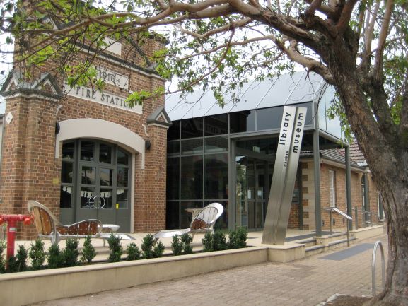
John Street runs north-south downhill to the floodplain from the commanding position of St John’s church. Lower John Street is the location of the Italianate house Macaria (c1842), St Paul’s Catholic church and the government buildings associated with the Camden police barracks (1878) and courthouse (1857), and Camden Public School (1851). This area also contains the oldest surviving Georgian cottage in the town area, Bransby’s Cottage (1842). Lower John Street has the Camden Temperance Hall (1867), which later served as Camden Fire Station (1916–1993), and the School of Arts (1866), which served as the Camden Town Hall, while the rear of the building was occupied for a time by Camden Municipal Council.
Volunteerism
Community voluntary organisations have been part of Camden’s life from the town’s foundation. In the late 1800s, they were male-dominated, usually led by the landed gentry, and held informal political power through patronage. James Macarthur sponsored the Camden School of Arts (1865) and Agricultural, Horticultural & Industrial Society (1886), later called the Camden Show Society, while the non-conformists sponsored various lodges and the temperance movement. A small clique of well-off local women established several conservative women’s organisations after Federation. Their social position supported their husbands’ political activities, and the influence of the Macarthur family was felt in these organisations, for example, the Camden Red Cross and Country Women’s Association.

Many men and women from Camden and the district saw military service in the Boer War and later World War One and Two when residents set up local branches of national patriotic funds and civil defence organisations. On the outskirts of the town, there were active defence establishments during World War II, including an airbase, army infantry, and training camps.
Coal mining
Economic prosperity from coal mining in the district’s western part challenged old hierarchies in the postwar years, replacing the old colonially-based rural hegemony. New community organisations like Rotary and later the Chamber of Commerce fostered business networks in the town. The Camden Historical Society (1957) promoted the town’s past and later opened a local museum (1970).
Urbanisation
The New South Wales state government decreed that the town would become part of a growth area in the form of ‘new cities’ under the Macarthur Growth Centre Plan (1973), modelled on the British Garden City concept. Increasing urbanisation threatened the town’s identity and the number of community members formed by the Camden Residents’ Action Group (1973).
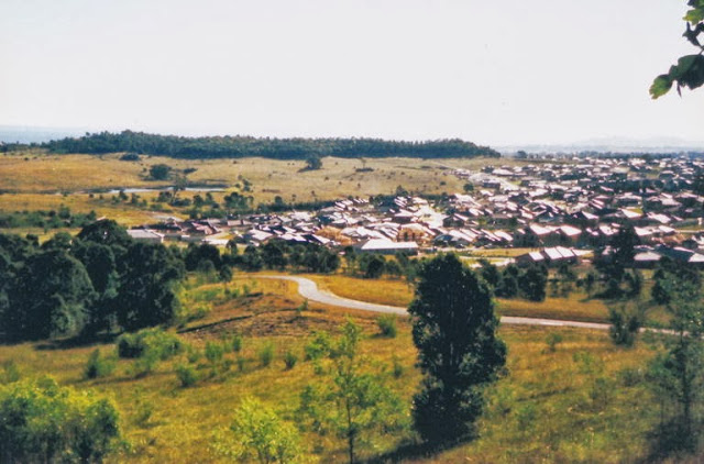
In 2007 Camden was the administrative centre of the Camden Local Government Area, which had a population of over 51,000 (2006) and an area of 201 square kilometres. The Camden LGA became part of the state government’s Sydney South West Growth Centre, planned to house 500,000 new residents, and is one of Australia’s fastest-growing urban areas.
Wave of nostalgia
Increasing levels of Sydney’s urbanisation have continued, threatened the loss of rural landscapes around the town, and awakened a wave of nostalgia. The NSW state government created the Camden Town Conservation Area (2008) based on the mid-20th century country town that aimed at preserving the town’s integrity and material fabric.

Posted 19 September 2022
Discover more from Camden History Notes
Subscribe to get the latest posts sent to your email.

