
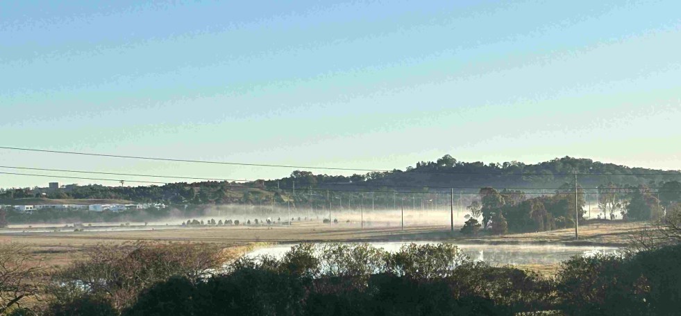
A walk with a view in the Cowpastures
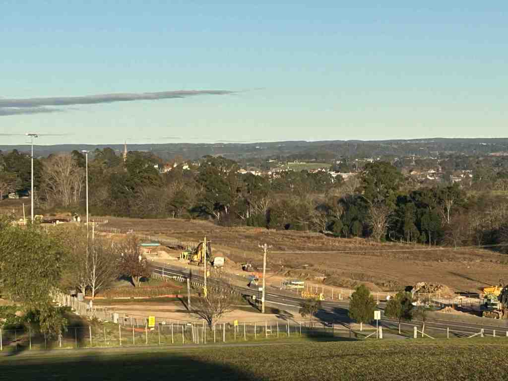
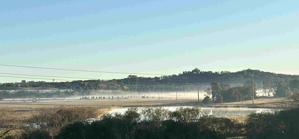
On any day, walkers, dog walkers, runners and joggers make their way along the pathway that leads over Herberts Hill, where they can take in the magnificent local views across the Nepean River floodplain. Coming from Elderslie or Narellan, the pathway follows Camden Valley Way and passes over the top of Herberts Hill. The hill is named after Thomas Herbert, who was a small part of the English settler society project in New South Wales and the Cowpastures landscape. This walk can be included in the historic Camden and Cowpastures walks and are most dramatic if taken just after dawn.
The St John’s Church spire emerges to the northwest through the trees, which have grown on the floodplain over the last century to radically alter the colonial landscape of the Cowpastures. In the late 19th century, the floodplain was mostly bare, cleared of all vegetation, giving an uninterrupted view of the town. The elevation of Herberts Hill is 88 metres, which places it 24 metres above the Nepean River floodplain and Narellan Creek floodplain, providing a lookout across the countryside. (CC 2015)
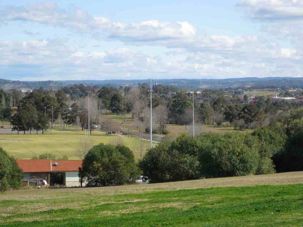
Herberts Hill, also called Rheinbergers Hill, is on the southern side of Camden Valley Way about halfway between Camden and Narellan. The hill reserve is culturally and visually significant, with vistas over Elderslie, Camden township, Narellan, the Nepean River floodplain, and the historic properties of Kirkham, Camelot, and Studley Park. It serves as a scenic rural gateway between Narellan and Camden. The families who were granted land in the early colonial period helped establish the settler society in the Camden district. (CC 2015)
The hill is named after Thomas Herbert, who was allocated a grant of 100 acres in 1812 by Governor Macquarie, along with a number of other settlers fronting the Great South Road.
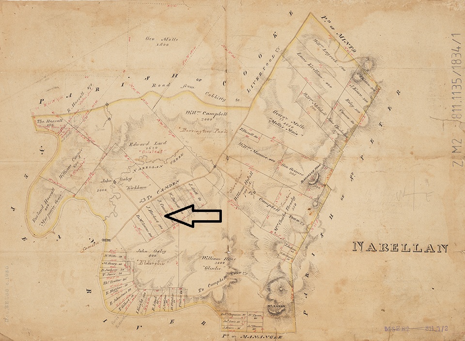
In 1815 Thomas was an overseer, or farm manager, on Camden Park, in charge of three herdsmen and a number of shepherds in 1806. He assisted Elizabeth Macarthur at the Stock Farm at Seven Hills as overseer during John’s absence between 1801 and 1805. In 1811 he was ‘free by servitude’ and granted land at Narellan. He was still recorded as an overseer on Camden Park in 1828. (SLQ 2026 Campbell & Herbert)
Ancestry
Herbert was born in 1772 near London and worked with horses as a boy as a postilion, riding the lead horse for the Duke of Chandos’ carriage horse team, and lived in the household of the Duke until the Duke died in 1789. (SLQ 2026: Herbert)
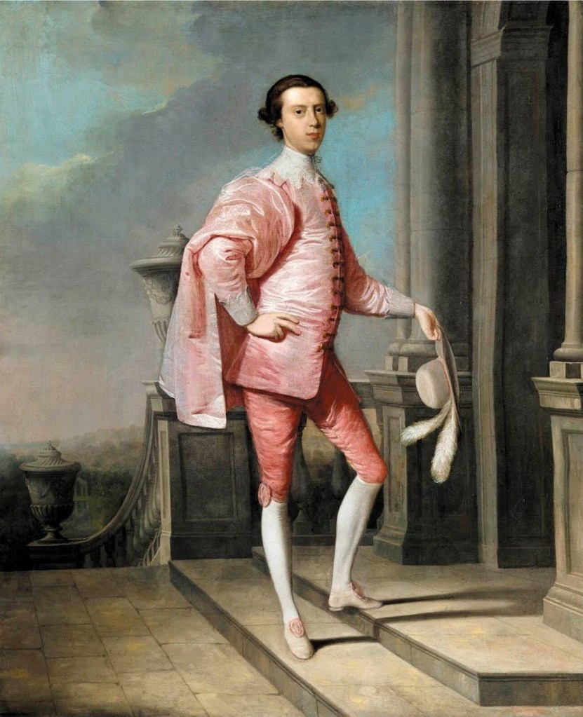
Herbert initially worked as a postilion, which is a rider who sits on the left horse of a pair to guide and control the team pulling a wheeled vehicle, rather than driving from a seat on the carriage.

According to Atkinson, Herbert was an ‘able and energetic’ man but was often at the mercy of events. Atkinson argues that this is how Herbert found himself standing in front of an ironmongers’ shop window in Oxford Street run by John (Macgauran) and Dennis (Doland). The window was broken, but not by him. Herbert saw a quick profit and reached in and took a brass candlestick worth 10/-. He was immediately caught, charged with breaking, entering and stealing, and convicted at the Old Bailey. He was sentenced to death, which was commuted to transportation for life. Herbert arrived in New South Wales on the Pitt as a convict in 1792. (Atkinson 1988: 16-19) (SLQ 2026: Campbell & Herbert)
In 1815 Herbert married Catherine Campbell, a fellow convict, who arrived in New South Wales on the Sydney Cove in 1807. (Jackson et al 2008:136) Campbell was born in 1795. While employed as a servant, she was convicted of theft by her employer at Lancaster (Liverpool) Quarter Sessions and sentenced to 7 years’ transportation. Herbert and Campbell had seven children between 1809 and 1826. Campbell had a relationship with two other men. (SLQ 2026: Campbell)
Thomas died in 1846 at Narellan, aged 74 and was buried in St John’s Anglican Church at Camden. Catherine died in 1871 at Upper Picton, aged 86. (SLQ 2026: Campbell)
Herberts Hill, Rheinbergers Hill, Longley Hill
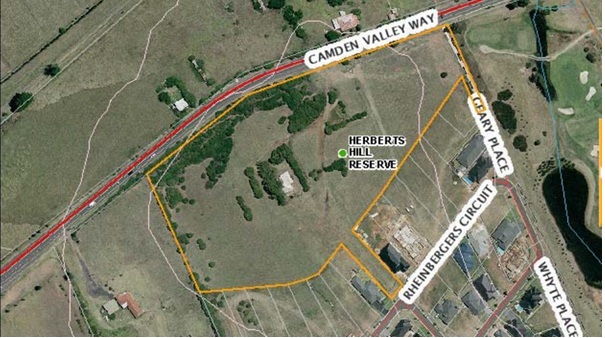
The hill is also known as Rheinbergers Hill and Longley Hill. (Burnett et al 2005: 21)
The hill reserve is also associated with the Scott, Longley, Whyte and Rheinberger families. The original function of the site as a home and for market gardening was once a common activity in Camden. (CC 2015:4)
Longley Hill
Longley Hill is named after the Longley family, who built Yamba Cottage around 1915 on Camden Valley Way, formerly the Hume Highway and before that the Great South Road, on a 32-acre block purchased off Mary Simpson of Vermont, near Camden in 1915. The 32-acre block was one of two; the other 18 acres were bought by Mary Simpson of Vermont, near Camden. (Willis 2013)

Frederick Longley was a descendant of James Longley, a farmer from Badgery’s Creek. The Longley family also had farming interests at Bringelly and Luddenham. Frederick married Catherine Martin in 1880 at Berrima, became a school teacher, and taught at Nundle from 1886 until 1890, then in Goulburn from 1894 until 1904, then eventually at Narellan from 1906 until 1915. Frederick gave up teaching, took up farming and established an orchard at Yamba from 1922. When Frederick died in 1923, his farming interests involved stone fruit, poultry, dairy farming, viticulture and orcharding at Yamba and a number of other locations. (Willis 2013)
His son, also Frederick, carried on the family’s farming interests and took advantage of the rail and road links to the property. On his death in 1982, the property passed to Jack Longley. Frederick concentrated on stone fruit, melons, pumpkins and poultry while raising Friesian cattle which were entered in the Camden Show. During the 1950s, the Longleys ran a farm stall on the Hume Highway frontage of the property, selling peaches, nectarines and eggs. (Willis 2013)
Reflection
Get some fresh air, get fit and take in the sights. There are magnificent views of the local area from Herberts Hill, also known as Rheinbergers Hill, and take in some of the cultural and visually significant places in the district. Herberts Hill is a small and important part of the story of the Cowpastures. It is also part of the English settler society project in the local area and colonial New South Wales.
Access to Herberts Hill can be made from three different directions. Firstly, through the reserve on Rheinberger Circuit, Elderslie.
Secondly, take a walk along the pathway that follows Camden Valley Way starting at Currans Reserve carpark in Elderslie to Herberts Hill. The round walk is just over four kilometres and at a steady pace should take about an hour. The walk is flat, and Herberts Hill rise about 24 metres above the floodplain. There is an uninterrupted view of the Camden township and the surrounding floodplain.
The third access point is via the pathway following Camden Valley Way from Narellan.
Herberts Hill, situated between Camden and Narellan, offers stunning views of the Nepean River floodplain. Historically significant, it is named after early settler Thomas Herbert, who received land in 1812. The hill serves as a recreational and cultural space, providing walkers and joggers with a scenic experience.
References
Atkinson, Alan 1988. Camden, Farm and Village Life in Early New South Wales. Oxford University Press, Melbourne.
Burnett, Brian & Richard Nixon, John Wrigley 2005. Place Names of the Camden Area. Camden Historical Society & Camden Area Family History Society, Camden.
CC 2015. Herberts Hill Reserve Specific Area Plan of Management. Camden Council, Oran Park. Online https://www.camden.nsw.gov.au/assets/pdfs/Council/Plans-and-Strategies/Plans-of-Management/Herberts-Hill-Reserve-Specific-Area-Plan-of-Management-adopted-14-April-2015-1.pdf Accessed 27/6/26
SLQ 2026. Catherine Campbell. Convict Records, State Library of Queensland. Online at https://convictrecords.com.au/convicts/campbell/catherine/62046 Accessed 26/7/26
SLQ 2026. Thomas Herbert. Convict Records, State Library of Queensland. https://convictrecords.com.au/convicts/herbert/thomas/119382 Accessed 26/7/26
Jackson, Tony & Cathey Shepherd, Sharon Greene, Brian Burnett 2006. Camden Pioneer Register 1800-1920. 3rd Edition. Camden Area Family History Society, Camden.
Willis, Ian, 2013. Kirkham, Dictionary of Sydney, Online at https://dictionaryofsydney.org/entry/kirkham, viewed 01 Aug 2026
Updated 1 August 2026. Originally posted on 27 July 2026 as ‘Camden’s Herberts Hill: Views, History, Culture and Walk’.
Discover more from Camden History Notes
Subscribe to get the latest posts sent to your email.

