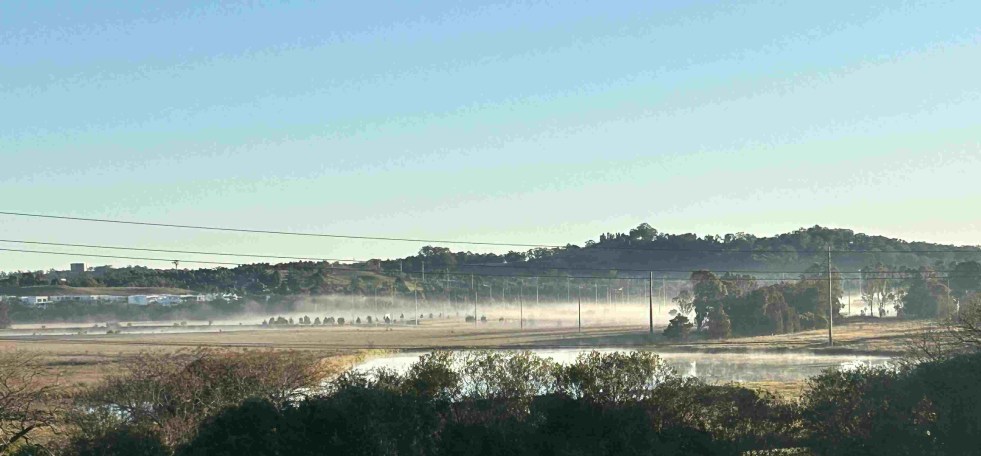
Aesthetics · Art · Artists · Belonging · Colonialism · Community identity · Community work · Crafts · Cultural Heritage · Design · Education · Elyard Reserve, Narellan · Heritage · History · Living History · Local History · Local Studies · Memorialisation · Memorials · Narellan · Parks · Place making · Public art · Sense of place · Settler colonialism · Settler Society · Storytelling · Tourism · Urban Planning · Urbanism

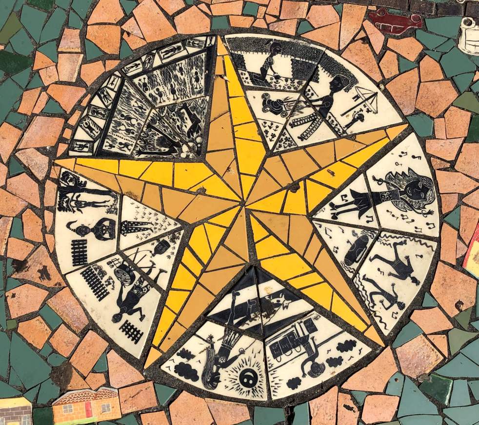
Narellan Community Mosaic Project: art in the park

Narellan Community Mosaic Project 2005

Walking from the Narellan Library carpark to Elyard Street along the paths next to the creek, you will pass one of Narellan’s public art installations – the Narellan Community Mosaic Project.

This image shows the extent of the Narellan Community Mosaic Project with its concentric rings of mosaic tiles creating a spectacle for the observer of the past and present in the Narellan area. (I Willis, 2023)

Public art installations in Narellan have received little attention and are hidden in plain sight. Other public art installations in the Narellan area include the Cowpastures Story, a mosaic bench, and a Goanna on the loose,

The Narellan Community Mosaic Project art installation is easy to miss as it blends in with the lawn and park landscape of Elyard Reserve. Maybe that was the intention of the artists. The work was commissioned by Camden Council through funding from the New South Wales Department of Planning.

The art installation uses mosaic tiles to represent the area’s past and present. The artwork adds to the character and placemaking of the Narellan Library Civic Space on Elyard Street, Narellan.

Mosaic Artwork

The installation is a series of concentric rings using storytelling to tell the Narellan story. The story starts at the centre with Indigenous Australians. As you move out from the centre, the artwork is a timeline through history, representing the present in the outer rings.

The centre of the artwork has stylised figures representing First Australian’s art, the oldest art on the continent, around a five-pointed star, possibly a metaphor for the Southern Cross from the southern skies. This section contains stylised stick figures representing activities from the past and present – a mother walking her dog, shopping, gardening, and mowing the grass, a BBQ, and more traditional Indigenous figures.  

The centre circle of the Narellan Community Mosaic project with a five-pointed star perhaps represents the stars of the Southern Cross, with its stylised figure reminiscent of the traditional art of the First Australians. (I Willis, 2023)

Moving outwards from the centre, there are representations of European settlement patterns crisscrossed by roadways. Here the ring is divided into different periods from the colonial settler society past to the present.

These inner rings are encircled by a further round of local places of significance in the Narellan area. They include Harrington Park House, Narellan Railway Station, Struggletown, Burton Arms Inn (1830), St Thomas Church (1861), St Thomas Chapel, Ben Linden and Bullock teams.

The outer circle shown here illustrates the historic sites of the Narellan area. The Harrington Park house is in the centre of the image, with the 20th-century house Ben Linden on the left and Bullock teams on the right of the centre. The inner circle represents European settlement from the time of a settler society to the 21st century. (I Willis, 2023)

The outer ring of mosaic tiles is divided into segments celebrating agriculture, cultural activities, flora and fauna, and a wayfinding activity. The edge of the artwork is tiled with details of local children who contributed to its creation and design.

In the outer area of the artwork are three metal benches supported by metaphorical books representing the site as a place of learning for the community. The seating is a popular spot for some to have their lunch break during their busy day, have a break and take in the bookish environment.

A local worker enjoying the ambience of the Narellan Community Mosaic Project in their lunch break, taking in the bookish atmosphere of the environment provided by the adjacent Narellan Library building. (I Willis, 2023)

Contributing artists

The contributing artists to the installation all have a strong track record and are well respected in their fields.

This mosaic tile gives credit to the artists involved in creating the art installation and the details of the commissioning authorities. (I Willis, 2023)

Project Co-ordination -Marla Guppy from Guppy & Associates

Marla’s biography on her website states:

Marla Guppy is a cultural planner and public art strategist. Over the last twenty years she has worked on a range of projects that explore social environments and identity. She has a particular interest in fostering creative involvement in the design of local environments and public buildings. She has considerable experience in working with specific communities of interest and has worked collaboratively with corporate and community organisations and creative industries.

Project artist – Cynthia Turner

Turner’s  biography on the Design & Art Australia website states that Cynthia started working on mosaics when Kids Activities Newtown asked her to work on a mosaic at the Enmore Swimming Pool after seeing a mosaic-covered seat in her garden.

This would turn out to be the start of a successful career as a public artist specialising in designing and making mosaic artworks for streetscapes, parks, community centres and schools. Turner’s artworks can be found in Sydney, Wollongong, Dubbo and Tasmania. Most are public artworks commissioned by local councils and can be seen in the form of public benches, mosaic walls and footpaths; they all feature mosaic surfaces. Turner has used a variety of materials in these mosaics, such as handmade tiles, broken ceramic tiles, sheeted glass tiles and cut stained glass.

Ceramic artist – Christine Yardley

Heritage artist – George Sayers

George Sayers worked as a commercial artist in Great Britain before he came to Australia in 1964. He works in most mediums: oil, watercolour, drawing, pastel and etching.

Sayers has taken an interest in the historic buildings and landscapes of the Cowpastures area and more contemporary scenes of the Camden area. He published Views of Camden and Surrounding Areas in 1996.

 Henryk Topolnicki  from Art is an Option

Working as a sculptor, Henryk created artworks based on his skills as an accomplished blacksmith, woodworker and welder.

The Art is an Option website states:

Private commissions and public artworks by Henryk have a distinctive level of delicate-often relating to natural forms such as insects or birds-requiring a very fine level of craftsmanship by the artist.

Art is an Option contributed to other artworks in the Narellan Library Civic Space in 2006 called the Cowpasture Story consisting of a  ‘Sculptural Mobiles & Screen’ and jointly commissioned by Camden Council and Narellan Rotary Club.

Narellan Community Mosaic Project shortly after its installation in 2006. (Art is an Option)

Updated on 2 May 2023. Originally posted on 17 April 2023.

Agency · Agriculture · Agriculture history · Attachment to place · Belonging · British colonialism · Camden · Cawdor · Cobbitty · Colonial Camden · Colonial frontier · Colonialism · Community identity · Cowpastures · Cowpastures Estates · Cowpastures Gentry · Cultural Heritage · Cultural icon · Denbigh · Economy · Elderslie · England · Farming · Georgian · Gothic · Harrington Park · Heritage · History · Hope and loss · House history · Indigenous Heritage · Johm Macarthur · John Oxley · Kirkham · Landscape · Lifestyle · Local Studies · localism · Macarthur · Maryland · Menangle · Myths · Picton · Pioneers · Place making · Placemaking · Sense of place · Settler colonialism · Settler Society · Storytelling · The Oaks · Urban growth

The Cowpastures’ English-styled-gentry and their private villages

A certain type of Englishman

These Englishmen were also known as the Cowpastures gentry, a pseudo-self-styled-English gentry.

All men, they lived on their estates when they were not involved with their business and political interests in Sydney and elsewhere in the British Empire.

By the late 1820s, this English-style gentry had created a landscape that reminded some of the English countryside. This was particularly noted by another Englishman, John Hawdon.

There were other types of English folk in the Cowpastures, and they included convicts, women, and some freemen.

EstateExtent (acres)Gentry  (principal)
Abbotsford (at Stonequarry, later Picton)400 (by 1840 7,000)George Harper (1821 by grant)
Birling Robert Lowe
Brownlow Hill (Glendaruel)2000 (by 1827 3500)400 (by 1840, 7,000)
Camden Park2000 (by 1820s, 28,000)John Macarthur (1805 by grant, additions by grant and purchase)
Cubbady500Gregory Blaxland (1816 by grant)
Denbigh1100Charles Hook (1812 by grant), then Rev Thomas Hassall (1828 by purchase)
Elderslie (Ellerslie)850John Oxley (1816 by grant), then Francis Irvine (1827 by purchase), then John Hawdon (1828 by lease)
Gledswood (Buckingham)400John Oxley (1816 by grant), then Francis Irvine (1827 by purchase), then John Hawdon (1828 by lease)
Glenlee (Eskdale)3000William Howe (1818 by grant)
Harrington Park2000Gabriel Louis Marie Huon de Kerilliam (1810 by grant), then James Chisholm (1816 by purchase)
Jarvisfield (at Stonequarry, later Picton)2000Henry Antill (by grant 1821)
Kenmore600John Purcell (1812 by grant)
Kirkham1000William Campbell (1816 by grant), then Murdock Campbell, nephew (1827 by inheritance)
Macquarie Grove400Rowland Hassall (1812 by grant)
Matavai Farm200Jonathon Hassall (1815 by grant)
Maryland Thomas Barker
Narallaring Grange700John Oxley (1815 by grant), then Elizabeth Dumaresq (1858 by purchase)
Nonorrah John Dickson
Orielton1500William Hovell (1816 by grant), then Frances Mowatt (1830 by purchase)
Parkhall (at St Marys Towers)3810Thomas Mitchell (1834 by purchase)
Pomari Grove (Pomare)150Thomas Hassall (1815 by grant)
Raby3000Alexander Riley (1816 by grant)
Smeeton (Smeaton)550Charles Throsby (1811 by grant)
Stoke Farm500Rowland Hassall (1816 by grant)
Vanderville (at The Oaks)2000John Wild (1823 by grant)
Wivenhoe (Macquarie Gift)600Edward Lord (1815 by grant), then John Dickson (1822 by purchase)

This Charles Kerry Image of St Paul’s Anglican Church at Cobbitty is labelled ‘English Church Cobbitty’. The image is likely to be around the 1890s and re-enforces the notion of Cobbity as an English-style pre-industrial village in the Cowpastures (PHM)

Private villages in the Cowpastures

VillageFounder (estate)Foundation (Source)
CobbittyThomas Hassall (Pomari)1828 – Heber Chapel (Mylrea: 28)
CamdenJames and William Macarthur (Camden Park)1840 (Atkinson: Camden)
ElderslieCharles Campbell (Elderslie)1840 – failed  (Mylrea:35)
Picton (Stonequarry in 1841 renamed Picton in 1845)Henry Antill   (Jarvisfield)1841  (https://www.aussietowns.com.au/town/picton-nsw#:~:text=Origin%20of%20Name,at%20the%20Battle%20of%20Waterloo.)
WiltonThomas Mitchell (Parkhall)1842 – failed (https://www.towersretreat.org.au/history/park-hall-east-bargo-1841-1860)
The OaksMrs John Wild (Vanderville)1858 (https://en.wikipedia.org/wiki/The_Oaks,_New_South_Wales)
MenangleJames and William Macarthur (Camden Park)1863 – arrival of railway (https://camdenhistorynotes.com/2014/02/16/menangle-camden-park-estate-village/)
   

Updated on 26 May 20223. Originally posted on 28 May 2022 as ‘The Englishmen of the Cowpastures’

Agriculture · Art · Attachment to place · Belonging · Camden Story · Colonialism · Cowpastures · Cultural Heritage · Cultural icon · History · Landscape · Local History · Memorial · Memorials · Monuments · Oran Park · Parks · Place making · Placemaking · Public art · Settler colonialism · Settler Society · Storytelling · Tourism

Cowpastures memorial, Oran Park

A celebration of a landscape of cows at Oran Park

As you wander around the administration-library-shopping precinct at Oran Park, there is a sense of anticipation that you are being watched. If you look around, several bronze bovine statues are guarding the site. They are a representation of the Cowpastures Wild Cattle of the 1790s.

The bronze herd of horned cattle consists of six adult beasts and one calf wandering in a line across the manicured parkland landscape. The bovine art connoisseur can engage with the animals and walk among them to immerse themselves in a recreated moment from the past – a form of living history.

The Cowpastures public art installation at Perich Park in Central Avenue at Oran Park (I Willis, 2017)

The bronze cattle dramatically contrasts with the striking contemporary architecture of the council building across the road. Opening in 2016, the cantilevered glass-boxed and concrete Camden Council administration building was designed by Sydney architects GroupGSA.

This bovine-style art installation is the second memorial to the Cowpastures, the fourth location of European settlement in the New South Wales colony. The artwork is found in Perich Park, named after the family that endowed the community with the open space.

The herd of bronze cows in Perich Park in Central Avenue at Oran Park (I Willis, 2017)

The story of the Cowpastures is told on the storyboard located adjacent to the artwork.  It states:

The Wild Cattle of the Cowpastures

There are several versions of this story. There seems to be a consensus that two bulls (one bull calf) and five cows were purchased at the Cape of Good Hope and landed at Sydney Cove with the First Fleet in January 1788. The cattle were black and the mature bull was of the Afikander [sic – Afrikander] breed.

Shortly after the arrival of the First Fleet the two bulls and five cows could not be found and it was not until seven years later in 1795 that a convict reported sighting a herd of cattle in the bush.

Governor Hunter dispatched Henry Hacking to report on the cattle. Hunter resolved to inspect them himself and in November 1795 with a party of mainly Naval officers he found a herd of sixty-one cattle near the Nepean River near what is now known as Menangle.

Governor Hunter named the area The Cowpastures Plains. He wrote ‘They have chosen a beautiful part of the country to graze in…and they may become…a very great advantage resource to this Colony’. They were rather wild and inferior but bred rapidly.

By 1801 the herd had increased naturally to an estimated five or six hundred head. In 1811 they were estimated to be in their thousands.

The bronze cattle here have been kindly donated to the Community by the Perich Family.

Information board for Cowpasture art installation at Perich Park in Central Avenue at Oran Park (I Willis, 2017)

The bronzed-bovines in Perich Park on Central Ave were installed in 2016 to coincide with the opening of the new council building.

The Perich Park art installation is preceded by an earlier artwork that depicted more bovines just up the street. The other animal sculptures were a set of concrete cows that were represented wandering around in a small reserve opposite the Oran Park development sales office in Peter Brock Drive.

The reserve is located between Peter Brock Drive and Moffat Street, and this batch-of-bovines were installed around 2010. The reserve and open space is not designated parkland, and signage indicates that it is destined for housing development.

A concrete cow in the reserve in Moffat Street Oran Park (I Willis, 2010)

A concrete cow in the reserve in Moffat Street at Oran Park (I Willis, 2010)

Placemaking

The use of public art is one approach to placemaking that is employed by urban planners and designers, architects, and others. The authorities responsible for creating the Oran Park community and the new suburbs within it have used public art for placemaking.

What is placemaking?

Placemaking is a multi-faceted approach to the planning, design and management of public spaces. Placemaking capitalizes on a local community’s assets, inspiration, and potential, with the intention of creating public spaces that promote people’s health, happiness, and well-being. 

In the United States, the National Endowment for the Arts states that creative placemaking.

integrates arts, culture, and design activities into efforts that strengthen communities. Creative placemaking requires partnership across sectors, deeply engages the community, involves artists, designers and culture bearers, and helps to advance local economic, physical, and/or social change, ultimately laying the groundwork for systems change.

Storytelling promotes the concept of place and the process of placemaking. One of those stories is the Cowpastures and the Wild Cattle history from the days of colonial New South Wales.

Understanding the past through storytelling contributes to the construction of community identity and builds resilience in new communities. The cultural heritage of an area is the traditions, ceremonies, stories, events and personalities of a place. There are also dark and hidden stories of the Cowpastures that need telling, such as the frontier violence of the Appin Massacre.

The Cowpasture art installation uses a living history approach to tell the story of the European occupation of the local area that is part of the history of colonialism and the settler society project in New South Wales.

1920s · 1973 New Cities Campbelltown Camden Appin Structure Plan · Aesthetics · Agriculture · Attachment to place · Belonging · British colonialism · Camden · Camden Council · Camden Story · Camden Town Centre · Cobbitty · Colonial Camden · Colonial frontier · Colonialism · Community identity · Cowpastures · Cultural Heritage · Cultural icon · Curtilage · Denbigh · Dharawal · Economy · Edwardian · England · Farming · Frontier violence · Georgian · Gothic · Governor Macquarie · Heritage · Historical consciousness · Historical Research · Historical thinking · History · Interwar · Landscape · Landscape aesthetics · Living History · Local History · Local Studies · Macarthur · Memory · Menangle · Modernism · Place making · Ruralism · Sense of place · Settler colonialism · Storytelling · Town planning · Urban growth · Urban Planning · Victorian

Camden Heritage Conservation Area – an English-style village in the Cowpastures

Heritage conservation

In 2006 Camden Council designated the Camden town centre as a  Heritage Conservation Area, later incorporating it in the 2019 Camden Development Control Plan.

A heritage conservation zone, according to Camden Council, is :

 an area that has historic significance… [and]… in which historical origins and relationships between the various elements create a sense of place that is worth keeping.

The map of the Camden Heritage Conservation Area from the Camden Council Development Control Plan 2019 (CC DCP 2019)

Historical significance

Several writers have offered observations on Camden’s historical significance.

Historian Ken Cable argued in the 2004 Draft Heritage Report prepared by Sydney Architects Tropman and Tropman that: Camden town is a significant landmark in the LGA.  

In 2006 Sydney architect Hector Abrahams stated that Camden was ‘the best-preserved rural town in the entire Cumberland Plain’ (Camden Advertiser, 28 June 2006).

Hector Abrahams -best preserved- Camden Advertiser 2006 Jun28
Architect Hector Abrahams commented that Camden was the best-preserved country town rural town in the Cumberland Plain. Camden Advertiser 28 June 2006.

Historian Alan Atkinson has argued that Camden is ‘a profoundly important place’, while historian Grace Karskins maintains that ‘Camden is an astonishingly intact survival of early colonial Australia’.  

Sense of place

In the early 20th century, poets, artists, and writers waxed lyrical that the town was like ‘a little England’.

Camden Council documents stress the importance of the town’s rural nature for the community’s sense of place and community identity.

Camden Aerial 1940 CIPP
An aerial view of Camden township in 1940 taken by a plane that took off at Camden airfield. St John’s Church is at the centre of the image (Camden Images)

This is quite a diverse range of views.

This blog post will look at the historical elements that have contributed to the town’s sense of place and its historical significance.

While none of these elements is new, this is the first time they have been presented this way.

A private venture of Englishmen James and William Macarthur

The village was a private development of Englishmen James and William Macarthur on the Camden Park Estate family property.

The Macarthur brothers had their private-venture village of Camden approved in 1835, the street plan drawn up (1836) and the first sale of land in 1841. All are within the limits of Camden Park Estate.

The Macarthur brothers had another private venture village at Taralga on Richlands and Menangle on Camden Park Estate.

Camden James Macarthur Belgenny
James Macarthur (Belgenny Farm)

Creation of a little English-style village

The notion of an English-style village on the family estate must have been an enticing possibility for the Macarthur brothers.

In Camden village, James and William Macarthur named streets after themselves and their supporters. They include John Street, Macarthur Road, Elizabeth Street, Edward Street, Broughton Street, Exeter Street, Oxley Street, and Mitchell Street. The Macarthur family funded the construction of St John’s church on the hill and donated the surrounding curtilage.

St Johns Church
St Johns Church Camden around 1900 (Camden Images)

The Macarthur brothers created vistas from the family’s Georgian hilltop Georgian mansion across the Cowpastures countryside to their Gothic-style village church.

The Englishness of the Camden village entranced many visitors and locals, including artists and writers. On a visit in 1927, the Duchess of York claimed that the area was ‘like England.’

Strategic river crossing into the Cowpastures

The village was strategically located at the Nepean River ford, where the first Europeans crossed the river. By the 1820s, the river crossing was the main entry point to the Macarthur brothers’ Camden Park Estate, the largest gentry property in the area.

The village’s situation on the Great South Road reinforced the Macarthur brother’s economic and social authority over the countryside.

The river crossing was one of the two northern entry points to their Camden Park Estate realm, the other at the Menangle.  Menangle later became another private estate village.

The Macarthur village of Camden would secure the northern entry to the family’s Camden Park estate, where the Great South Road entered their property. By 1826 the river ford was the site of the first toll bridge in the area.

Camden Cowpastures Bridge 1842 Thomas Woore R.N. of Harrington Park CIPP
Camden Cowpastures Bridge 1842 Thomas Woore R.N. of Harrington Park (CIPP)

None of this was new as the river crossing had been the entry into the Cowpastures reserve declared by Governor King in 1803. The site was marked by the police hut in the government reserve at the end of the Cowpasture track from Prospect.

English place names, an act of dispossession

The Camden village was part of the British imperial practice of placing English names on the landscape. The village’s name is English, as is the gentry estate it was located – Camden Park.

English place names were used in the area from 1796 when Governor Hunter named the Cow Pastures Plain site. The Cowpastures were a common grazing land near a village.

Naming is a political act of possession or dispossession and is an active part of settler colonialism.

Camden Signage
The Camden sign on the entry to the town centre at Kirkham Reserve on Camden Valley Way, formerly The Great South Road and Hume Highway. (I Willis)

The Cowpastures was a meeting ground between the  Dharawal, the Dharug and the Gundungurra people. The area was known as ‘Baragil’ (Baragal)’ or Benkennie (dry land).

Indigenous names were generally suppressed by English placenames until recent decades.

Initially, the Wild Cattle of the Cowpastures that escaped from the Sydney colony in 1788 occupied the meadows of the Nepean River floodplain.

The Cowpastures became a contested site on the colonial frontier.

Dispossession in the English meadows of the Cowpastures

The foundation of the Macarthur private village venture was part of the British colonial settler project.

The first Europeans were driven by Britain’s imperial ambitions and the settler-colonial project and could see the economic possibilities of the countryside.

Under the aims of the colonial settler project, as outlined by Patrick Wolfe and later LeFevre, the new Europeans sought to replace the original population of the colonised territory with a new group of settlers.

Hunter’s naming of the Cowpastures was the first act of expropriation. Further dispossession occurred with the government reserve, and later Governor Macquarie created the government village of Cawdor in the centre of the Cowpastures.

Art Governor Macquarie SLNSW
Governor Macquarie (SLNSW)

The Europeans seized territory by grant and purchase, imposed more English place names in the countryside, and created a landscape that mirrored England’s familiarity.

The colonial settlers brought Enlightenment notions of progress in their search for a utopia.

Cowpasture patriarchs

The Macarthur private venture village was located in a landscape of self-style English gentry, and their estates were interspersed with several small villages.

The gentry estates and their homestead and farm complex were English-style village communities. One of the earliest was Denbigh (1818).

denbigh-2015-iwillis
Denbigh Homestead Open Day (2015 IWillis)

The oligarch-in-chief was Camden Park’s John Macarthur.

The Europeans used forced labour to impose English scientific farming methods on the country.

The Cowpasture colonial elite created a bunyip aristocracy and styled themselves on the English gentry.

On the left bank of the Nepean River were the gentry estates of Camden Park along with Brownlow Hill. On the right bank were the gentry properties of Macquarie Grove, Elderslie, Kirkham and Denbigh and several smallholders.

The ideal society for the colonial gentry included village communities. To foster their view of the world, the Europeans created the small village of Cobbitty around the Hassall family’s private Heber Chapel.

The village of Stonequarry was growing at the southern limits of the Cowpastures at the creek crossing on the Great South Road.  The village was located on Antil’s Jarvisfield and was later renamed Picton in the 1840s.

The picturesque Cowpastures countryside greeted the newly arrived Englishmen John Hawdon from County Durham. In 1828 Hawdon became the first person to put in writing that the Cowpastures area reminded him of the English countryside when he wrote a letter home.

The progress and development of the country town

The Enlightenment view of progress influenced James and William Macarthur’s vision for Camden village. They sought to create an ideal village community of yeoman farmers and sponsored self-improvement community organisations, including the School of Arts.

Camden School of Arts PReeves c1800s CIPP
Camden School of Arts PReeves c1800s (Camden Images)

Within the Macarthur fiefdom, former estate workers became townsmen, took up civic duties and ran successful businesses.

The village of Camden prospered and became a thriving market town and the economic hub of a growing district.

The architectural styles of the town centre shine a light on the progress and development of the Macarthur village. The architectural forms include  Georgian, Victorian, Edwardian, Interwar modern, Mid-20th century modern, and Post-modern.

The town centre serves a host of functions for the community that are indicated by the types of land use in a country town. These include commercial, government, open space, industrial, transport, residential, religious, and agricultural.

The country town idyll and the appearance of heritage

Since the 1973 New Cities Structure Plan for Appin, Campbelltown and Camden, there has been increased interest in the cultural heritage of the town centre. This is the first appearance of the influence of post-modernism in the Camden story.

The New Cities Plan 1973[1]
The New Cities Structure Plan Campbelltown Camden Appin (1973, SPA NSW Governbment)

John Wrigley conducted the first heritage study of the Camden town centre in 1985 for the Camden Historical Society.

Urban growth and the loss of rural countryside have encouraged a nostalgic desire for the past. This process led to the evolution of Camden, the country town idyll.

The heritage of the town centre is what the community values from the past that exists in the present. It comprises tangible and intangible heritage, as well as multi-layered and multi-dimensional. The town centre story is a timeline with many side shoots or a tree with the main stem and branches.

Camden time traveller and the town centre

The living history of the town centre is evident at every turn, and a visitor can be a time-traveller into the past.

A view along Argyle Street is a view into the past with the integrity of the built heritage still intact from over 100 years ago.

The traveller can participate in the area’s living history ‘simply by being present’.

One of these sites is the commanding view from the hilltop at St John’s church. Here the traveller can view the Cowpasture countryside that nestles the Camden town centre within its grasp.

Cover  Pictorial History Camden District Ian Willis 2015
Front Cover of Ian Willis’s Pictorial History of Camden and District (Kingsclear, 2015)

The Camden community has a strong sense of itself and community identity based on the continuity of the Camden story and the changes that have occurred within it.

The Camden Heritage Conservation Area has a high value of historical significance. The factors that contribute to this significance clearly show how its historical origins, and the relationships between the elements, have created a sense of place that is worth keeping.

Updated 19 June 2023. Originally posted on 6 May 2020 as ‘Hope, heritage and a sense of place – an English village in the Cowpastures’

Aesthetics · Art · Attachment to place · Belonging · Camden · Colonial Camden · Colonial frontier · Colonialism · Community identity · Cowpastures · Cultural Heritage · Cultural icon · England · Farming · Floods · Frontier violence · Georgian · Gothic · Heritage · Historical consciousness · Historical Research · History · Landscape aesthetics · Living History · Local History · Local Studies · Macarthur · Memory · Myths · Place making · Ruralism · Sense of place · Settler colonialism · Storytelling

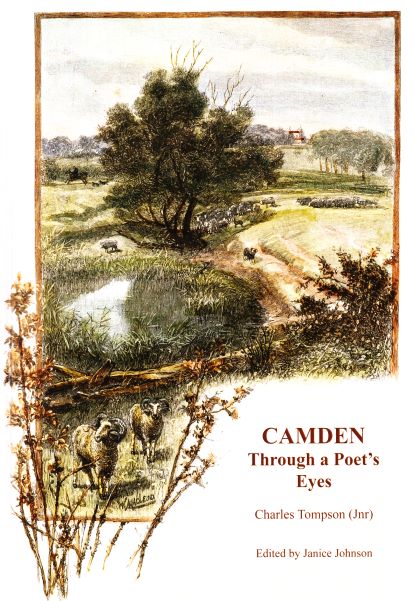
Charles Tompson, a colonial diarist of the Cowpastures

Janice Johnson (ed), Camden Through a Poet’s Eyes, Charles Tompson (Jnr). Camden Historical Society, Camden, 2019. pp.126. ISBN 978-0-6485894-9-5

In 1854 Charles Tompson described that the ‘village of Camden’ had ‘the aspect and the attributes of an English village’ (p.118). In doing so, he was probably the first European to describe Camden’s Englishness, an attribute that numerous writers have agreed with, particularly in the early 20th century. Tompson was not the first to note the Englishness of the Cowpasture district. That privilege belonged to John Hawdon in 1828.

These are some of the observations of the Cowpastures drawn from the pen of Charles Tompson in a new collection of his work, Camden Through a Poet’s Eye, Charles Tompson (Jnr). The Camden Historical Society has published a work that the late Janice Johnson had been working on while she was alive. The book has been funded by a bequest Johnson estate.

Tompson-Camden-ThroughAPoetsEyes-Cover_lowres
Cover of Camden Through a Poet’s Eyes, Charles Tompson. ‘The  Cow-Pastures, Camden Park’ William McLeod. c1886.

Tompson was a prolific writer and observer of the Cowpastures under the byline ‘From our Correspondent – Camden’ for The Sydney Morning Herald between 1847 and 1852. He wrote about the ordinariness of the area while occupying the position of Clerk of Petty Sessions, and his reports are far from ordinary.

Tompson was educated by colonial standards, born on the Castlereagh and attending the local parish school run by Irish rebel Reverend Henry Fulton. His observations are full of colour and movement and provide an invaluable archive of data, descriptions and general goings-on across the area.

Tompson published regular reports on various topics, including farming, the weather, cropping, local identities, police rounds, court proceedings and the movement of people through the area, amongst other topics. He was an astute observer and provided the earliest detailed overview of the early years of Camden village from his position at the local courthouse.

A detailed reading of Tompson’s work provides the patient and curious observer with a detailed description of rural life in the Cowpastures. In 1847 Tompson identified the area as the Cowpastures (p.23) as it was to remain into the late 19th century. He provided a useful description of the area (p.23). For example, there was a constant shortage of farm labour in 1847 to cut hay by hand on ‘small scale’ farms across the area worked by smallholders. (p.28). Maize was planted in October (p.28), and wheat and hay were harvested by hand-sickle in November (p.33), although the drought restricted the harvest (p.32).

Market prices are provided for those who need to know about such things. Horses were worth between £8 to £10 in 1847 (p.29), wheat might get 4/6 a bushel, maize worth 2/- a bushel, and good hay was worth £10 per ton. (p.32). By March 1848 price of wheat had dropped to 3/6 to 4/- a bushel, while fine flour was worth £12 a ton, and vegetables were scarce, with potatoes between 1d to 1½d per pound (p.42). Flour was ground at one of the mills in the area. (p.23)

Tompson Book Back Cover Camden sketch 1857-lowres
Back Cover of Camden Through a Poet’s Eyes Charles Tompson. Sketch of Camden, HG Lloyd, 1857 (SLNSW)

The local population and its growth (p.23) were detailed by Tompson, along with the villages and hamlets in the immediate area, including Narellan, Cobbitty (p.24), Picton and Menangle (p.25). Tompson could be effusive in his description and Cobbitty was a ‘diamond of the desert on the dead sea shore’ while he could be more grounded and just described Narellan as the ‘Government township’. (p. 24)

The local colonial grants and their links to each location are detailed for the reader. Cobbitty was surrounded by ‘Wivenhoe, Denbigh, Matavai and Brownlow Hill – all beautiful in their own way – from the homely milkmaid-like undecorated farm and the verandahed cottage, with group plantations, to the elegant Italian villa, embowered in orange groves, and the secluded chateau of dignified retirement’ (p.24). Similar descriptions were used by travel writers in the early 20th century.

The gentry estates were the same ones that reminded Englishman John Hawdon of his Durham homeland in the 1820s. The description of the landscape provided by Tompson reminds the reader how short the gap was in years between the original European settlement of the Cowpastures and his presence in Camden village in the 1840s.

Camden Park was described by Tompson as ‘magnificent’, which had, in the last few years, ‘been opened up and cultivated by a story of a primitive pioneer who takes farms on clearing leases’ (pp24-25). The tenant farmers were not the yeoman farmer the British colonial authorities were trying to create at the time. They were closer to a peasant culture.  Tompson likened Camden Park to a European ‘principality’ rather than the gentry ‘Estate’ it was and would remain for over the next 150 years. (p.26)

TompsonCharles-Camden-ThroughAPoetsEyes-lowres

The Razorback Range was ‘scarcely…a mountain’ and was ‘in fact a tract of excellent arable land’. The Nepean River and Bent’s Basin was a ‘small lake of about a furlong’s diameter’ and it was ‘round and deep’. (p.27)

The weather was an ever-constant in Tompson’s travails of the Cowpastures, as were the constant dry spells that are all part of the Australian environment. He laments ‘how sadly the rain keeps off’ in October 1847 (p.27). A month later, he left his thermometer in the sun and it rose to 1200F when left on the ground on his way home from church (p.28). He observed that the continued dry spell of 1847 had ‘driven’ the smallholders ‘to despair’ (p.28).

Thunderstorms, unsurprisingly, were typical of a summer’s afternoon across the Cowpastures. In December 1847, a ‘heavy thunderstorm passed over, without much rain’ (p.33), as it still happens today. Thunderstorms could cause bushfires that burnt throughout the hotter months of the year (p.30). Bushfires were an ever-present part of the Cowpasture’s ecology – both natural and man-managed – by Indigenous Australians.

Tompson was not a fan of the Indigenous people and possessed the British attitude to the inferior nature of the Australian Aborigine that was the basis of the settler society colonial project. In March 1848, ‘the blacks [Dharawal] from the south country always visit the Cowpasture…in great numbers’. Reminiscent that the colonial frontier could be a violent site and a male domain. Tompson reported that there was a woman of a lonely farm hut ‘scarcely considers her safe’ as the Indigenous people moved through the area ‘in the absence of her husband’.(p.44)

The newbies to the local area in the 21st century could do themselves a favour and read the description of the 1848 flood at Camden. The flood was caused by an east-coast-low-pressure system, as they are in eastern Australia today. The 1848 flood event was over after three days, reaching its peak within 24 hours of the river starting to rise. Tompson witnessed an ‘expanse of water several miles in circumference’ that had previously ‘dry land’. (p.43)

Disease was a problem with influenza (p.31) prevalent in 1847, and ‘everybody is wrapped up, pale, coughing and wearing a certain indescribable dreamy appearance’. (p.31) Tompson reported the presence of scarlet fever in 1848 (p.61) and called it scarlatina (p.61) as it was also known. Even as early as 1848, the Camden village was regarded by many Sydney ‘invalid refugees’ as a type of health resort, with many staying at Lakeman’s Camden Inn. (p.61)

The very English hunting activity appeared in 1849 and the Sydney gentry brought their ‘dingo hounds’. Tompson reported that they were joined by some local ‘gentlemen’ and went deer hunting ‘in the bosky glens of the Razorback’. It was reported that some hounds ‘ran down a fine kangaroo’, and the party returned drenched ‘by heavy rain’. The following day the party moved to Varroville. (p.79)

Janice Johnson’s collection of Tompson’s musings and sometimes whimsical commentary on life in the Cowpastures is a convenient summary of work published in the Sydney Morning Herald. The researcher does not have to wade through hundreds of pages looking for a short descriptive paragraph as Alan Atkinson did for his work on Camden.

Johnson has done the hard graft by extracting these snippets of Cowpasture life using the National Library’s wonderful database Trove. This is a treasure trove of information for any researcher, complemented by a useful index. For those interested in colonial New South Wales, this book should be a standard reference of the colonial period in any library.

Updated 29 April 2023. Originally posted on 23 September 2019.

Aesthetics · Architecture · Art · Attachment to place · Belonging · British colonialism · Built heritag · Camden · Camden Park House and Garden · Camden Story · Camden Town Centre · Church History · Churches · Collective Memory · Colonial Camden · Colonialism · Community identity · Cowpastures · Cultural Heritage · Cultural icon · England · Farming · Gothic · Heritage · Historical consciousness · Historical Research · History · Landscape aesthetics · Legends · Living History · Local History · Local Studies · Macarthur · Memorialisation · Memorials · Memory · Monuments · Myths · Place making · Ruralism · Sense of place · Settler colonialism · Settler Society · Social History · St John's Church Camden · Symbolism · Tourism · Victorian · Women's history

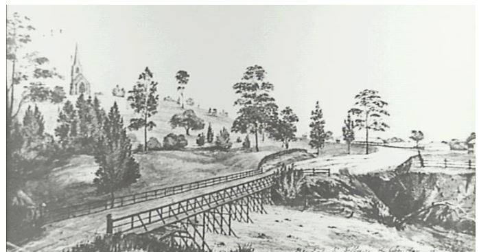
St John’s Church, a contested sacred site in the historic landscape of the Cowpastures

A sense of place and a contested narrative

St John’s church is a contested site where there is competition around the ownership of the dominant narrative surrounding a former horse paddock. The paddock in question lies between St John’s Anglican Church and the former Rectory, all part of the St John’s Church precinct.

St Johns Church
St Johns Church Camden around 1900 (Camden Images)

Church authorities want to sell the horse paddock to fund a new worship centre.

There has been a chorus of objections from some in the Camden community over the potential sale. Community angst has been expressed at public meetings, protests, placards, and in articles in the press.

camden st johns church paddock 1907 cipp
Camden Rectory & Horse Paddock 1907 with Menangle Road on right-hand side of the image (Des & Pru Fowles/Camden Images)

The principal actors (stakeholders) who have taken up positions around the issue include churchgoers, non-churchgoers (residents, outsiders, ex-Camdenites, neighbours), the parish, local government, state government, and the Macarthur family.

The former horse paddock looks like an unassuming vacant block of land in central Camden. So why has there been so much community angst about its possible sale?

camden st johns fjoss image 7 (5)
St Johns Anglican Church showing a former horse paddock in front of the church (2018 C Cowell)

The simple answer is that the community ascribes representations of a church beyond the building being a place of worship. Yet this raises a paradox for the owners of these religious sites. Generally speaking, different faiths put worship and the spiritual interests of their followers ahead of their property portfolio.

This paradox has created angst in some communities when the owners of religious buildings and sites want to sell them, for example, in Tasmania in 2018 or other examples discussed by Graeme Davison.

Unraveling a paradox

Historian Graeme Davison, in his book The Use and Abuse of Australian History, has highlighted the different representations that communities have ascribed to local churches. They have included:

  • a symbol of the continuity and community rather than a relic of their faith;
  • a local shrine where the sense of family and local piety are given tangible form;
  • ‘a metaphor of the postmodern condition’;
  • a ‘kind of absent present, a site now unoccupied but irreplaceable and unable to be rebuilt;
  • a transcendence and spiritual continuity in a post-Christian society. (pp. 146-161)

So the question here is, are any of Davison’s representations applicable to Camden’s St John’s Church?

camden st_johns_church02
St Johns Anglican Church Camden 2018 (I Willis)

Cultural landscape

St John’s church is the centre of Camden’s cultural landscape, its cultural heritage and the narrative around the Camden story. I wrote in the Sydney Journal in 2008 that

In 2012, I extended this and said that community icons, including St John’s,

In this dispute, the actors, as others have done,

The actors in the dispute want to preserve the landscape identity of the area by preserving the church precinct, including the horse paddock.

A world long gone

The church precinct is a metaphor for a world long gone, an example of the past in the present. In Davison’s eyes ‘a symbol of continuity and community’.

St John’s Anglican Church is part of an English-style landscape identity, that is, Camden’s Englishness. This is not new and was first recognised in 1828 by Englishman John Hawdon.

Hawdon saw a familiar landscape and called it a ‘little England’.  A type of English exceptionalism.

The colonial oligarchs had re-created an English-style landscape in the Cowpastures that mirrored ‘home’ in England. The English took control of territory in a settler society.

The local Indigenous  Dharawal people were dispossessed and displaced by the English through the allocation of land grants in the area.

The English subdued the frontier with violence as they did other parts of the imperial world.

The Hawdon allegory was present when the town was established by the Macarthur family as a private venture on Camden Park Estate in 1840. The construction and foundation of St John’s church was part of the process of the building of the new town.

The first pictorial representation of this was  used in Andrew Garran’s 1886 Picturesque Atlas of Australasia, where there is

camden park 1886 garran
Engraving showing vista of Camden village from Camden Park House. The aspect is northeast with Cawdor centre distance and St John’s church right-hand distance.  (Andrew Garran’s 1886 Picturesque Atlas of Australasia)

The hilltop location of the church was no accident.  St John’s church is ‘the moral heart’ of English-style ‘idyllic representations as the

The hilltop location has spiritual significance with Biblical references to love, peace and righteousness.

A sense of place

St John’s church has had a central role in the construction of place and community identity in the town.

camden_johnst_chs0083
St John’s Anglican Church in its hilltop location at the top of John Street Camden. This image is by Charles Kerry in the 1890s (Camden Images)

The church and its hilltop location are an enduring colonial legacy and a representation of the power of the colonial gentry,  particularly the position of Camden Park Estate and the Macarthur family within the narrative of the Camden story.

Camden Park 1906 (Camden Images)
Camden Park House and Garden in 1906 is the home of the Macarthur family. It is still occupied by the Macarthur family and is open for inspection in spring every year. (Camden Images)

Many Camden folk feel a sense of belonging to the church expressed by memory, nostalgia, customs, commemorations, traditions, celebrations, values, beliefs and lifestyles.

The community feel that the church belongs to them as much as it belongs to the churchgoers within the church community.

Belonging is central to placeness. It is home and a site where there is a sense of acceptance, safety and security. Home as a place is an important source of stability.

An extension of this is the role of the church as a loved place in terms laid out by Peter Read in his book, Returning to Nothing, The Meaning of Lost Places. As Veronica Strang writes in Read’s book:

camden st johns vista from mac pk 1910 postcard camden images
Vista of St John’s Church from Macarthur Park in 1910. Postcard. (Camden Images)

The church buildings and precinct are a shrine to a lost past and are considered by many to be sacred land. The sale of the former horse paddock has caused a degree of community grief over the potential loss of sacred land.

St John’s church is an important architectural statement in the town centre and is one of Australia’s earliest Gothic-style churches.

So what does all this mean?

The place of St John’s church in the Camden community is a complex one. The story has many layers and means different things to different people, both churchgoers and non-churchgoers.

The church is a much-loved place, and the threatened loss of part of the church precinct generates feelings of grief and loss by many in the community.

The legacy of the English landscape identity from the early 19th century and the establishment of the Cowpastures is very real and still has a strong presence in the community’s identity and sense of place. The English-style Gothic church is a metaphor for Hawdon’s ‘Little England’ allegory.

The Cowpastures was the fourth location of European settlement in Australia, and the local area still has a strong Anglo-demographic profile.

These factors contribute to re-enforcing the iconic imagery projected by St John’s church combined with the story of a settler society and its legacy in a contested landscape.

Check out this publication to read more about the Camden district.

Cover  Pictorial History Camden District Ian Willis 2015
Front Cover of Ian Willis’s Pictorial History of Camden and District (Kingsclear, 2015)

Updated on 16 September 2023. Originally posted on 31 January 2019 as ‘A contested sacred site in the historic landscape of the Cowpastures’

British colonialism · Camden Museum · Colonial Camden · Colonialism · Community identity · Convicts · Cultural Heritage · Elizabeth Farm · Farming · Georgian · Gothic · Governor Macquarie · Heritage · History · Landscape aesthetics · Local History · Macarthur · Myths · Place making · Settler colonialism · Victorian

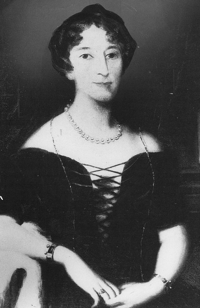
Celebrity author at Camden Museum


The Camden Museum hosted celebrity author Michelle Scott Tucker recently at a local book launch. The event attracted an enthusiastic audience of 50 members and guests to an engrossing talk from Tucker, the author of Elizabeth Macarthur, A Life at the Edge of the World.

Camden Museum MSTucker talking BookLaunch 2018Jun13
Michelle Scott Tucker spoke about her new book Elizabeth Macarthur A Life At the Edge of the World at the Camden Museum. She had the large audience sitting on the edge of their seats as she told the story of Elizabeth and her life in colonial New South Wales. The launch was held at the Camden Museum on Wednesday 13 June 2018 (I Willis, 2018)


Michelle delivered an eloquent and gripping lesson on Elizabeth Macarthur to an audience sitting on the edge of their seats. Tucker spoke for 40 minutes without notes and then handled a number of penetrating questions. Earlier in the day she had been interviewed on ABC Sydney Local Radio by James Valentine in wide ranging conversation about Macarthur that clearly impressed him. Tucker is an impressive media performer telling an engrossing story about her hidden subject of Elizabeth.


After the Museum talk there was a long line of those who had purchased books to have them signed by the author.  The most excited person in room was Camden Historical Society secretary Lee Stratton who drove into Surry Hills to pick up Michelle and then returned her to the city after the launch. Lee is a devoted fan and was not phased at all by her providing this generous effort.

Camden Museum MichelleScottTucker BookSigning 2018Jun13
Michelle Scott Tucker signing a copy of her new work Elizabeth Macarthur A Life At the Edge of the World at the Camden Museum. There was a long queue for book signing from the large audience of members and friends on Wednesday 13 June 2018 (I Willis, 2018)


Michelle Scott Tucker writes in an engaging and open style that is easily accessible by anyone interested in colonial Australia, women’s biography or just a great yarn. She takes a fresh look at an old story from a woman’s perspective, from the other side.


In the early 19th century the world was divided into the women’s private sphere and the public world inhabited by men.  Michelle Scott Tucker takes a look from the domestic private world of women. It is a form of radical history.

Book Elizabeth Macarthur 2018 Cover TextPub
The cover of Michelle Scott Tucker’s Elizabeth Macarthur A Life at the Edge of the World. The book was launched in Camden at the Camden Museum to a large and enthusiatic crowd of readers on Wednesday 13 June 2018 (Text Publishing)


Michelle’s analogy of her approach to the story is looking at the stitching on the back of tapestry, and inspecting the intricate nature of the threads. This gives you an insight into how the whole work is kept together from the hidden and dark shadows of the work. Without the stitching the work would fall apart, and so it was the Macarthur family enterprises in colonial New South Wales. Tucker draws the stitches together to create a story showing the colour and movement of colonial New South Wales.


Elizabeth Macarthur, the farmer’s daughter from Devon, married a cantankerous irascible army officer called John Macarthur when she was pregnant with her first child. Tucker draws an parallel with another Georgian story that of the women in the romantic novel Pride and Prejudice by Jane Austin. She makes the point that Elizabeth Macarthur, and husband John, were Georgian figures while her family were Victorians.


Tucker tells how Elizabeth Macarthur, heavily pregnant and with a small child at her side,  endured probably the worst journey out from England of any convict transport on the Second Fleet in the Scarborough. She nursed her husband back from illness that he suffered at the Cape and lost a child on the voyage out which was buried at sea. She suffered the social ignominy of sharing a cabin space with convict women well below her station in life.

Camden Museum MSTucker BookLaunch President Ian Willis with Michelle 2018Jun13 Lee Statton
The president of the Camden Historical Society Dr Ian Willis with Michelle Scott Tucker at the Camden launch of her new book Elizabeth Macarthur A Life at the Edge of the World. The launch was held at the Camden Museum on Wednesday 13 June 2018 (Lee Stratton)


Macarthur was not on her own and many colonial women endured the sea voyage from England with few comforts. Their diaries detail the trials and tribulations throughout the early years of the colony. One such figure in the Camden story was Caroline Husband who fell on hard times and fled their Hampstead Hill house near London with debt collectors in pursuit. She married pastoralist Henry Thomas and eventually lives at Wivenhoe, and her descendants grew up at Brownlow Hill.


The ever practical Elizabeth managed and developed the family business empire in colonial New South Wales while her husband was dealing with military charges in England. She entertained governors, politicians, businessmen, officers, while managing a large domestic staff, farm workers and convicts on their extensive landholdings. The role and influence of Elizabeth Macarthur as part of the story of settler colonialism in Australia and has been understated along with many other women of her time.

Camden Museum MSTucker BookLaunch Harry Warner Michelle and Frances Warner 2018Jun13 Lee Statton
Camden identities Frances and Harry Warner with author Michelle Scott Tucker at the Camden launch of Elizabeth Macarthur A Life at the Edge of the World. Frances and Harry have lived most of their lives at Camden Park and have been involved in a host of community activities over many years. Frances organised a small card gift for Michelle from Camden Park. The launch was held at the Camden Museum on Wednesday 13 June 2018. (Lee Stratton)


Tucker makes the point in an article for Inside Story that the story of Elizabeth Macarthur is not unique and that other colonial women made a significant contribution on their own. There was Esther Abrahams who ran Annandale, and Harriet King who raised a family and ran a property west of Parramatta. In Van Diemen’s Land (now Tasmania) a retail empire was developed by former convict Maria Lord, while Eliza Forlonge ran a pastoral empire.


Camden Park was an out-station in the Macarthur family empire and Elizabeth Macarthur never lived there. The mansion house was the home of her sons, William and James. Elizabeth lived at Elizabeth Farm at Parramatta all her life and died at their holiday home at Watsons Bay in her 80s.

Camden Museum MSTucker BookLaunch John Michelle and Edwina 2018Jun13 Lee Stratton
The owners of Camden Park House John and Edwina Macarthur Stanham with author Michelle Scott Tucker. The event was the Camden launch of Tucker’s Elizabeth Macarthur A Life At the Edge of the World held at Camden Museum on Wednesday 13 June 2018. (Lee Stratton)


Unlike many of her colonial contemporaries who viewed the Australian landscape as a Gothic world Elizabeth had a more sympathetic eye. She drew comparisons with England and in her letters home she stated that her around her home at Parramatta, she wrote:

The greater part of the country is like an English park, and the trees give to it the appearance of a wilderness, or shrubbery commonly attached to the habitations of people of fortune’.

Many of her contemporaries contributed to the English-style landscape aesthetic that was identified as early as 1828 by John Hawdon when he arrived in the Cowpastures. The Englishness of the Camden township is still evident and has shaped the landscape since the arrival of the Europeans.


Under Elizabeth’s gaze the colonial outpost of Sydney grew from a military garrison to a bustling colonial port in the South Pacific. Macarthur supported her husband, John, throughout his ordeals and never returned to England, despite having the means to do so. Her female descendants regularly traveled between Camden Park, Sydney and London and elsewhere, and benefited from the transnational networks that she and her family established in the early 19th century.

camden-library museum
The venue for the Camden launch of Michelle Scott Tucker’s Elizabeth Macarthur A Life at the Edge of the World on Wednesday 13 June 2018. Camden Library Museum in John Street Camden  (I Willis, 2016)


Elizabeth Macarthur is an important character in the Camden story and there are other Macarthur women in her family who played similar roles such as Elizabeth Macarthur Onslow, Sibella Macarthur Onslow and Enid Macarthur Onslow. All intelligent, strong and successful women. They were not alone in the Camden story and others that could be mentioned include Rita Tucker, Zoe Crookston, Clarice Faithful, amongst others.


Elizabeth Macarthur produced a family that founded the township of Camden, and created a pastoral and business empire that still endures today. She is celebrated in our local area with the Elizabeth Macarthur Agricultural Institute, Elizabeth Macarthur High School and roads and streets named after her and her family.


As Michelle Scott Tucker states of Elizabeth Macarthur, she  ‘played a crucial role in Australia’s colonial history. Hers is not a household name — but it ought to be’. Elizabeth Macarthur, A Life at the Edge of the World certainly goes a long way in this direction.

The book by Michelle Scott Tucker Elizabeth Macarthur, A Life at the Edge of the World is available at the Camden Museum.

Attachment to place · British colonialism · Colonial Camden · Colonialism · Community identity · Convicts · Cowpastures · Elderslie · England · Farming · Governor Macquarie · Heritage · Historical consciousness · History · Landscape aesthetics · Local History · Place making · Sense of place · Settler colonialism · Victorian

The Cowpastures Project

The Cowpastures project is a community based collaborative research enterprise which is co-ordinated by UOW historian Dr Ian Willis.

Presentation The Cowpastures 2017Oct3


It is a long term venture which aims to reveal the intricacies of the Cowpastures district from 1795 to 1850.

The Dharawal people occupied the area for centuries.


Sydney1790_Aborgines in Port Jackson
Sydney 1790 Aborigines in Port Jackson (SLNSW)

The district was part of the Australian colonial settler society project driven by British colonialism.

There was the creation of the government reserve for the wild cattle between 1795 and 1823. After this period the Cowpastures became a regional locality that was in common usage well into the 19th century.


1824-view-of-cowpastures-joseph-lycett
View upon the Nepean River, at the Cow Pastures New South Wales 1824-1825 Joseph Lycett (SLNSW)

The British aimed to create an English-style landscape from their arrival in the area from 1790s. The earliest written acknowledgement of this by Englishman John Hawdon in 1828.


1932_SMH_CowpastureCattle_map
Map of the Cowpastures government reserve (SMH 13 August 1932)

Learn more about the Cowpastures from these blog posts and other resources: 

A colonial diarist of the Cowpastures

This blog post is a review of Janice Johnson (ed), Camden Through a Poet’s Eyes, Charles Tompson (Jnr) (2019).  Tompson was a prolific writer and observer of the Cowpastures under the byline ‘From our Correspondent – Camden’ for The Sydney Morning Herald between 1847 and 1852. In 1854 Charles Tompson described that the ‘village of Camden’ had ‘the aspect and the attributes of an English village’ (p.118) for the first time.

A contested sacred site in the historic landscape of the Cowpastures (blog post)

This blog post examine community concerns around the sale of glebe land attached to St John’s Anglican Church in Camden and highlights community sensitivities to sale of church sites. This church was largely funded by the Macarthur family and has since its foundation in 1847 has received considerable endowments from the family.

The Cowpastures Region 1795-1840 (blog post on regionalism & boundaries)

This blog post attempts to put a regional boundary on The Cowpastures for the first time and examines some of the historical evidence for this boundary.

Camden Cowpastures Bicentenary Celebrations  (Blog post)
‘Just like England’, a colonial settler landscape  (Peer-reviewed article)
Cowpastures and Beyond: Conference 2016  (Camden Area Family History Society)
Convicts in the Cowpastures (Blog post)
Governor Macquarie in the Cowpastures 1810 (Blog post)
Governor Macquarie returns to the Cowpastures 1820 (Blog post)
Mummel and a Cowpastures Patriarch (Blog post)

The Cowpastures, just like a English landscape (Presentation)

The Cowpasture, just like an English landscape (Slideshare)
Viewing the landscape of the Cowpastures (Blog post)
John Hawdon of Elderslie (Blog post)
John Hawdon of Elderslie English Origins (Blog post)
The Cowpastures at the Campbelltown Arts Centre (2017) (Exhibition)
The Came by Boat Exhibition Campbelltown Arts Centre (Exhibition Review, 2017)
John Macarthur the legend (Blog post)
Hope, heritage and a sense of place – an English village in the Cowpastures (Blog post)

This blog post looks at the historical elements that have contributed to the Camden sense of place, and ultimately its historical significance.

A walk in the meadows of the past

This blog post is about the Miss Llewella Davies Pioneers Walkway at the Camden Town Farm. The beauty of the Cowpastures landscape characterises the recently opened Miss Lewella Davies Memorial Walkway which weaves its way across the Nepean River flats on the western side of Camden’s township historic town centre.

Agricultural heritage · Agriculture · Appin · Attachment to place · British colonialism · Burragorang Valley · Business · Camden · Camden Museum · Camden Story · Colonial Camden · Colonialism · Communications · Community identity · Cultural Heritage · Cultural icon · Economy · Engineering Heritage · Families · Family history · Farming · Heritage · Historical consciousness · Historical Research · Historical thinking · History · Living History · Local History · Local Studies · Lost trades · Macarthur · Memory · Moveable Heritage · Myths · Pioneers · Place making · Placemaking · Ruralism · Sense of place · Settler Society · Silver mining · Storytelling · Teamsters · Traditional Trades · Transport · transport history · Yerranderie

The Bennett wagon, a piece of transport history

Camden Museum acquires the Percival wagon

One of the more oversized items in the collection of the Camden Museum is an item that few of the current members are aware of or would know the history. The Percival wagon was located next to Macaria for several decades, the former headquarters of Camden Council.

In 2012 a group of schoolboys got the opportunity to pull it to bits and put it back together again. They did a lot of work but were unable to finish the project. The wagon has been fully restored and conserved and is now located at the Wollondilly Heritage Centre in a new blacksmith’s display.

Camden Percival Wagon_0003
The historic Camden (Percival) wagon is probably a Bennett construction and was placed in the forecourt area next to Macaria by the Camden Historical Society in 1977. Where it stayed for several decades until 2012. (Camden Historical Society)

Bennetts Wagon Works at St Marys

The Percival wagon is likely to have been built at the Bennetts Wagon Works at St Marys, which started in 1858 and eventually closed down in 1958. The Western Plains Cultural Centre at Dubbo states:

Bennett coach and Wagon works were operated by brothers James and George T. Bennett. Their tabletop wagons became famous throughout Australia; they were capable of carrying from 10 to 20 tonnes, and were regarded as the best heavy transport wagons to be bought. They were used in both rural and urban areas.

The Bennett wagon works at St Marys employed around 25 men at the end of the 19th century, with its wagons selling for between £150 to £250. The wagons were usually painted green and red or red and blue, and some had nicknames, like ‘The Maxina’ (in South Creek Park now), ‘King of the Road’, and ‘The Pioneer’.

st-marys-bennett-wagon-works-1910-penrithcitylibrary-e1499829672934.jpg
George T. Bennett’s Wagon Works, St Marys. The photograph, taken in 1910, shows George Bennett’s wheelwright and blacksmith’s workshop in Queen Street, St Marys, which was built in about 1875. The business was on the western side of Queen Street, a short distance north of King Street. George’s brother James joined him in the business, but James built his own workshop closer to the highway after a disagreement. George closed his business in 1920. (Penrith City Library)

The Penrith City Regional Library states the Bennett wagons were used by teamsters to haul silver from the Burragorang Valley. In 1904 there were 15 teams of horses and bullocks plying the road between Yerranderie and Camden railhead from the silver field from around 1900 to 1925.

The silver ore was initially forwarded to Germany for smelting, and after the First World War, it went to Port Pirie in South Australia and then Newcastle. The story of the teamsters who worked out the Burragorang is celebrated in a monument outside Macaria in John Street, which was installed in 1977 by the Camden Historical Society.

Wagon finds a home at Camden

The historical society’s wagon was among the last in the Macarthur area. It was around 70 years old when the society purchased it from Sydney Percival of Appin in 1977 using a public fundraising appeal organised by society president Owen Blattman and Dick Nixon for $200. Once the society secured the funds and purchased the wagon, it was restored by retired Camden carpenter Ern Howlett and painted red and blue.

Deidre Percival D’Arcy says:

 My father, Norman Dyson Percival, owned the wagon and the property Northampton Dale. He first offered the wagon to Campbellltown & Airds Historical Society where Norman”s brother, Sydney Rawson Percival, was a member. He assisted in the move to Camden Historical Society. 

Northampton Dale

The original owner of the society’s wagon was Sydney’s father, Norm Percival, who died in 1942 with the wagon passing to his son. Norm lived on the Northampton Dale property, part of William Broughton 1000 acre grant of Lachlan Vale.

John Percival purchased Northampton Dale when Broughton’s grant was subdivided in 1856 and named it after his home in England. The Percival property was used for horse breeding, beef cattle and later as a dairy farm. During the First World War, the farm was a popular venue with local people for playing tennis. (Anne-Maree Whitaker, Appin, the Story of a Macquarie Town)

Campbelltown Percival Wagon_0001

Typical of Bennett wagons, the society’s Percival wagon was used to cart wheat at Junee in 1913, while around 1900, it had previously been used to cart chaff from Campbelltown Railway Station to the Cataract Dam construction site.

Wagon at Appin

The wagon was also used to cart coal in Wollongong and around the Percival Appin farm of ‘Northampton Dale’ and the Appin district. The Percival wagon had been restored by the Percivals in 1905 and was fitted with new front wheels and plied for business around with Appin area. The signage along the side of the wagon was ‘EN Percival, Appin’.

The Percival wagon was placed adjacent to Macaria in John Street in 1977 and, by 1992, was a little the worse for wear. A team of society members took to the task with gusto and contributed over 200 hours to the restoration, with Camden Council contributing $600 to the total cost of $1200.

Another decade passed, and the weather and the elements again took their toll on the wagon. Repainting was needed in 2001.

Camden HS Teamsters Wagon
The Percival wagon in Argyle Street Camden was driven by Mr Biffin before being located next to Macaria in John Street in 1977 (Camden Museum)

Restoration by Macarthur Anglican School students

In 2012 the Dean of Students at Macarthur Anglican School, Tim Cartwright, suggested that the wagon become a restoration project for the school boys. Cartwright, who had retrained as a teacher, had been a master carpenter in Europe before coming to Australia. The wagon was taken out to the school later that year, and the students completed some work.

Tim Cartwright stated in 2018

When the School took possession of the Wagon, the entire sub structure was affected by white-ant and dry rot. This became evident when the front wheels folded under themselves unable to steer or take their own weight.

A small team of enthusiastic Year 7 and Year 9 boys with no practical carpentry experience gathered every Friday afternoon and sometimes through School holidays, with the intention of renovating and replacing all parts of the Wagon to bring it to a point where it could be used rather than just as a display.

Over the four year period the boys learnt essential Carpentry skills often producing work that demanded great attention to detail and a skill level that would be demanding even for modern practice.

The boys included Adam Ebeling, Jack Jansen, Richard Cartwright, Henry Cartwright
Tom Oliver, Daniel Pearce.

The boys took great pride in their work and were always concerned to replicate original parts instead of compromising on easier or more convenient solutions. This project has been rich in learning in many aspects and I am thrilled to have led the boys on this pathway of preserving our local heritage and introducing them to skills they will be able to revisit in years to come.


Restoration and conservation by The Oaks Historical Society

Volunteers at The Oaks Historical Society have completed the wagon’s latest restoration.

The Oaks Cover Newsletter 2019 Wagon Restoration
Camden HS Wagon SoS Cover
Camden Museum, Teamsters’ Wagon, Statement of Significance, Item No 1995.423.

Read more about Bennett Wagons

Bennett Family and Business

The Bennett Wagon Enclosure, St Marys NSW

The Bennett Wagon On The Move – St Marys NSW Spring Festival 2013 (YouTube)

The 10 tonne Bennett wagon ‘All The Go’ at Marlie Stud.

Originally posted on 9 May 2023. Updated 24 July 2020

Aesthetics · Agricultural heritage · Agriculture · Attachment to place · British colonialism · Colonial frontier · Colonialism · Convicts · Cowpastures · Cultural Heritage · Cultural icon · England · Families · Farming · Georgian · Goulburn · Heritage · Historical Research · History · History of a house · House history · Landscape · Landscape aesthetics · Legends · Local History · Local Studies · Macarthur · Memory · Pioneers · Place making · Ruralism · Sense of place · Settler colonialism · Tourism

Richlands, an outpost of a colonial farming empire

A farming outpost of empire

Richlands Georgian style homestead built in the 1840s  on the 2016 open day (I Willis)

The Richlands estate, north of Goulburn in the NSW Southern Tablelands, was an important part of the Macarthur family pastoral empire for nearly 100 years.  The Richlands estate acted as an outstation about one days ride west of Camden Park estate. The property  reached its hiatus in the 1840s when its extent reached around 38,000 acres including the private village of Taralga.

James Macarthur managed the Richlands estate with his brother William Macarthur from Camden Park. (Belgenny Farm)

James and William Macarthur initially took up adjacent land grants of around 2000 acres between Taralga Creek and Burra Lake in 1822.  The area had been traversed by a party led by Charles Throsby in 1819 looking for an alternative route to Bathurst other than the arduous route across the Blue Mountains. Throsby and company journeyed from the Moss Vale area, crossing the Wollondilly River then the Cookbundoon Ranges near Tarlo, turning north are eventually arriving at Bathurst.

Opening up the Southern Tablelands

Reports of these areas encouraged pastoralists to take up land, one of the first was Hannibal Macarthur, John Macartur’s nephew, at Arthursleigh on the Wollondilly. In a speculative venture in 1822 James Macarthur and partners Lachlan MacAlister and John Hillas, overseer with William Macarthur, moved a mob of cattle over the Cookbundoons and left them in charge an assigned convict Thomas Taylor at Tarlo. Hillas and MacAlister also took up a grants adjacent to the Macarthur holdings.

On the death of John Macarthur in 1834 the Richlands estate passed to Edward Macarthur, a career British soldier, while managed by James and William Macarthur on his behalf.

Governed by absentee landlords

While the Richlands estate was governed by absentee landlords the real story is of those who formed the microcosm of society on the estate. They  included convicts, managers, tenant farmers, servants and the Burra Burra people, who were dispossessed and displaced from their country.

Fledgling settlement of Taralga

For the twenty years of the Richlands estate it was managed from the fledgling settlement of Taralga on the southern edge of the property. There was a central store and a number of skilled tradesmen,  convicts and their overseers were based in the village from the 1820s.

Taralga village main street 2000s. The initial management of the Richlands estate was conducted from the village in the 1820s until it was shifted to the new hilltop homestead built in the 1840s. The village is one of number of private towns that the Macarthur family established in colonial NSW. ULSC

Rural empire of 38,000 acres

James and William Macarthur acquired land by grant and purchase north and south of the hamlet of Taralga including 600 acres from Thomas Howe of Glenlee in the Cowpastures in 1837. The diary of Emily Macarthur’s, James’ wife, showed that William made six-monthly visits to Richlands from 1840. Lieutenant Colonel Edward Macarthur visited Richlands in 1851 after being posted to Sydney as deputy adjutant general.

Edward Macarthur (1789-1872), who inherited the Richlands estate on the death of his father John Macarthur in 1834. ( Richard Daintree and Antoine Fauchery, c1858)

Strategic hilltop

Work began to move the management of the estate from the village to the hilltop overlooking Burra Lake and Guineacor to the east. Hilltop locations for homesteads were common throughout the Cowpastures and as they were of other Macarthur properties. This practice followed Laudon principles and provided a defendable strategic location on the estate.

Richlands Georgian style homestead on hilltop location built in the 1840s on 2016 open day (I Willis)

William Campbell was appointed superintendent in 1839 and work began on stone offices on the farm hilltop site, along with underground grain silos, convict accommodation and outbuildings. Work was completed by 1844 when Thomas and Martha Denning occupied the house forming a small quadrangle.  Denning was appointed overseer (farm manager).

Georgian-style residence

Work on a new on a Georgian-style residence began in 1845 for new English estate manager George Martyr, who took up the position after his arrival in the colony in 1848 after marrying Alicia in Sydney.

Martyr took an active interest in community affairs serving on Goulburn Council and supervising construction of the Catholic Church in the village. A qualified surveyor from Greenwich, Martyr surveyed the village of Taralga and the Macarthurs offered village lots for sale from 1847. George and Alicia raised six children on Richlands.

Richlands Georgian style homestead built for estate manager George Martr and his family in the 1840s on the 2016 open day (I Willis)

The property was eventually resumed by the New South Wales Government in 1908, broken up for closer settlement and sold in 30 smaller lots in 1910.

Notes

Peter Freeman Pty Ltd, Richlands-Taralga, Conservation Management Plan, Richlands Conservation Management Plan, 1997.