
Australian women played a crucial role in the first Australia Day on July 30, 1915, which aimed to support sick and wounded soldiers from World War I. Originally suggested by Ellen Wharton-Kirke, the day centered on fundraising for the Red Cross. Women's contributions towards Australia Day remain overlooked in historical narratives surrounding Australia Day and the Anzac story.
Category: Australia

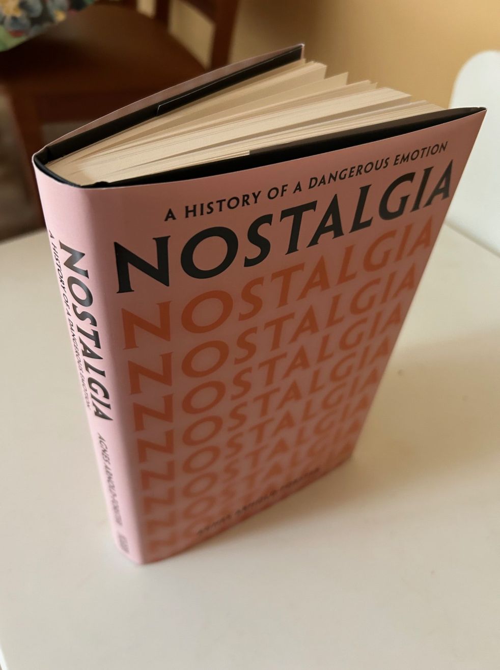
Exploring nostalgia, more than a rear vision view of the world
Agnes Arnold-Forster's "Nostalgia: A History of a Dangerous Emotion" explores the multifaceted nature of nostalgia, reflecting societal anxieties and its weaponization by politicians. The book illustrates nostalgia's importance in contemporary culture, as seen in varying contexts like music and Australia Day debates, while offering a historical perspective on its evolution and impact.
Share this:

Share this:
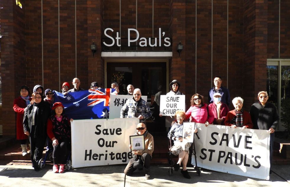
Why does the sale of a local church create community angst? What is going on?
The sale of church land has sparked community angst, particularly at St. Paul's Anglican Church in Bankstown. The proposed heritage listing has led to concerns about redevelopment and closure. Similar issues have arisen in Tasmania, where the sale of local churches has evoked strong emotional and historical attachments. The opposing views between churchgoers and non-churchgoers present an unresolved ethical dilemma.
Share this:

Share this:
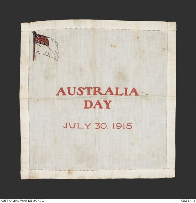
Australia Day 1915 in Camden: Record-breaking Wartime Fundraiser
In mid-1915, the Camden Patriotic Fund took over fundraising for the first Australia Day appeal directing proceeds to the Red Cross for Australian wounded. The patriotic fund raised a substantial amount of money through various events. Meanwhile, on a national scale, the significance of the first Australia Day evolved from an idea initiated by Mrs. Elle Warton-Kirke of Manly NSW to an important Red Cross day. In Camden, the 1915 Australia Day activities were a significant wartime fundraiser, demonstrating the community's support for the war effort.
Share this:
Share this:
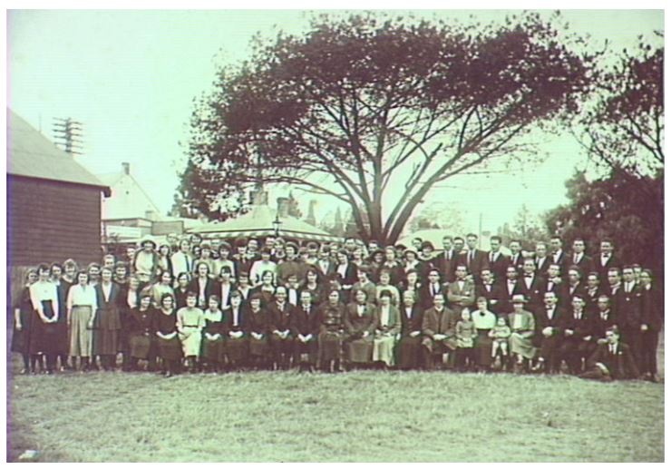
Camden Trainee Teachers Camp 1924: Unveiling a Mysterious Journey
In 1924, a group of trainee teachers from Sydney Teachers College visited Camden for practical training, sparking local curiosity. This visit was part of a tradition that began in 1921, providing hands-on experience in local schools. The program's success was notable, drawing attention from education authorities and the media, and leaving a lasting impact on the community.
Share this:

Share this:

Local historian talks at an international conference in Adelaide
Dr Ian Willis OAM challenges myths of WWI in his talk at the 2024 Australian Historical Association conference. He examines the Australian military's response to sick and wounded soldiers and the role of the British Red Cross. The conference aims to uncover home truths and dispel historical myths. Dr Willis's research focuses on the Red Cross's role in soldier recovery.
Share this:

Share this:

Fall of Singapore and the Camden response
The Fall of Singapore in February 1942 was a disastrous military defeat for the British Imperial forces and a defining point of the Second World War for Camden.
Share this:

Share this:

Understanding the Anzac Myth: Truths and Contradictions
The Anzac story is vital to Australian identity, yet its meaning remains contested. Historian Dr. Jen Roberts argues that the narrative, while centered on duty and sacrifice, encompasses contradictions surrounding nationalism, trauma, and the realities of war. Anzac's evolution reflects cultural transformations, highlighting diverse interpretations and ongoing relevance in society.
Share this:

Share this:

The Llewella Davies Memorial Walkway, a walk in the meadows of the past
The Camden Town Farm Miss Llewella Davies Pioneers Walkway opened in 2020 in the former colonial landscape of the Cowpastures. The area was part of the original grants that made up the Macarthur family's Camden Park Estate and in pre-European times the country of the Dharawal people.
Share this:

Share this:
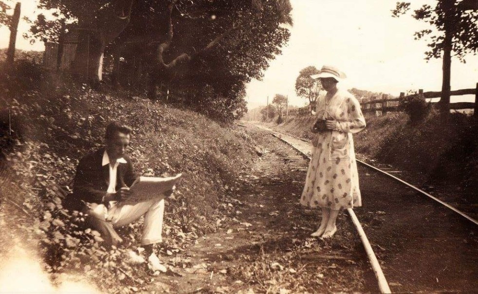
The mysteries of a photograph
How the mysteries of a pretty picture from yesteryear allows you to peel back the layers of the past. Each layer has a meaning and a story that is told by the historian. The stories provide context for the photograph and give it greater meaning.

