

The Penrith Museum of Printing, part of History Week 2018 in New South Wales, showcases operational printing presses from 1860 to 1970. Visitors learn about traditional printing techniques through live demonstrations. Established in 2001, the museum highlights the evolution of local newspapers and the significant role of printers and compositors.
Category: Industrial Heritage

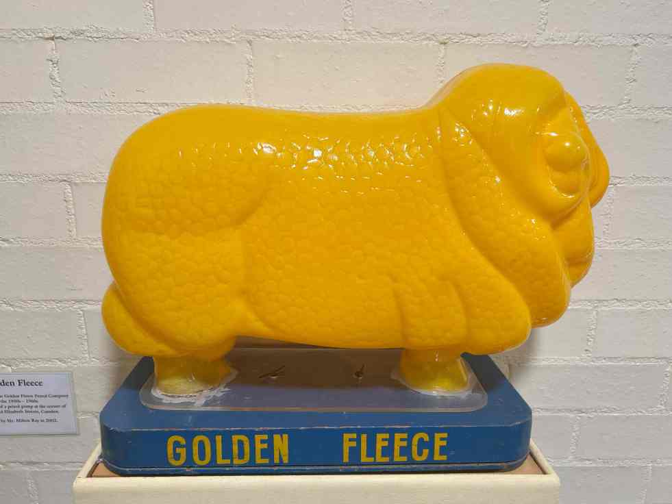
Discover the Golden Fleece Globe Light at Camden Museum
The Camden Museum showcases the Golden Fleece Globe Light, a plastic ram, symbolizing Australia's wool industry and its historical significance. Donated by Milton Ray in 2002, it highlights the Golden Fleece brand's marketing legacy. The ram, based on a prized merino, represents both local history and broader national heritage.
Share this:

Share this:

Camden’s Treadle Sewing Machine: A Revolution in Women’s Agency
The Camden Museum's treadle sewing machine symbolizes the significant role of sewing in women's lives from the 19th century onwards. Sewing machines democratized work, enhancing women’s agency by saving time and allowing for business opportunities. Women contributed immensely to the war efforts through Red Cross circles, producing thousands of items during both World Wars.
Share this:

Share this:

The Celebration Society: Revitalizing Picton’s Retail Scene Through Adaptive Re-use
The Celebration Society opened in 2024 in the former Corbett hardware store, revitalizing Picton's retail scene. Owners Deborah and Michael Quinn, along with business partners, preserved the building’s historic integrity. The venue includes a café and space for events, enhancing community engagement and contributing to the area's renewal.
Share this:

Share this:
Burragorang Coalfields: From Prosperity to Closure
The Burragorang Valley's coal mining history spans from the early 1800s to the closure of the last operational mine in 2000. The community relied on coal for jobs, but the inevitable end affected the region. International mining companies became involved, and the introduction of electricity transformed mining processes. Many mines opened and closed throughout the years, leaving a rich and complex history documented in various sources.
Share this:

Share this:

Garden Palace, showing the wonders of the age
In 1882, a massive fire at Macquarie Street, Sydney, destroyed the Garden Palace and valuable contents, causing significant loss of records and artefacts. The origin of the fire remains a mystery. The Palace was originally built for the Sydney International Exhibition in 1879.
Share this:

Share this:
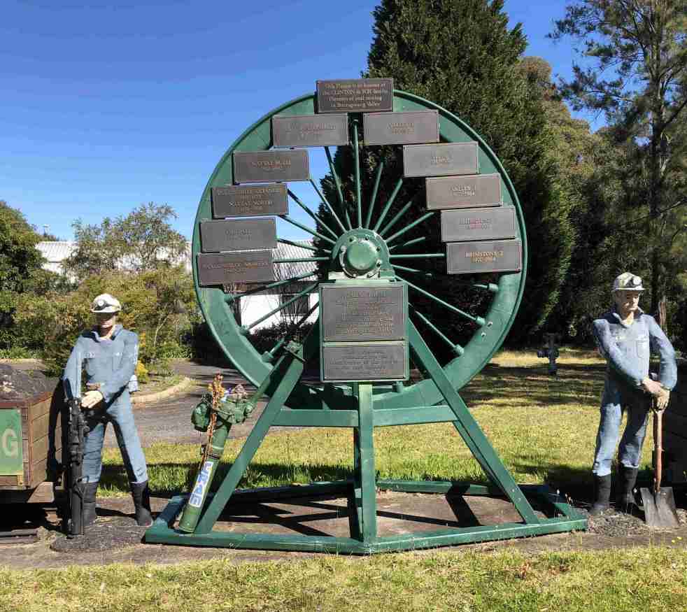
Camden Teamsters Memorial, when the horse was king on the Yerranderie Road
Tribute to mining and industrial heritage If you wander along the John Street heritage precinct, you will come across a quaint monument with a large wagon wheel reminding you of when the horse was king on the Yerranderie Road. The Camden Teamster's Memorial is on John Street, Camden. The memorial is between Macaria, a… Continue reading Camden Teamsters Memorial, when the horse was king on the Yerranderie Road
Share this:

Share this:
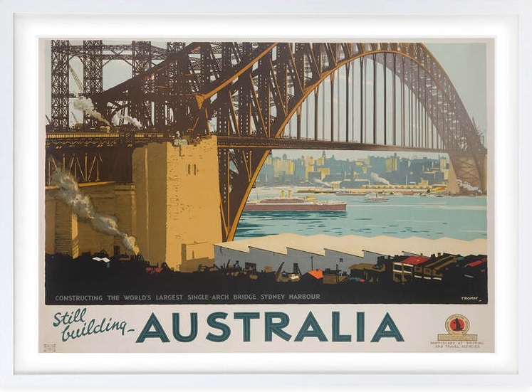
The Sydney Harbour Bridge, an engineering marvel
The Sydney Harbour Bridge is an icon on the Sydney urban landscape. The bridge is an engineering marvel of modernism and the early 20th hope of a new nation.
Share this:

Share this:

Mundane objects tell an interesting story
Utility covers are mundane objects that tell interesting stories about the past in an area. Others consider then to be a form of street art and street aesthetic.
Share this:

Share this:
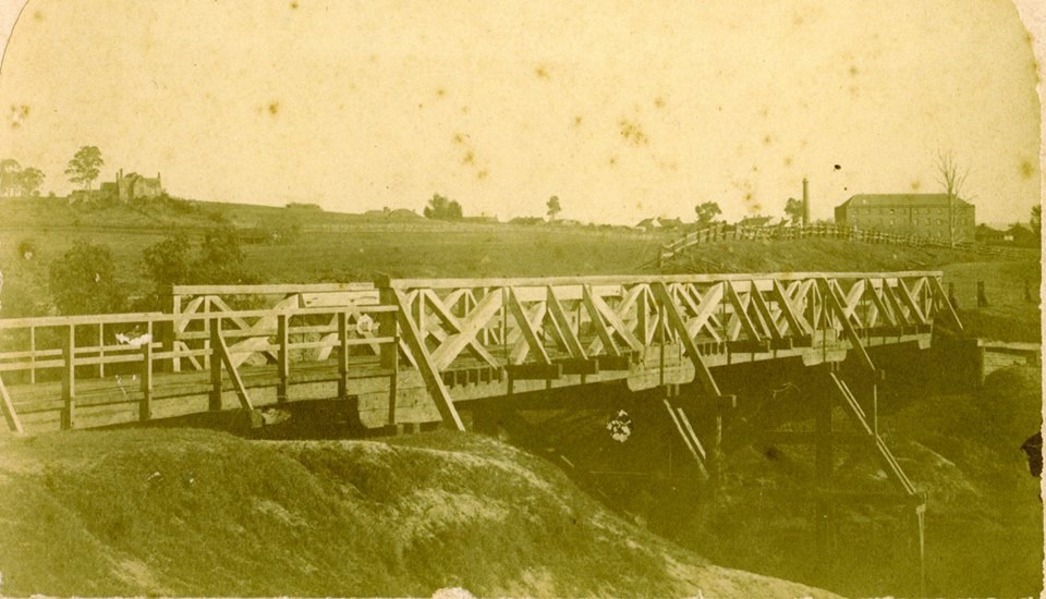
The Cowpastures bridge at the Nepean River crossing
Access across the Nepean River has been an issue since European settlement. The problem was solved by building a bridge with the first in 1826, the next in 1860 followed by 1900 and 1976.

