Adaptive Re-use · Aesthetics · Architecture · Argyle Street · Attachment to place · Business · Camden · Camden Gasworks · Camden Story · Communications · Community identity · Cultural Heritage · Cultural icon · Electricity · Engineering Heritage · Gas · Gothic · Heritage · Historical Research · Historical thinking · History · Industrial Heritage · Infrastructure · Living History · Local History · Local Studies · Memory · Myths · Place making · Public art · Sense of place · Service utilities · Storytelling · Streetscapes · Technology · Town planning · Urban Planning · urban sprawl · Urbanism · Utilities · Water

Mundane objects tell an interesting story

Utility pit covers

What is under your feet and totally ignored? What do you walk over every day? What is essential in an emergency? What provides access to critical utilities? The answer lies under our feet. What is it? Give up yet?

The answer is the humble utility inspection cover.

Gas Cover Durham Argyle Street Camden 2016 (I Willis)

Utilities like electricity, water, gas, sewerage, communications and others are essential in any community. Camden has acquired the utilities as time has progressed over the past 150 years to the present. Argyle Street has several utilities buried beneath the street and footpaths. Their histories provide valuable insight into the town’s development and progress, particularly in the 20th century.

The arrival of electricity, gas, and water was part of Camden modernism and its influence. These utilities have transnational origins beyond the township and illustrate the linkages between the town and the wider world.

For example, the supply of clean drinking water in Camden was linked to an outbreak of scarlet fever in the later 19th century. Contagious diseases were a significant health concern in the 19th century and were an ever-present worry in daily life. Clean drinking water had a significant influence on the development of public health.

I was walking along Camden’s Argyle Street, and it struck me that utility inspection covers are a historical statement in their own right. They are an entry point for the utility service as they also provide an entry to the stories surrounding the utility’s delivery.

Even the different logos for utilities illustrate the changes in the history of a telco or electricity supplier. A cover might be a statement about a utility supplier that is now defunct. The utility cover is made of different materials – cast iron, concrete, and others.

These are all mysteries that are waiting to be solved for the curious mind. Or just for the bored and idle with nothing better to do.

What about the Gas Cover from Durham above?

Durham Gas Cover

This is an inspection cover for the gas pipes using a Durham fitting probably around 1912. The Durham drainage fitting is a cast-iron, threaded fitting used on drainage pipes; has a shoulder such as to present a smooth, continuous interior surface. (Free Dictionary)  The Durham patent system of screw-joint iron house drainage was manufactured by the Durham House Drainage Co. of York USA (1887).

The Durham cover is for the Camden gas supply, installed in 1912 by the Camden Gas Company. The gasworks was built in Mitchell Street and made gas from coal. There were many gas street lights in Argyle Street which were turned on in early 1912. The Camden News reported in January 1912 that many private homes and businesses had been connected to the gas supply network and were fitted for gaslighting.

Mr Murray, the gasworks manager, reported that construction at the gasworks had been completed, the retort had been lit, and he anticipated total supply by the end of the month. (Camden News, 4 January 1912) Throughout 1912 there was an ongoing dispute between Mr Alexander, the managing director of the Camden Gas Company, and Camden Municipal Council over damage to Argyle Street while laying gas pipes and who was going to pay for it. (Camden News, 12 September 1912)

In 1946 Camden Municipal Council purchased the Camden Gas Company. The gasworks was sold to AGL in 1970. (Peter Mylrea, ‘Gas and Electricity in Camden’, Camden History March 2008.)

NRCC

What is this cover for the NRCC? Does it still exist?

NRCC Inspection Cover 2016 Argyle St Camden (I Willis)


The NRCC does not exist anymore, and the logo stood for the Nepean River County Council. It was the electricity supplier for the Campbelltown, Camden and Picton area from 1954 to 1979 when it was amalgamated with Prospect County Council. This, in turn, became Integral Energy. Integral Energy was formed by the New South Wales Government in 1995 from the amalgamation of Illawarra Electricity and Prospect Electricity with over 807,000 customers.

NRCC office open 1956 Picton SLNSW

The Campbelltown office of the NRCC was located in Queen Street next to the Commonwealth Bank and in 1960 shifted to Cordeaux Street. By 1986 a new advisory office was opened in Lithgow Street. The council opened a new shop front at Glenquarie Shopping Centre at Macquarie Fields. There were shopfronts in Camden, Picton and other locations.

Logo Design

In  October 1954, the NRCC approved a design for its official seal. Alderman P Brown suggested a logo competition, and many entries were received for the £25 prize. The winning design by artist Leone Rush of Lidcombe depicts electricity being extended to rural areas by a circular outline of “Nepean River County Council”.
(Camden News, Thursday 4 November 1954.)

NRCC Seal (http://www.nepeanrivercountycouncil.com.au/)
Nepean River County Council Seal (http://www.nepeanrivercountycouncil.com.au/)

Former NRCC employee Sharon Greene stated that ‘It was like a small family business where everyone was happy to be there.’ (Camden Advertiser, 25 May 2009)

Former office manager, Kay Kyle, said that things in the office in 1959 were pretty bare when she started as a junior clerk.

She said:

‘We had no cash registers or adding machines, we hand wrote receipts and added the figures in our head for daily takings. That was a good skill to have. Eventually we received an old adding machine from Picton, but one day it added incorrectly so I wouldn’t use it again.’  (http://www.nepeanrivercountycouncil.com.au/nrccstories.html)

Former linesman Joe Hanger recalls working for the NRCC. He said,

‘In 1954 we were transferred to Nepean River County Council. They wanted linesmen and I went on the line crew and eventually worked my way up and got a pole inspectors job going around creosoting the poles. Eventually I got my own crew, mainly pole dressing. There were 7-8 in the crew. I was then made a foreman in about 1978.’ (http://www.nepeanrivercountycouncil.com.au/nrccstories.html)

Working in the outdoor crews could be dangerous, as Joe Hanger remembers.

‘In July 1974 I fell from a 40ft pole while doing work near The Oaks. We had to check out why a back feed to The Oaks was loosing voltage. We were looking for crook joints. The pole is still out there, near a bend just before the straight road into The Oaks. We had opened the air break switch behind us and the airbreak switch ahead, we forgot that the transformer was on the other side of the open point. I checked the pole and Neville Brown had gone along to the next pole to open the next section. I was standing on the low voltage cross arm and grabbed one of the wires and was struck by the electricity. Luckily my weight caused me to fall away. I ended up falling about 25 feet and just another pole lying on the ground. If I had the belt on it may have been a different matter. I had a broken leg, broken rib and a great big black eye. I was very lucky.’

(http://www.nepeanrivercountycouncil.com.au/nrccstories.html)

There are a host of other stories and wonderful memories from former employees of NRCC @ http://www.nepeanrivercountycouncil.com.au/nrccstories.html.

Friends of the Nepean River Country Council

Past organisations like the Nepean River County Council have staunch supporters. If you are one of them, join the Friends of NRCC. 

Friends of NRCC

The telco inspection lid

This inspection lid is for the telco, which was the Postmaster-General Department of the Australian Government.

PMG Inspection Cover 2016 Argyle St Camden (I Willis)

The telco had a rich history of communications in Australia, starting in 1810 with the first postal service. In 1810 Governor Macquarie appointed Australia’s first postmaster Isaac Nicholls and the colonial government of New South Wales Government the first regular postal services, including rates of postage. The new Sydney General Post Office was opened in George Street in 1874.

The first telephone service was established in Melbourne in 1879.

At Federation, the new Commonwealth Postmaster-General’s Department assumed responsibility for telephone, telegraph and postal services. In the 1920s, the department took control of international short wave services and the Australian Broadcast Commission in the 1930s.

In 1975 the Postmaster-General Department was broken up, and the postal service moved to Australia Postal Commission (trading at Australia Post). Telecommunications became the responsibility of the Australian Telecommunications Commission trading at Telecom Australia. Telecom Australia was corporatised in 1989, renamed Telstra Australia in 1993, and partially privatised in 1999.

In 1992 the Overseas Telecommunications Commission (est 1946) was merged with Telecom Australia.

Telstra Inspection Cover 2016 Argyle St Camden
Inspect Cover Telecom
Telecom Inspection Cover 2016 Argyle St Camden (I Willis)

 MWS&DB

Service Valve cover for water MWS&DB Argyle St Camden 2016 (I Willis)

The MWS&DB was the Metropolitan Water Sewerage and Drainage Board, today is known as Sydney Water. The organisation has gone through several name changes:

  • the Board of Water Supply and Sewerage from 1888 to 1892,
  • from 1892 to 1925 as the Metropolitan Board of Water Supply and Sewerage,
  • the MWS&BD from 1925 to 1987,
  • then the Water Board from1987 to1994, then finally as the
  • Sydney Water Corp Ltd (1995-1999) with Ltd dropped in 1999.

Deks G (Gas)

Deks Cover for gas in Argyle Street Camden 2016 (I Willis)

Deks was established in Australia by Mr George Cupit in 1947 and remained a family business until it became part of the Skellerup Group in 2003. Deks have a presence in 28 countries. They have supplied plumbing fittings, including flashings, fittings or flanges, for over 100 years. (http://www.deks.com.au/about/)

Malco W (Water)

Malco Cover for Water Argyle Street Camden 2016 (I Willis)

Malco Industries reported in the Sydney Morning Herald in 1951 that the company incorporated three separate businesses involved in heavy industrial activities on its site at Marrickville. There were three divisions (1) Malleable Castings was founded in 1915 and was claimed to be one of Australia’s leading producers of iron castings. (2) EW Fittings was incorporated in 1925 and made cast iron pipe fittings for water, gas, steam and oil. (3) Link-Belt Co Pty set up in 1949 and industrial transmission equipment. (Sydney Morning Herald (NSW: 1842 – 1954), Friday 6 April 1951, page 6)

Romwood SV

Service Valve Romwood Argyle Street Camden 2016 (I Willis)

Havestock Cover

Havestock Cover Argyle Street Camden 2016 (I Willis)

Havestock is a business that has made pit lids since the 1980s. Havestock is now part of the global EJ Group and designs, manufactures and distributes man-hole covers, pit covers and other infrastructure access covers and grates. (http://www.hygrade.net.nz/product-category/by-brand/by-brand-havestock/) (http://www.homeimprovementpages.com.au/connect/havestock_pty_ltd/)

Updated 26 October 2021. Originally posted 21 October 2016.

Aesthetics · Attachment to place · British colonialism · Camden · Cobbitty · Colonial Camden · Community identity · Cowpastures · Cultural Heritage · Cultural icon · Entertainment · Floods · Heritage · Historical consciousness · History · Landscape aesthetics · Leisure · Local History · Macarthur · Memory · Menangle · Myths · Nepean River · Place making · Ruralism · Second World War · Sense of place · Settler colonialism · Sydney's rural-urban fringe · Town planning · Urban growth · Urban Planning · urban sprawl · War · War at home · Water

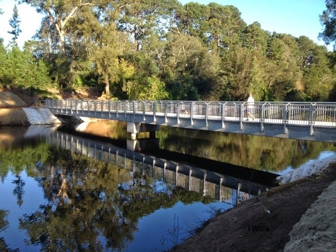
Nepean River, more than a water view

The Nepean River is one of the most important waterways in the Sydney basin and has particular significance for Sydney’s southwestern rural-urban fringe.

Nepean River near Cobbitty 1900 (Camden Images)


The Nepean River catchment extends south and east of the Sydney Basin to take in areas near Robertson and Goulburn.

West of Wollongong the tributaries including Cataract Creek, Avon River, Cordeaux River that flow north-west and then into the deep gorges of Pheasants Nest and Douglas Park.

The river opens up into a floodplain and flows past  Menangle and crosses the Cowpastures and southern Cumberland Plain past Camden and Cobbitty.

The river then flows north through the gorge adjacent to Wallacia and enters Bents Basin before it is joined by the Warragamba River and changes its name to the Hawkesbury River.

The Nepean River is economically important to the Sydney Basin and is used for mining, irrigation, recreation and other activities. It is ecologically significant to the area and has several rare and endangered species of plants.

Cultural importance

The river has an important meaning in terms of its intangible cultural heritage to the local landscape. The river and its surroundings had special meaning to the Indigenous Dharawal people of the Cowpastures area.

The river defines the landscape and the construction of place in the localities along the river including Menangle, Camden, and Cobbitty.

One locality of special significance is Little Sandy at Camden.

Little Sandy

Little Sandy on the Nepean River at Camden has been a popular spot with local Europeans for many decades for swimming, picnicking, boating and fishing. It is rich in the memories of local folk played out their childhoods, experienced the pangs of youth and enjoyed time with their families.

Little Sandy has been an important part of Camden cultural heritage for generations. It is a locality with a strong sense of place and identity with people’s memories.

The site has layers of meaning that can be peeled back and reveal a landscape of diverse dimensions. Its story has meaning across the generations.

The site and the pondage were created on the Nepean River with the construction of the Camden Weir in 1907. It is a culturally created landscape.

Today thousands of local residents enjoy the same rituals at Little Sandy on their jaunts along the Nepean River bike path with the friends and family.

Little Sandy with footbridge across the Nepean River at Camden c.1950. Diving board in foreground. (Camden Images)
Little Sandy with a footbridge across the Nepean River at Camden c.1950. Diving board in the foreground. (Camden Images)


Swimming carnivals

Nepean River swimming carnival 1917 Little Sandy (Camden Images)


In the early 20th century Little Sandy was a favourite swimming spot. In the 1920s the Camden Swimming Club built galvanised iron dressing sheds painted green in an area now known at Kings Bush Reserve.

Swimming became one of Elderslie’s earliest organised sporting activities after the Nepean River was dammed in 1907 with the construction of the Camden Weir.

Water backed up behind the weir for four kilometres through the Elderslie area and provided relatively deep water suitable for swimming.

The Camden Aquatic Sports carnival was organised in 1909 and attracted over 1000 spectators and was the location of the Camden Swimming Club in the 1920s.

The area was divided into Big Sandy, which was a deep hole, near Kings Bush Reserve. About 100 metres upstream was Little Sandy where the water was shallower. Learn to swim classes were held for a short time and Boy Scouts would go swimming there, according to Milton Ray.

Len English says

“In the 1950s the area was used for swimming by pupils from Camden Public School’,  ‘The girls went with the female teachers to Little Sandy, while the male teachers and boys went downstream to Camden Weir.’

Olive McAleer says

‘Little Sandy was a popular spot for family picnics between the 1920s and 1940s’.

The river stopped being a swimming spot when it was condemned because of pollution by medical authorities in the early 1960s. It was replaced by Camden Memorial Swimming Pool in 1964. (P Mylrea, ‘Swimming in the Nepean River at Camden’, Camden History, March 2006)

Learn more @ Ian Willis, ‘Elderslie’, Dictionary of Sydney, 2008


Footbridge built 1943

Little Sandy footbridge over Nepean River at Camden in 1943 (Camden Images)


In  1943 military authorities from the Narellan Military Camp were anxious to undertake a practical training exercise for engineers. In September they sought the view of Camden Municipal Council on erecting a footbridge and the council immediately agreed with the proposal.

The council covered the cost of some of the timber so that the bridge remained the property of the council. The  Australian Military Forces Engineers supplied the labour, supervision, transport vehicles and operators for the transport of stores and construction material.

The site at the bottom Chellaston Street connected two reserves on either side of the Nepean River. One on the Chellaston Street side and the other at River Road Elderslie.

In late September 1943, 40 troops started building a wooden footbridge 120 feet long and 4 feet wide. Construction took around four weeks and was finished by 28 October.

Observers commented on a

‘fine piece of workmanship…that would be much appreciated’ by the local community.

(Camden News, 16 September 1943, 23 September 1943, 28 October 1943).

Nepean River 1900

Nepean River near Cowpasture Bridge 1900
Nepean River below Cowpasture Bridge 1900 (Camden Images/CA Poole)


This image of the Nepean River is taken in the vicinity of the Camden Weir. It gives an indication of the degraded state of the river around 1900. There is evidence of sedimentation and streambank erosion caused by hard-hoofed animals trampling river banks.

These issues were typical of Australia’s inland waterways in the late 19th century after extensive clearing of the catchments for forestry, farming and other activities.

Sue Rosen quotes from James Atkinson’s 1826  An Account of the State of Agriculture and Grazing in New South Wales in her book on the environmental history of the Nepean River

Atkinson states that even by the mid-1820s the river banks were undermined and collapsing into the stream. There were deposits of sand in the river channel and clearing practices had caused increased run-off,  accelerated the degradation of the river channel and increased obstruction in the river bed. All evident in the 1900  photograph of the river channel at Camden.

Atkinson felt that the original European settlers had failed to ‘improve’ the land for farming and that its farming potential had been compromised. The settlers had in Atkinson’s terms failed to fulfil the original objectives of opening up the land and favoured, according to Rosen, ‘the cultivation of a landscape reminiscent of British romantic pastoral scenes’.

The earliest reports of the Nepean River date from 1795. David Collins wrote about his impression after a wet spring in his An Account of the English Colony in New South Wales (London, 1798). These impressions have been quoted in Alan Atkinson’s Camden where it states there were

large ponds, covered with ducks and the black swan, the margins of which were fringed with shrubs of the most delightful tints.

After a dry spell, the river at Menangle was reported by George Caley in his ‘Report of a Journey to the Cowpastures’ (1804, ML) to be ‘reduced to a small compass’ and the water having ‘the foul appearance of a pond in a farmyard’.

Learn more  

Sue Rosen Losing Ground An Environmental History of the Hawkesbury-Nepean Catchment, Sydney: Hale & Iremonger, 1995.

Alan Atkinson, Camden, Farm and Village Life in Early New South Wales, Melbourne, OUP, 1988.

 Camden Weir 1907

Camden Weir 1917
The picturesque scene at the Camden Weir on the Nepean River c.1917 (Camden Images)


The Camden Weir pondage created an aesthetic water feature that runs through the Camden township and took in the Little Sandy. The aesthetic has moral, experiential, spiritual and well-being aspects to it.

The Camden Weir was constructed by New South Wales Public Works Department after the completion of the Cataract Dam from 1907.

The compensation weir was one of number constructed along the Nepean River to safeguard the ‘riparian rights’ of landowners affected by the interruption of flow to the river, according to John Wrigley.

A riparian right is the ability to take water from the river. The water supply dams of the Upper Nepean  Scheme reduced the flow of the tributaries of the Nepean River, and the weirs were to ‘compensate’ for the loss of water flow.

The other weirs near Camden were at Menangle, Begins, Thurns, Camden Sharpes and Cobbitty. The weirs were eventually transferred to the management to the Metropolitan Water Sewerage and Drainage Board as part of the Sydney Water Supply system.

Learn more @ John Wrigley,’ Nepean River Weirs’, The District Reporter 3 August 2001


Water has a calming effect on the mind and takes the mind to a quiet, tranquil and peaceful place.

Some say it can dim our internal chatter and calm some people.

Water provides a degree of serenity and the purifying effect it can have on the soul. Water can have a soothing meditative effect on some people.

People need to re-charge and re-vitalise in the tranquillity of the environment provided by the tranquillity and serenity of the pool provided by the weir.

For others, a visually pleasant water feature can also be a source of healing and relaxing in a man-mad environment.

Those that went swimming at Little Sandy had an experiential relationship with the water. Water is used to nourish and replenish man after exertion.

Swimming carnivals were a time of community celebration and strengthening community resilience.

The pondage at Little Sandy also has a scientific value for the marine ecosystem it supports. It supports a range of life from eels, to perch, birds, reptiles and other life.

The Little Sandy pondage creates a pleasant water feature that circles the township. The beauty of the scene with the trees along the water’s edge framing the quiet of the pond.

People doing simple tasks like fishing, picnicking, walking and re-engaging with nature on the water’s edge.    The surface of the water is a mirror that reflects the images of the trees and bushes on the water’s edge.

At dawn on a cold frosty morning, steam rise of the water’s surface as the walkers’ feet crackle under the frozen grass on the water’s edge.  There is a splash as a kingfisher dives into the water after a fish, that breaks the silence of the space.

The world disappears momentarily as you sit on the water’s edge taking in the serene quiet surroundings of the pond.

A new footbridge

Little Sandy Footbridge after completion of work 2014 (I Willis)


The Little Sandy footbridge was officially opened on 4 May 2014 with another community event.

The weather gods were kind, and while there was a cool breeze and an overcast start the sun came out and the crowd turned up with families of mums and dads and the kids.

Camden Council organised a family fun day in Chellaston Reserve where there were stalls, a free train ride along the bike track and information stands.

The day opened at 11.00am and wound up in the afternoon at 3.00pm. Camden Rotary provided a sausage sizzle which sold out early in the day.

An information stand was provided by Camden Historical Society which was staffed by volunteers John and Julie Wrigley, Bob Lester and Rene Rem, while others turned up later.

This was another community event that has been typical of the popularity of the site for the Camden community.

 Pre-cast concrete

The new pre-cast concrete 43-metre footbridge at Little Sandy on the Nepean River was completed in April 2014. Camden Council let contracts for the completion of a new footbridge in September 2013.

The new structure replaced a wooden footbridge that was damaged in a flood in 2012. The new footbridge was jointly funded by the council and the state government.

The finished footbridge is part of the Nepean River cycleway that joins Camden with Elderslie, South Camden and Narellan. Local resident Kevin Browne stated in  2012 (Camden Narellan Advertiser 31 July) that:

the bridge was part of the unique attraction of living in a rural area [and] the availability of serene, natural beauty.

After the 2012 damage to the footbridge and its closure, local residents started to campaign for its replacement.

This culminated in a community meeting in the mayor’s office in August 2013 when 19 local residents attended an information session with the mayor, the Member for Camden,  and the council’s general manager and engineering staff.

The original footbridge was constructed in 1943 as a military training exercise by the AMF Engineering Corps stationed at Narellan Military Camp.

Camden Council agreed to fund the cost of the materials while the engineers provided the labour (40 men), supervision and vehicles. The original footbridge was 120 feet long and 4 feet wide.

Learn more @ The District Reporter 17 August 2012.


Kings Bush

King’s Bush is the reserve adjacent the river’s edge at Little Sandy and is named after Cecil J King, the rector of St John’s Church between 1893 and 1927.

According to John Wrigley, King kept his horse in the paddock next to the river and swam at the same spot in the river.

Reverend King was a keen sports fan and played for the Camden Cricket Club and was the team’s wicketkeeper for several years. In 1927 he was the patron of the Camden Golf Club and president of the Union and St John’s tennis club.

King was ordained at St Andrew’s Cathedral in Sydney in 1887 by the Bishop Barry of the Sydney Archdiocese. (Camden Advertiser 2 June 1949)

Learn more  @ John Wrigley, Place Names on the Camden Area, Camden, CHS, 2005.


Chellaston Street

Chellaston Street ends at the Nepean River in Chellaston Reserve in the vicinity of Little Sandy. Chellaston was a single storey brick residence at 38 Menangle Road built by Camden builder John Peat and used as his family home.

Chellaston Street was part of land releases on the south side of the township in the 1920s. There were several land releases in the area during the Inter-war period including Victory Ave and Gilbulla Ave that run off Menangle Road.

Learn more  @ John Wrigley, Place Names on the Camden Area, Camden, CHS, 2005.


Learn more

Many people have fond memories of Little Sandy at Camden
The Nepean River at Little Sandy is part of the Cumberland Woodland 
Not far from Little Sandy there are stands of the rare Elderslie Banksia Scrub
Read about the Camden White Gum which can be found on the banks of the Nepean River at Little Sandy