
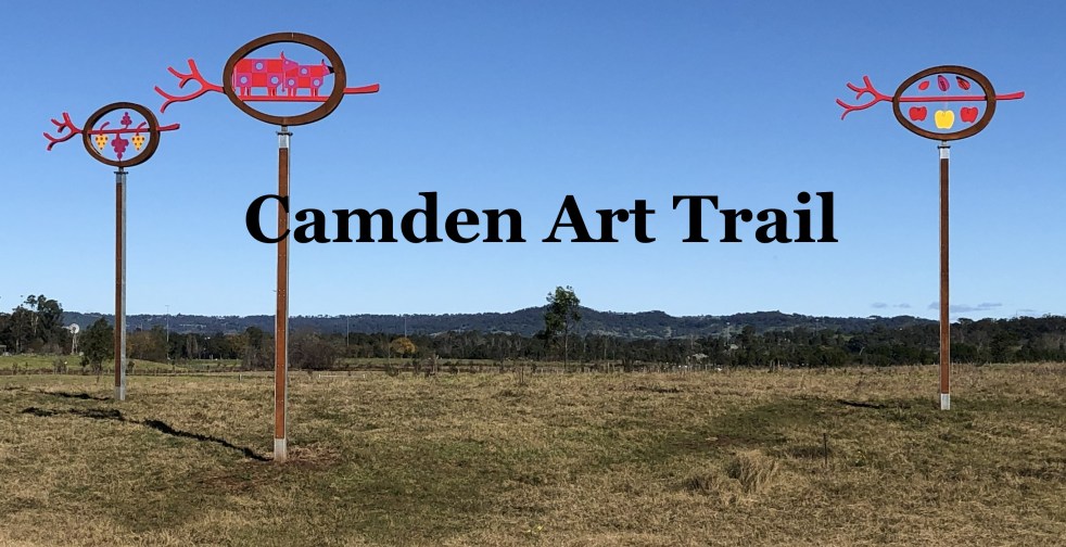
The Camden Public Art Trail, officially opened in June 2024, connects the Nepean River to Camden Town Farm and features stunning artwork installations across a 4.2-kilometer walkway. Funded by the NSW Government, the trail celebrates local heritage and ecology while providing an accessible outdoor experience for visitors, though dogs are not permitted.
Category: Public art

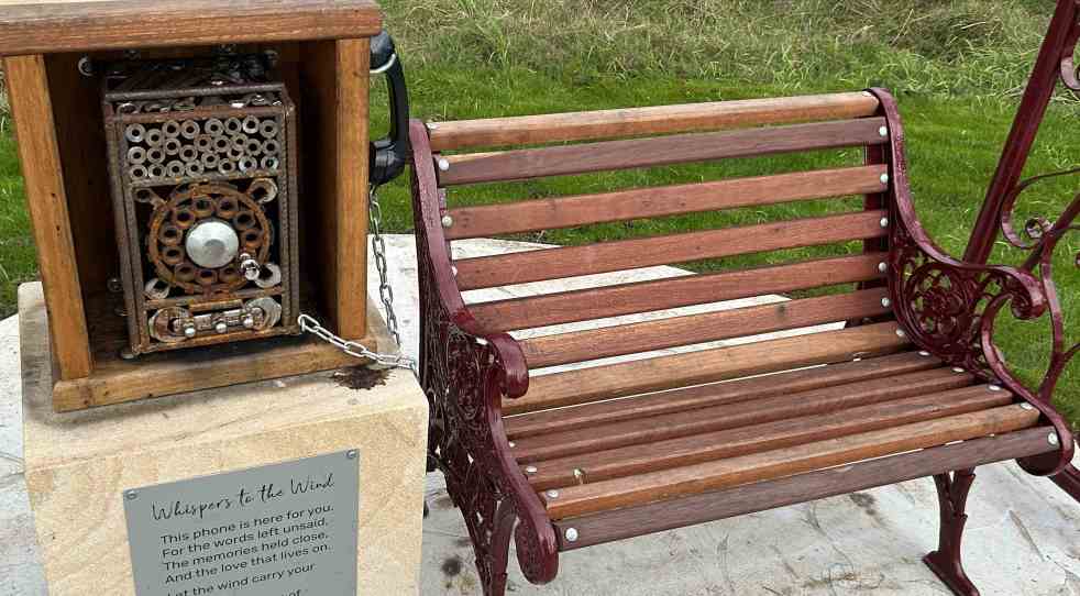
Whispering in the Wind: A Unique and Contemplative Art Installation in Camden
A new art installation, "Whispering in the Wind," has been unveiled along the Nepean River Trail in Camden, NSW. Created by artist Quinton Laws using recycled materials, the wind phone provides a space for reflection and connection for those grieving. Inspired by global installations, it encourages open expression of emotions.
Share this:

Share this:
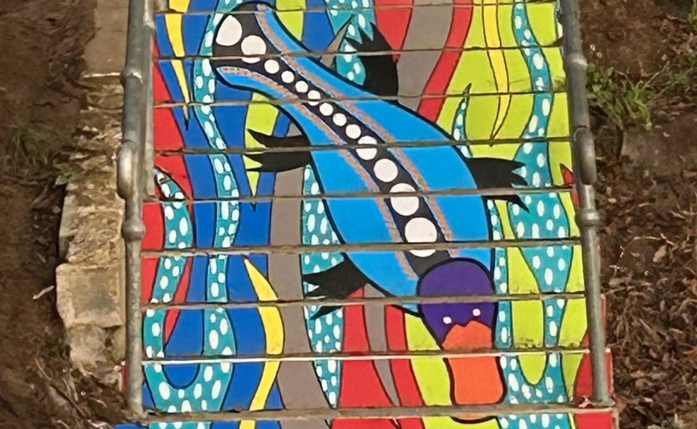
Exploring ‘By the River’: A Public Art Installation in Camden
Danielle Mate's art installation, "By the River," adorning the stairs between Chellaston Reserve and Little Sandy footbridge, features a platypus motif that reflects local Indigenous heritage. Commissioned by Camden Council and developed with community input, it enhances the area while celebrating its rich cultural history and ecology.
Share this:

Share this:
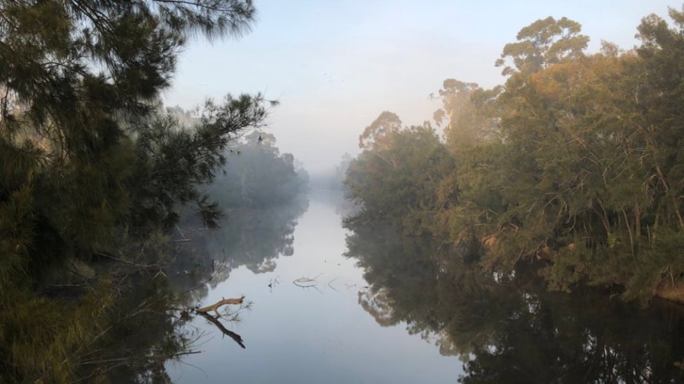
Exploring Little Sandy: Camden’s Hidden Gem
Little Sandy, a cherished location on the Nepean River in Camden, is celebrated for its rich community history and the memories it holds for locals. Enhanced by the Camden Weir, it features a modern footbridge and Aboriginal-inspired artwork, symbolizing its cultural significance as a site of gatherings, swimming, and personal milestones.
Share this:

Share this:
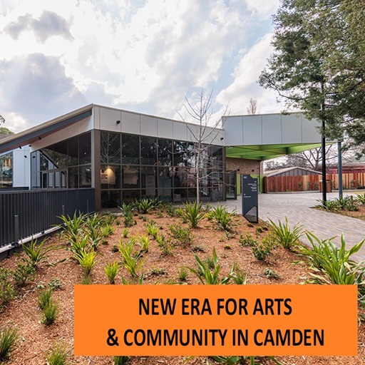
Community Hub Revitalization: Camden Civic Centre’s New Look
The Camden Civic Centre was officially reopened after a $9.9 million upgrade, enhancing its facilities as a modern, multi-purpose venue. The project included improved workspaces, public art installations, and a new grand piano. The council and government funding ensured a functional space for community events, strengthening local cultural support.
Share this:

Share this:
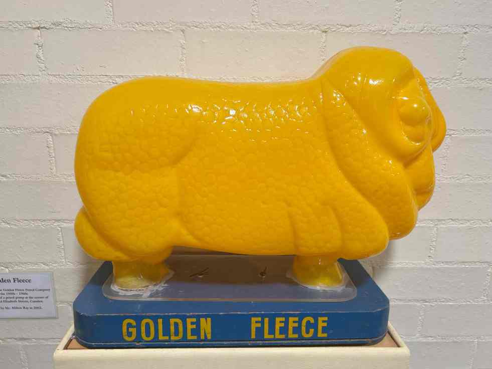
Discover the Golden Fleece Globe Light at Camden Museum
The Camden Museum showcases the Golden Fleece Globe Light, a plastic ram, symbolizing Australia's wool industry and its historical significance. Donated by Milton Ray in 2002, it highlights the Golden Fleece brand's marketing legacy. The ram, based on a prized merino, represents both local history and broader national heritage.
Share this:

Share this:
Discovering Australia’s Hidden Historical Sites
The local historical and cultural landscape in Australia is highly fragmented, lacking a central repository for information. Various apps, websites, and blogs exist but offer scattered data. Clio, a well-coordinated platform in the USA, exemplifies effective organization of local history, contrasting with Australia's disjointed efforts, which face funding challenges.
Share this:

Share this:
Discover the Hidden Signatures of Camden’s Former Bank
In Camden's old bank building, a hidden strongroom features signatures of former bank employees, each telling a unique story. Now part of Camden Markets Collective, these signatures are viewed as graffiti art, reflecting local history and culture. The community seeks to preserve this unique public art for future generations.
Share this:

Share this:
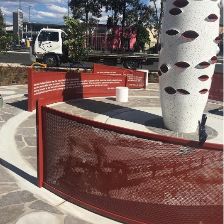
Narellan Town Centre Revitalization: a community-centric approach through placemaking
The redevelopment of Narellan Town Centre in 2017 enhanced its community space through placemaking, incorporating public art and amenities. Valued at $200 million, the extension nearly doubled its size, accommodating 100+ retailers and encouraging social interactions. The design reflects local history, fostering cultural identity and community engagement, achieving successful early usage by families.
Share this:

Share this:
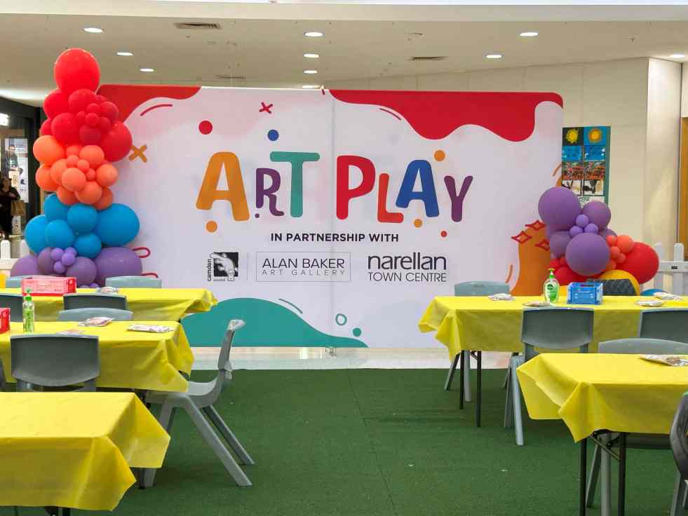
Creative Kids: Art Play Workshops at Narellan Town Centre
Over two weeks, the Narellan Town Centre hosted 'Art Play' workshops for kids aged 5 to 12, featuring various creative activities led by artists from the Alan Baker Art Gallery. The free sessions attracted over 200 children daily, providing an engaging and stress-free school holiday opportunity for families while fostering creativity and artistic skills.

