

This presentation examined the role of the historian and researcher and presented the importance of history and the role of a historian. Dr Ian Willis discussed the significance of historical consciousness and collective memory, emphasising the role of a historian as a researcher, analyst, interpreter, and storyteller. The presentation also highlighted "Pictorial History Camden & District," a book by Kingsclear Books, and covered aspects such as structure, select bibliography, index of names, and district maps. Additionally, various related sources and themes, such as the Whiteman and Macarthur families, were explored. The presentation concluded with suggestions for experiencing the past through community festivals, local studies, and living libraries.
Category: Legends

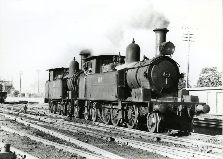
Exploring Camden’s Railway Heritage: Pansy and Its Timeless Stories
The Camden branch line, with its famous locomotive Pansy, holds a special place in the memories of locals and visitors. Operating from 1882 to 1963, it served as a lifeline for the community, transporting goods, passengers, and even wartime heroes. Despite its eventual closure, remnants of the line can still be seen today.
Share this:

Share this:

Yearning, Longing and The Remaking of Camden’s Identity: the myths and reality of ‘a country town idyll’.
This article discusses the concept of a "country town idyll" in Camden, an idealised version of a country town from an imagined past that uses history to construct imagery based on Camden's heritage buildings and other material fabrics. The paper delves into the origins of the idyll, examines its development, and investigates its validity in its contemporary context. It shows how its supporters have used history as a community asset to remake Camden's identity and explore how the 'country town idyll' has been used variously as a political weapon, a marketing tool, and a tourist promotion.
Share this:

Share this:
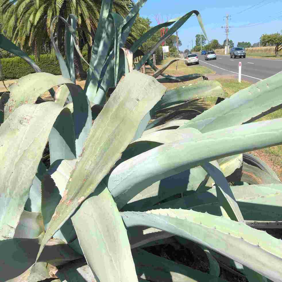
Agave on Cawdor Road, a part of local folklore
The agave plants near Cawdor Road, Camden, have become part of local folklore, with stories spanning murder, historical colonial gardens, and Indigenous conflict. These slow-growing succulents have sparked controversy and conjecture, with their true history and significance remaining a mystery. Despite attempts to uncover the truth, the agave's legend endures across generations.
Share this:

Share this:
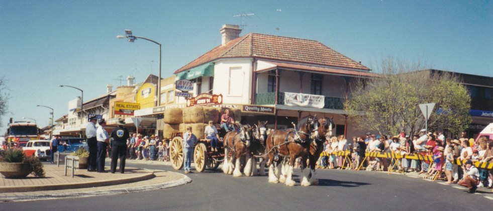
Camden Teamsters Memorial, when the horse was king on the Yerranderie Road
Tribute to mining and industrial heritage If you wander along the John Street heritage precinct, you will come across a quaint monument with a large wagon wheel reminding you of when the horse was king on the Yerranderie Road. The Camden Teamster's Memorial is on John Street, Camden. The memorial is between Macaria, a… Continue reading Camden Teamsters Memorial, when the horse was king on the Yerranderie Road
Share this:

Share this:
The Camden Story: the historiography of the history of the country town of Camden NSW
The history of telling the story of a small community has been interpreted in different ways at different times in the past by different historians. This area of study is called the historiography. I have recently published an article on the historiography of the small country town of Camden, NSW.
Share this:

Share this:
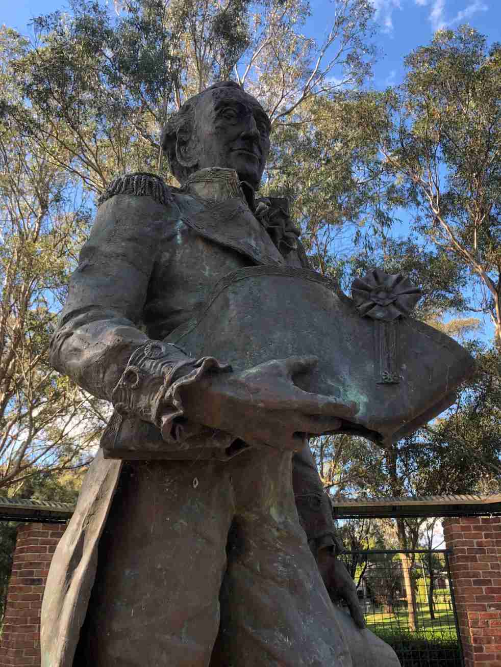
Governor Hunter, a Cowpastures memorial at Mount Annan
The statue of Governor Hunter in the Governors Green Park at Mount Annan is another celebration of the history of the Cowpastures.
Share this:

Share this:

Take a stroll through the past
The past is all around us and has created the present. The present would not exist without the past. We need to understand the past to understand the present.
Share this:

Share this:
Local Newspapers and a Regional Setting in New South Wales
UOW historian Dr Ian Willis has recently published an article in Media History (UK) about the role of local newspapers in the creation of Macarthur regional identity and the mythology surrounding New South Wales colonial identity John Macarthur.
Share this:

Share this:
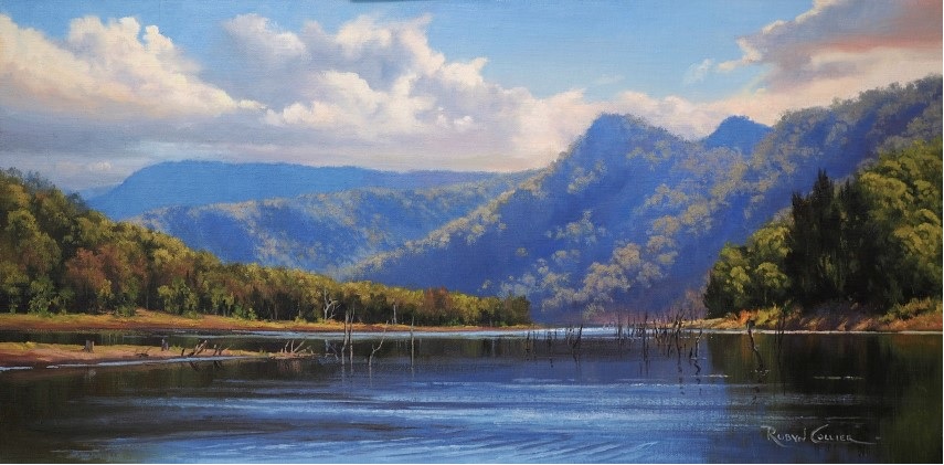
The Burragorang Valley, a lost Gothic fantasy
The Burragorang Valley is a lost Gothic fantasy where many people were attracted to the grandeur and beauty of the valley's landscape. Much of the valley's mystery has been lost under Lake Burragorang.

