
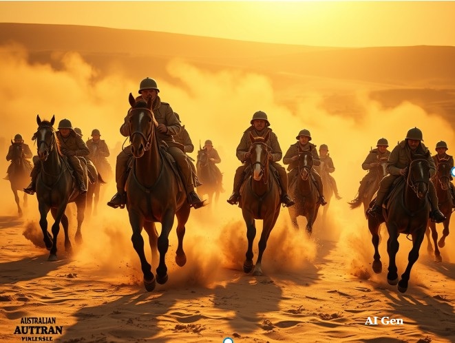
The authenticity of images on social media is increasingly questionable due to advancements in generative AI and deepfakes. Manipulation techniques distort reality, leading to curated perceptions and ethical dilemmas in photography. Iconic figures like Frank Hurley exemplify the tension between authenticity and representation, highlighting the need for transparency in image manipulation.
Tag: Technology


Exploring the Penrith Museum of Printing
The Penrith Museum of Printing, part of History Week 2018 in New South Wales, showcases operational printing presses from 1860 to 1970. Visitors learn about traditional printing techniques through live demonstrations. Established in 2001, the museum highlights the evolution of local newspapers and the significant role of printers and compositors.
Share this:

Share this:
The Role of Historians in an AI World
A Microsoft study suggests historians are among jobs most at risk from AI, particularly due to AI's ability to gather data. However, historians play a crucial role in interpretation, analysis, and narrative construction, capabilities AI lacks. Therefore, while AI may assist, it cannot replace historians, ensuring their continued relevance in understanding the past.
Share this:

Share this:

AI Transforming History Education: Opportunities & Challenges
The integration of AI into history education is transforming teaching methods and enhancing access to resources, promoting critical thinking among students. However, educators face challenges like increased anxiety and the risks of AI inaccuracies. The American Historical Association recommends guidelines to effectively incorporate AI while maintaining traditional pedagogical practices.
Share this:

Share this:
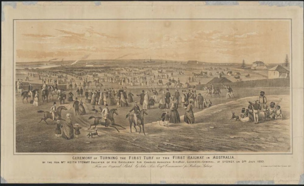
A Camden connection to the first railway line in New South Wales
26 September 1855 A forgotten anniversary of Sydney’s Central Railway Station On 26 September 1855, the first train left the Sydney terminus, a ‘tin shed’, with great pomp and ceremony and thus began the great railways of New South Wales. The ‘tin shed’ was replaced by two further buildings, one opened in 1874, and the current grand Victorian edifice of brick and sandstone in 1906.
Share this:

Share this:
Making Camden History
Making Camden History tells the story of how the history of the Camden District has been written from the 19th century. It is the history of the history of the local area.
Share this:

Share this:

Mundane objects tell an interesting story
Utility covers are mundane objects that tell interesting stories about the past in an area. Others consider then to be a form of street art and street aesthetic.
Share this:

Share this:
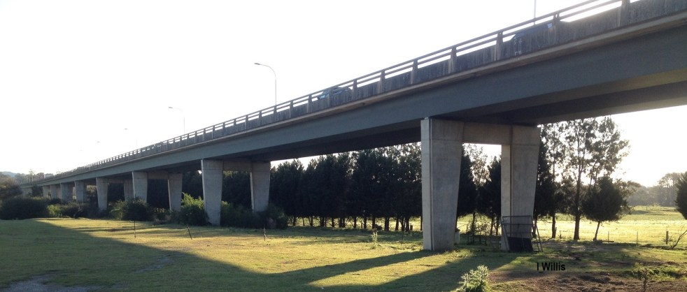
Macarthur Bridge
The Macarthur Bridge across the Nepean River at Camden NSW is an important engineering heritage item.
Share this:

Share this:
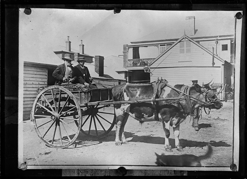
The Roy Dowle collection and old photographs
Old photographs are a glimpse into the past and capture many memories of another time. The Roy Dowle Glass Plate collection at The Oaks Historical Society is a source of many local images.
Share this:

Share this:
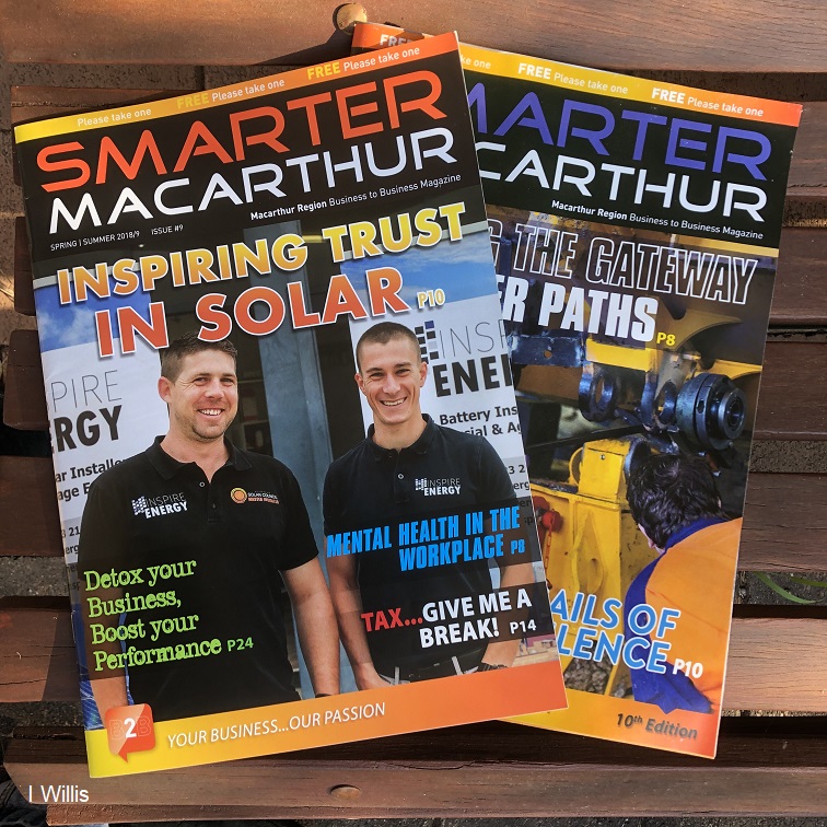
A new Macarthur regional masthead
A new Macarthur regional masthead called Smarter Macarthur magazine.

