
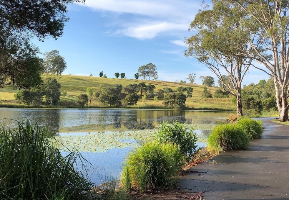
Western Sydney is a complex, diverse region with numerous communities, recognized by various government levels for planning and investment. Historically significant, it faces socio-economic disparities highlighted by the "Latte Line" and "Red Rooster Line." Recent developments, including the Western Sydney International airport, aim to enhance its identity and economic growth, fostering a sense of place.
Category: Town planning


Camden Council vote on listing the Camden Township on the State Heritage Register
On 11 March 2025, Camden Council discussed a motion by Councillor Peter McLean to list Camden Township on the State Heritage Register, citing its significant historical and cultural value. Despite support from the Camden Historical Society and several councillors, the motion was ultimately defeated in a 6-3 vote, with concerns raised about its impact on businesses.
Share this:

Share this:
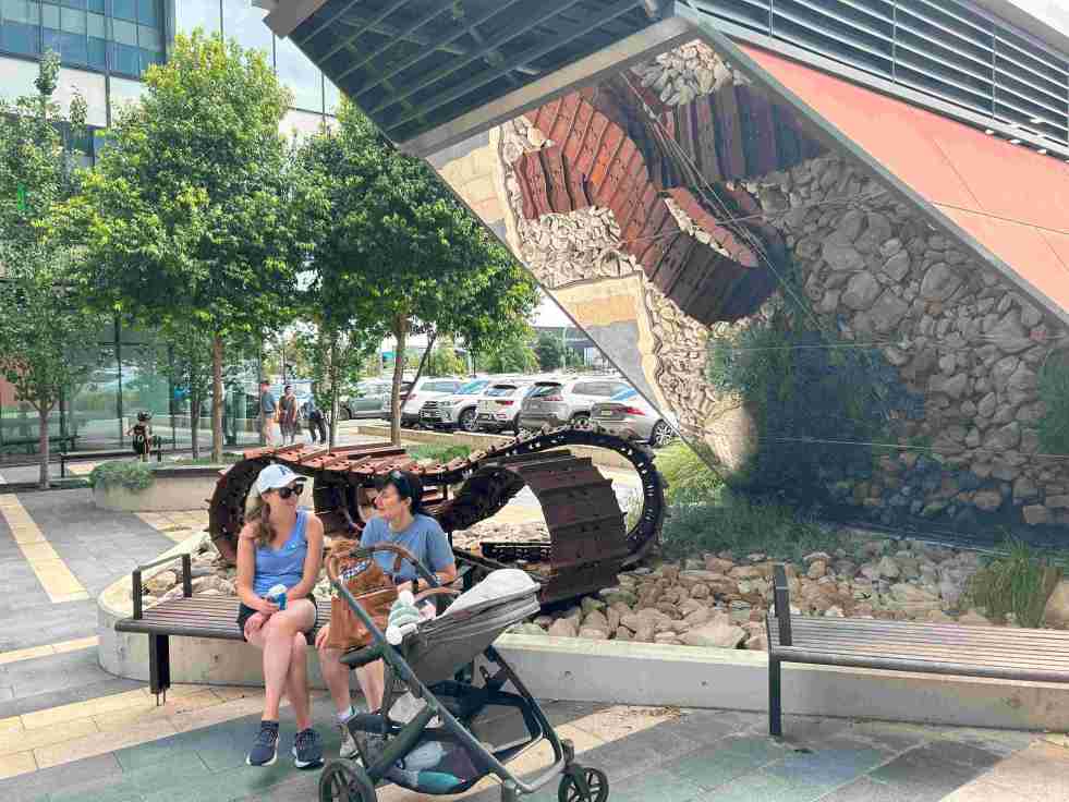
Exploring the ‘Infinity Tracks’ Art Installation in Oran Park
The 'Infinity Tracks' art installation in Oran Park honors the region's heavy haulage industry, highlighting the historical impact of the transport industry and Oran Park Town urban development. Commissioned in 2020 by Greenfields Development Co and TRN House, it enhances the forecourt's aesthetic while reflecting the area's economic growth and employment contributions from the haulage sector and urban development.
Share this:

Share this:

Camden Town Centre Enhancement Strategy: Stakeholder Concerns and Community Engagement
The 2014 Camden Town Centre Enhancement Strategy has faced controversy and distrust from residents and stakeholders, leading to a significant trust deficit. The proposed decked car park and lack of early and robust community engagement have fueled skepticism and discontent. Community consultation principles and the mayor's defense of the process are under scrutiny. Stakeholder concerns about legitimacy align with international practices.
Share this:

Share this:

Airds Shopping Mall demolition, the unmet expectations of mid-century modernism
The Airds shopping mall's future encapsulates the decline of mid-century modernism in the midst of urban neglect. Once a symbol of optimism, the area's decay reflects broader global trends in retail. From failed Radburn principles to public housing challenges, the mall's history mirrors the clash of modernism and neoliberalism in Campbelltown. Despite the despair former residents report that they recall happy memories and stories of hope growing up in the area.
Share this:

Share this:

Yearning, Longing and The Remaking of Camden’s Identity: the myths and reality of ‘a country town idyll’.
This article discusses the concept of a "country town idyll" in Camden, an idealised version of a country town from an imagined past that uses history to construct imagery based on Camden's heritage buildings and other material fabrics. The paper delves into the origins of the idyll, examines its development, and investigates its validity in its contemporary context. It shows how its supporters have used history as a community asset to remake Camden's identity and explore how the 'country town idyll' has been used variously as a political weapon, a marketing tool, and a tourist promotion.
Share this:

Share this:
Explore Narellan’s History: Heritage Walking Tour and Historic Sites
The Narellan Heritage Walking Tour, curated by local photographers Kylie and Peter Lyons, provides a fascinating exploration of the historical and architectural legacy of Narellan. This tour offers insights into the original villages predating Camden's establishment in 1840, featuring notable sites like The Old St Thomas Chapel and the Narellan Public School.
Share this:

Share this:
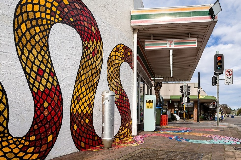
Public art at Campbelltown brightens up the Queen Street precinct
Public art is being used in the Campbelltown town centre to reinvigorate and revitalise the Queen Street precinct that has been subject to urban blight.
Share this:

Share this:
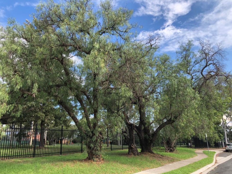
Camden pepper trees, a remnant of the past
In the 1890s, Camden Municipal Council started beautifying the town area by planting various trees, including peppercorns. These cultural plantings defined the local urban landscape for decades, yet only a handful remain today.
Share this:

Share this:
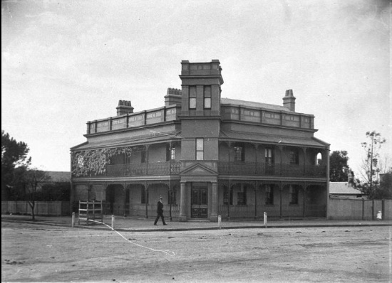
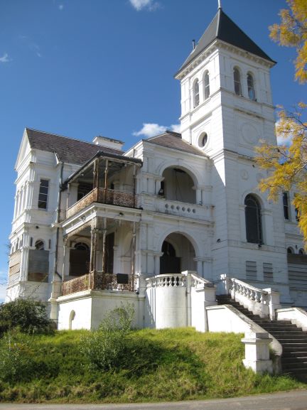
The former Bank of New South Wales building in the country town of Camden
In central Camden is an empty bank building of understated significance at the intersection of John and Argyle Streets. This building was the premises of Westpac, formerly the Bank of New South Wales, and was the second banking chamber on that site. Constructed in the 1930s by a prominent firm of local builders and designed by one of Sydney’s top award-winning architects. It is a building of much architectural merit, and few know its history.

