
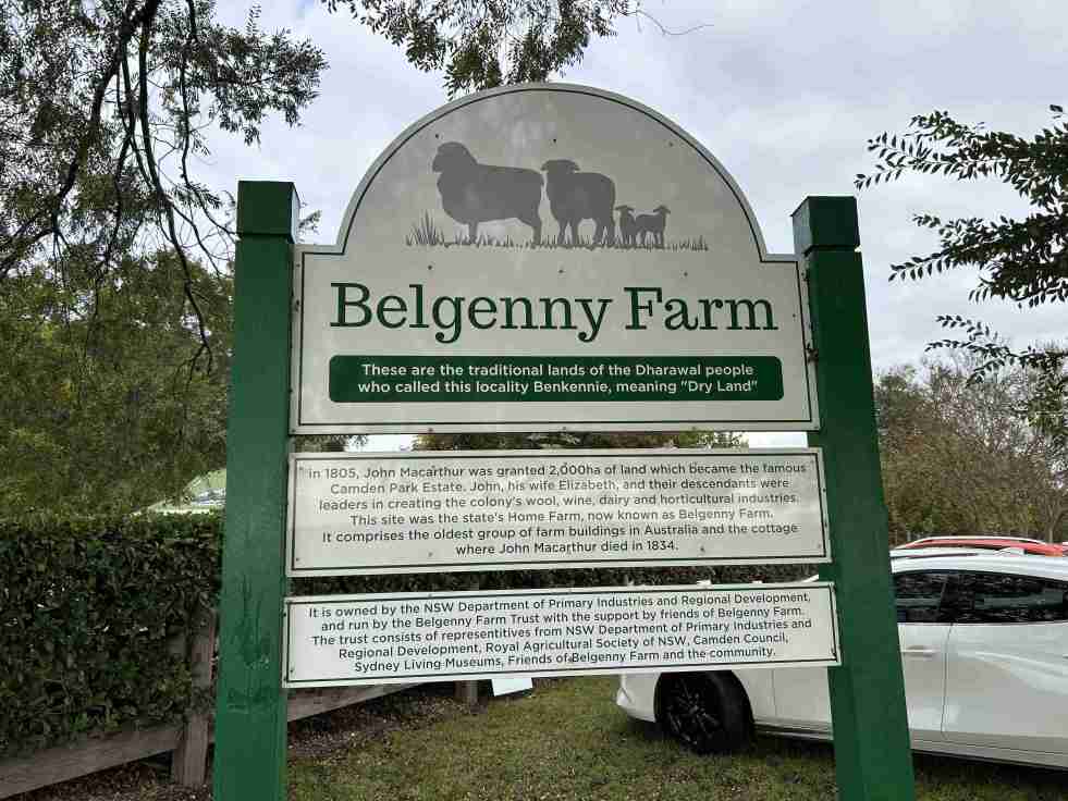
The Belgenny Farm Pioneer Farm Day successfully engaged visitors with Australia’s oldest farming complex, showcasing historical trades, games, and tours despite overcast weather. Families enjoyed activities like croquet and scavenger hunts, emphasizing the site's rich agricultural history and cultural significance. The event highlighted community involvement and fostered appreciation for heritage.
Category: Transport


Jet into the Weekend with Western Sydney International (Nancy-Bird Walton) Airport
Western Sydney International Airport offers a gateway to diverse weekend getaways, from local adventures to international travel. Its design integrates natural elements, reflecting Australian culture and providing a calming atmosphere. With 24/7 operations and various airline partnerships, it simplifies travel, encouraging exploration of the surrounding regions and unique experiences.
Share this:

Share this:
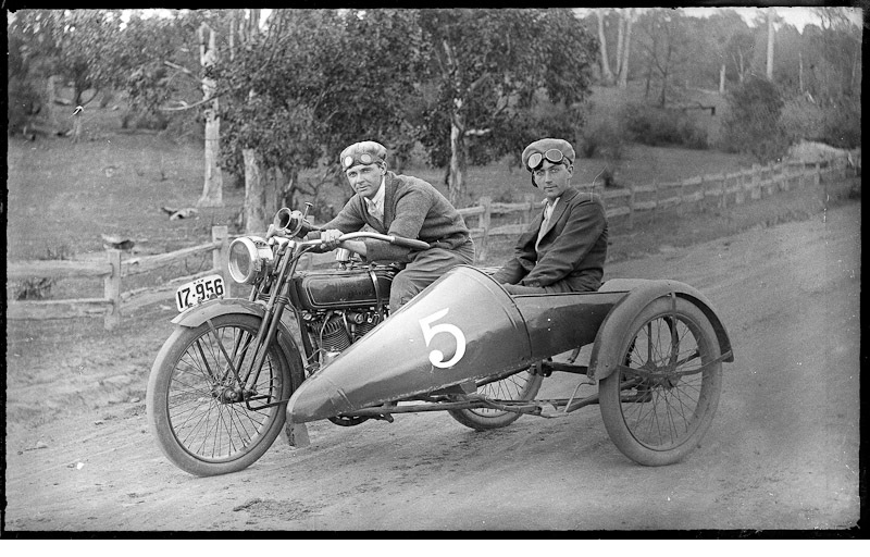
History of Camden Motorcycle Club: pioneers of adventure, movement and modernism
The Camden Motorcycle Club, founded in 1919 and led by Dr. Francis W. West, played a pivotal role in local motorcycle culture in early 20th-century Australia. Members,. like Laurie Kelloway, engaged in adventurous overlanding, promoting camaraderie and the excitement of the open road. The club also provided community support, such as raising funds for disabled veterans like Private Cecil Wheeler.
Share this:

Share this:

2025 Camden Show: A Photographic Journey
The photographic essay captures the vibrant atmosphere of the 2025 Camden Show, showcasing various activities, displays, and exhibitions. Highlights include the Woolworths produce pavilion, enthusiastic attendance from parents at performances, and contributions from local services like the Rural Fire Service, NSW Fire Brigade, and police, enriching the community experience.
Share this:

Share this:
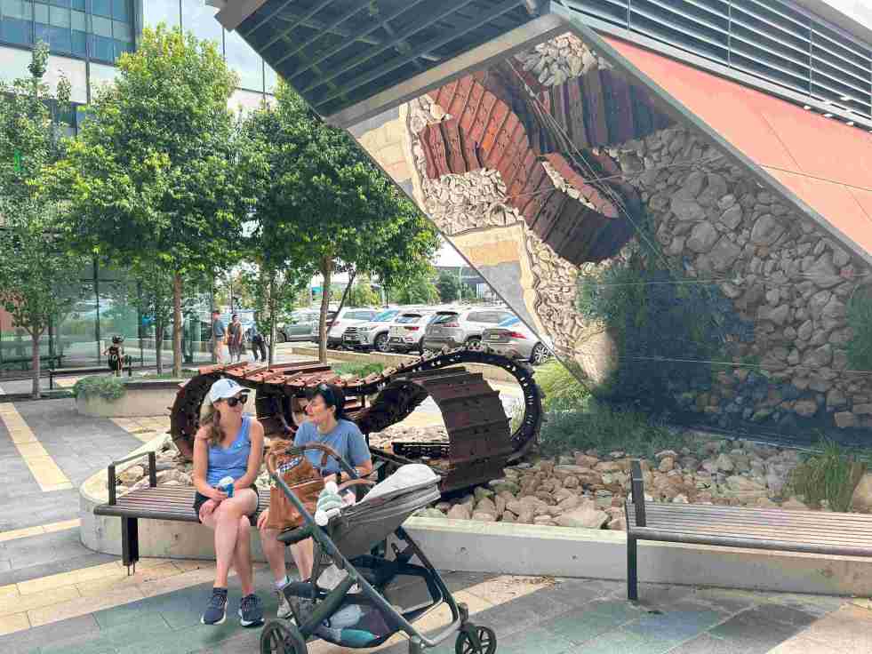
Exploring the ‘Infinity Tracks’ Art Installation in Oran Park
The 'Infinity Tracks' art installation in Oran Park honors the region's heavy haulage industry, highlighting the historical impact of the transport industry and Oran Park Town urban development. Commissioned in 2020 by Greenfields Development Co and TRN House, it enhances the forecourt's aesthetic while reflecting the area's economic growth and employment contributions from the haulage sector and urban development.
Share this:

Share this:
Camden Cottage Hospital, from accidents to amputations and early patient experiences
The Camden Cottage Hospital, opened in April 1899, initially struggled with low patient admissions due to community reluctance. Early cases included accidents and serious conditions, leading to treatments and surgeries like amputations. By early 1900, there was increasing community trust and the permanent facility opened in May 1902.
Share this:

Share this:
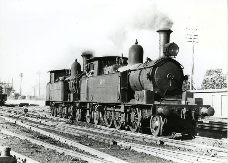
Exploring Camden’s Railway Heritage: Pansy and Its Timeless Stories
The Camden branch line, with its famous locomotive Pansy, holds a special place in the memories of locals and visitors. Operating from 1882 to 1963, it served as a lifeline for the community, transporting goods, passengers, and even wartime heroes. Despite its eventual closure, remnants of the line can still be seen today.
Share this:

Share this:
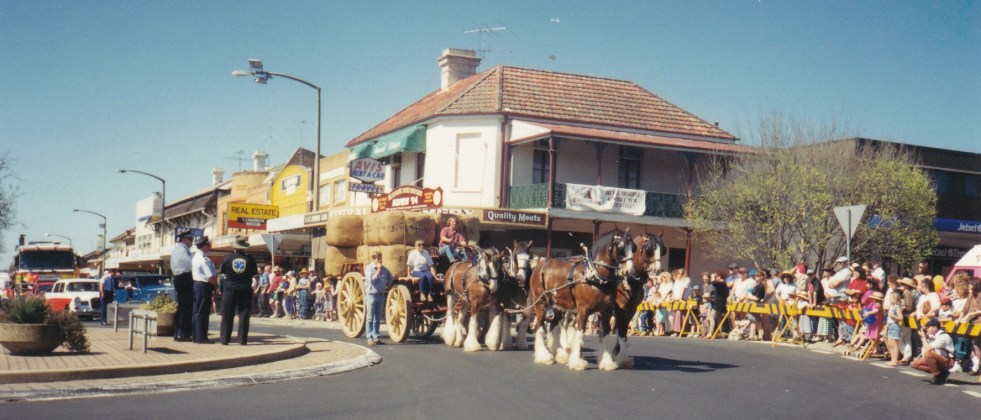
Camden Teamsters Memorial, when the horse was king on the Yerranderie Road
Tribute to mining and industrial heritage If you wander along the John Street heritage precinct, you will come across a quaint monument with a large wagon wheel reminding you of when the horse was king on the Yerranderie Road. The Camden Teamster's Memorial is on John Street, Camden. The memorial is between Macaria, a… Continue reading Camden Teamsters Memorial, when the horse was king on the Yerranderie Road
Share this:

Share this:
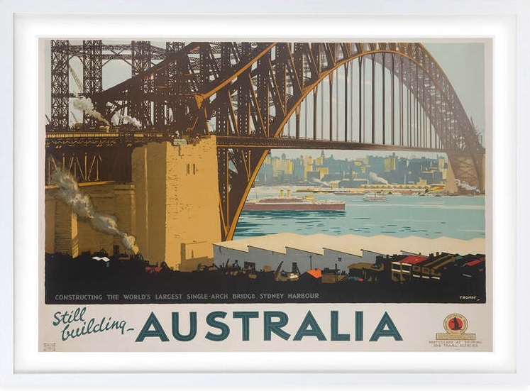
The Sydney Harbour Bridge, an engineering marvel
The Sydney Harbour Bridge is an icon on the Sydney urban landscape. The bridge is an engineering marvel of modernism and the early 20th hope of a new nation.
Share this:

Share this:

The Camden district, 1840-1973, a field of dreams
The Camden district was historically significant, serving as a social and economic center for over a century. It integrated farming, mining, and community life, shaped by Aboriginal heritage and European settlement. However, modern developments and infrastructural changes led to its decline, transitioning to a regional identity tied to Macarthur area governance and branding.

