

Western Sydney International Airport offers a gateway to diverse weekend getaways, from local adventures to international travel. Its design integrates natural elements, reflecting Australian culture and providing a calming atmosphere. With 24/7 operations and various airline partnerships, it simplifies travel, encouraging exploration of the surrounding regions and unique experiences.
Category: Utilities

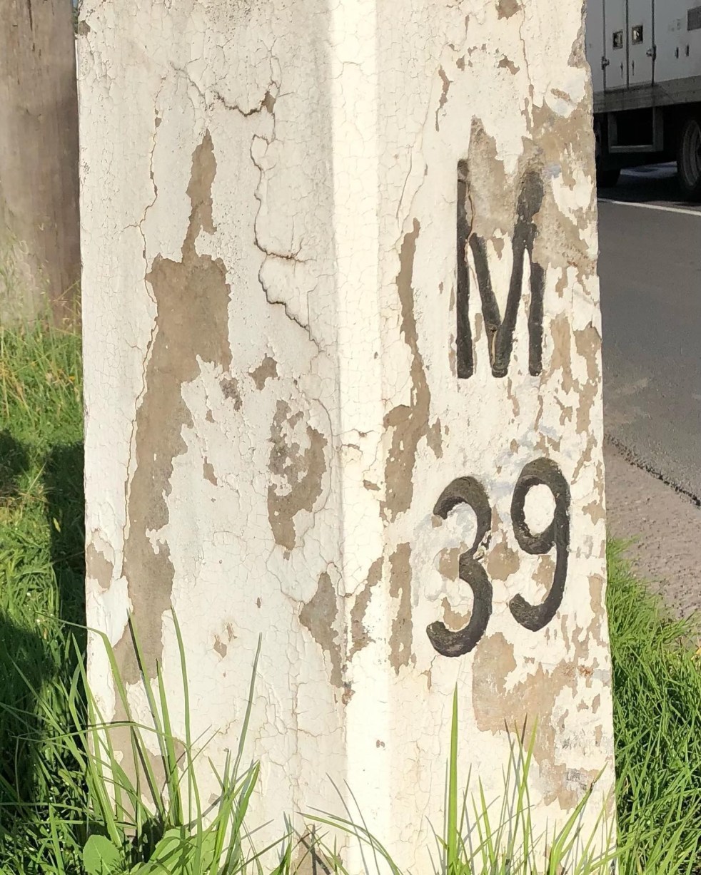
Mileposts captured the distance of the past
The white concrete mileposts in Camden, remnants of the Hume Highway, mark distances to destinations like Sydney and Mittagong. Originating from Roman times, these posts were part of a 1934 initiative to standardize road markers in NSW, aiding both travelers and road maintenance. They reflect Camden's cultural and engineering heritage.
Share this:

Share this:

Mundane objects tell an interesting story
Utility covers are mundane objects that tell interesting stories about the past in an area. Others consider then to be a form of street art and street aesthetic.
Share this:

Share this:
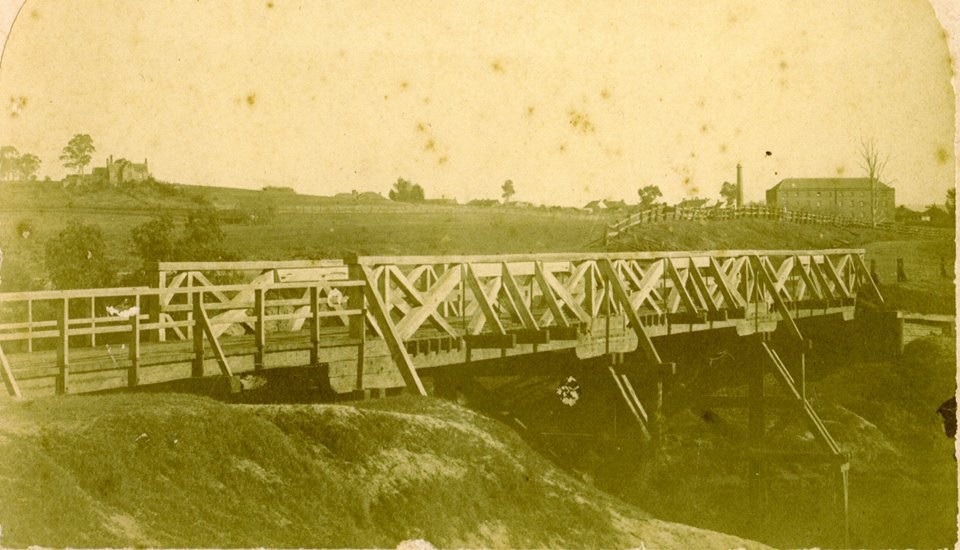
The Cowpastures bridge at the Nepean River crossing
Access across the Nepean River has been an issue since European settlement. The problem was solved by building a bridge with the first in 1826, the next in 1860 followed by 1900 and 1976.
Share this:

Share this:
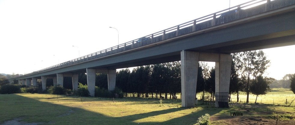
Macarthur Bridge
The Macarthur Bridge across the Nepean River at Camden NSW is an important engineering heritage item.
Share this:

Share this:
Outhouse at 80 John Street causes a fuss
In the backyard of an historic cottage at 80 John Street there is a funny little dunny that dates from the 1890s. In 2011 it created a great deal of fuss when there was a proposal for a two-storey commercial development at the rear of the cottage site and the demolition of the dunny for parking.
Share this:

Share this:
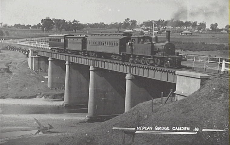
Pansy the Camden locomotive
The Camden train affectionately called Pansy is a distant memory that rekindles many memories and a nostalgia for the past.
Share this:

Share this:
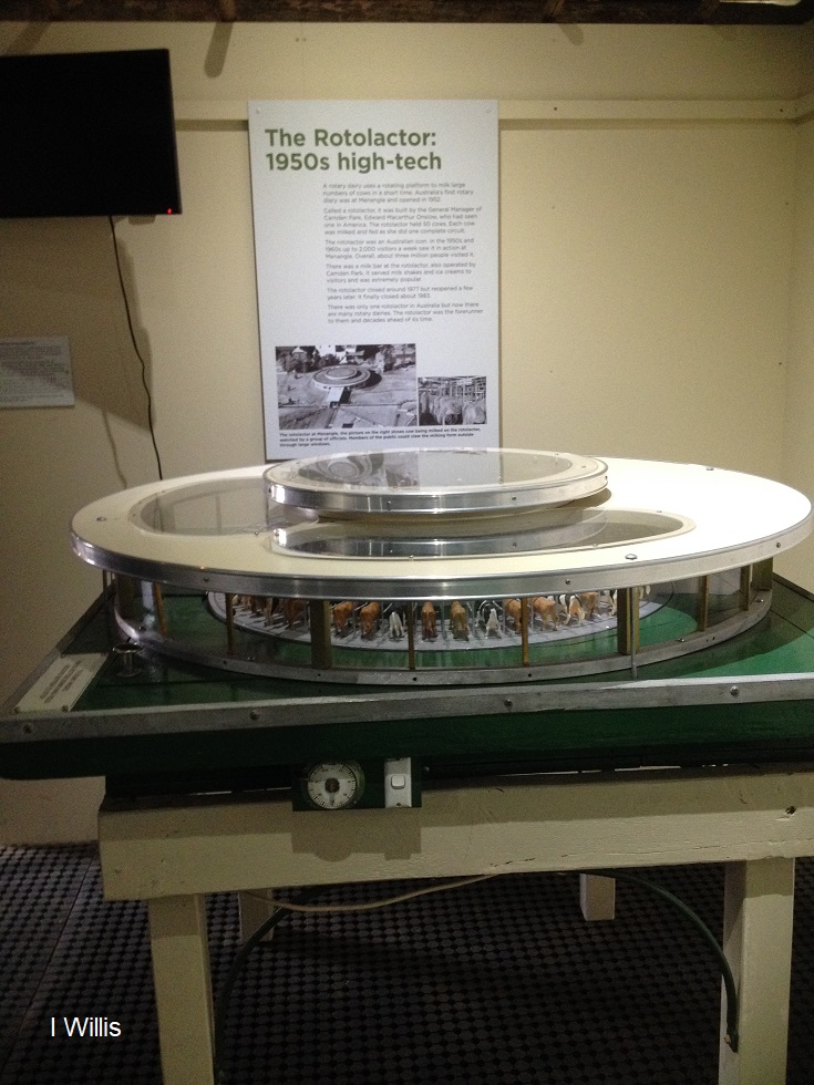
The Rotolactor, a Menangle milking marvel
The Rotolactor was Menangle's milking marvel. A rotating dairy that was a tourism attraction and an example of industrial modernism on the colonial property Camden Park estate.
Share this:

Share this:
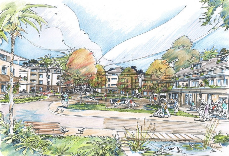
Former Camden High school site has a new retirement village development
The old Camden High site will be reborn as a retirement village
Share this:

Share this:
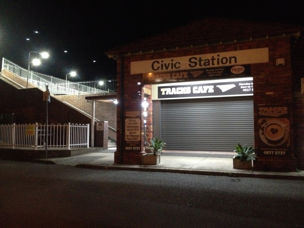
Civic Railway Station, revealing part of Newcastle modernism
Civic Railway Station, now closed, reveals some of the aesthetics of Newcastle modernism.

