
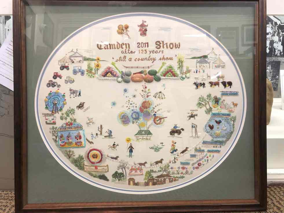
Elaine Balla, an accomplished embroidery artist, created 'The Camden Show' for the 2011 Camden Show's 125th anniversary, winning a Champion Exhibit Ribbon. Her work, now displayed at the Camden Museum, vividly represents community stories. Balla's contributions span sixty years, illustrating women's expression through the art of embroidery, their agency and telling community stories.
Category: Menangle

Understanding the Camden Story: History, Community, and Identity
The Camden story encapsulates the rich tapestry of tales and histories that define the Camden community, including dreamtime legends and settler accounts. It offers insight into the community's values, identity, and resilience, serving as both a historical narrative and a tool for local businesses, fostering deeper connections among residents.
Share this:

Share this:
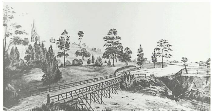
Menangle, A Historic English-Style Estate Village in Camden Park
The village of Menangle, situated within the Camden district, reflects an English-style private estate village that has evolved over 150 years. Embodying rural Englishness, it has experienced both prosperity and decline, closely tied to the history of the Camden Park estate. The village's story is intertwined with the Macarthur family's influence and the impact of industrialization and modernization.
Share this:

Share this:
Menangle School of Arts hall, the heart of a village, under redevelopment
The Menangle Community Association is leading a project to replace the former Menangle School of Arts with a modern community hall.
Share this:

Share this:

The Camden district, 1840-1973, a field of dreams
The Camden district was historically significant, serving as a social and economic center for over a century. It integrated farming, mining, and community life, shaped by Aboriginal heritage and European settlement. However, modern developments and infrastructural changes led to its decline, transitioning to a regional identity tied to Macarthur area governance and branding.
Share this:

Share this:
The Cowpastures’ English-styled-gentry and their private villages
A certain type of self-styled-English gentry created a landscape in their own vision in the Cowpastures.
Share this:

Share this:

Camden War Cemetery
Camden War Cemetery has the graves of a number of service personnel from the Second World War who were killed while based in the local area.
Share this:

Share this:

Camden Heritage Conservation Area – an English-style village in the Cowpastures
The Macarthur private village of Camden was located in the English style countryside of the Cowpastures countryside with its gentry estates and villages. Founded in 1840 it was all part the British imperial imperative and the settler colonial project that came with it.
Share this:

Share this:

Formidable women from the past
Formidable women from the past in the country town of Camden NSW
Share this:

Share this:
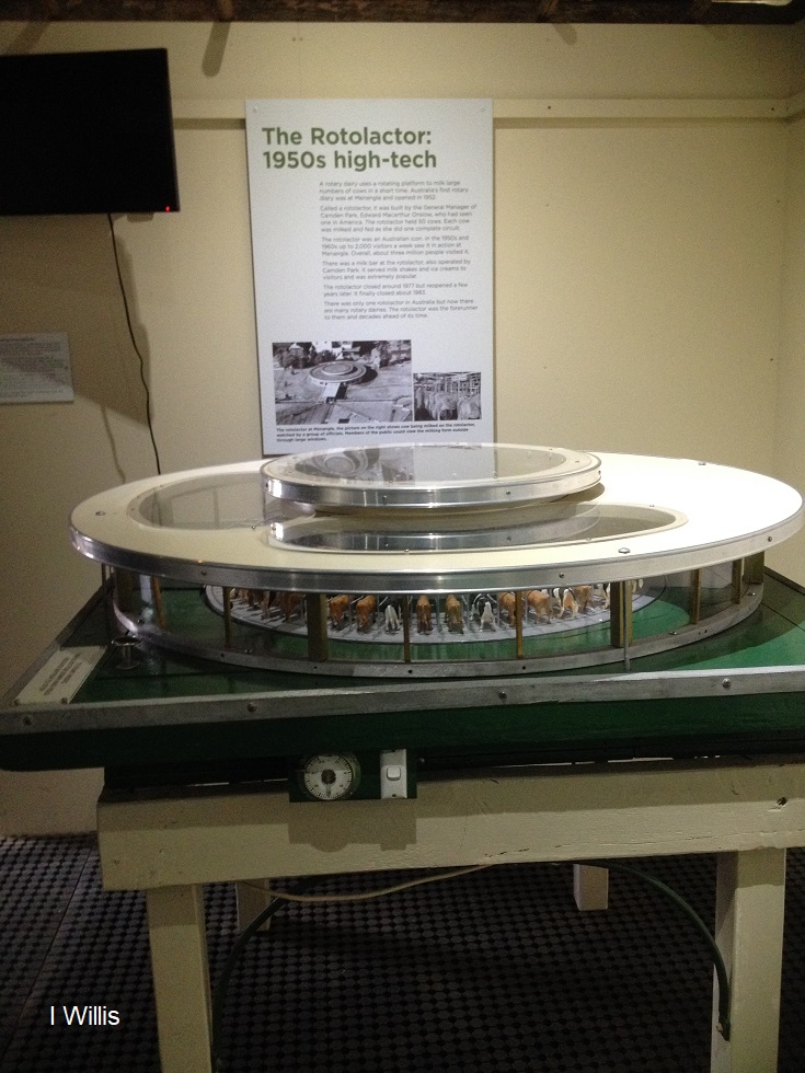
The Rotolactor, a Menangle milking marvel
The Rotolactor was Menangle's milking marvel. A rotating dairy that was a tourism attraction and an example of industrial modernism on the colonial property Camden Park estate.

