
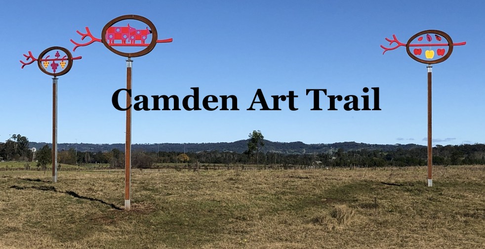
The Camden Public Art Trail, officially opened in June 2024, connects the Nepean River to Camden Town Farm and features stunning artwork installations across a 4.2-kilometer walkway. Funded by the NSW Government, the trail celebrates local heritage and ecology while providing an accessible outdoor experience for visitors, though dogs are not permitted.
Category: Heritage

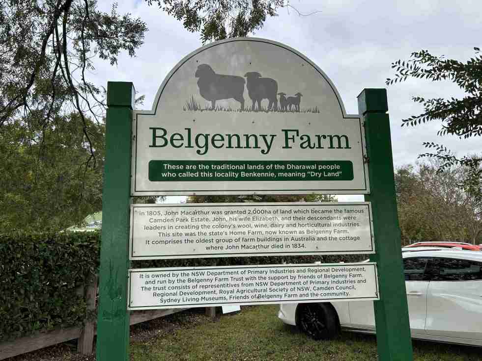
Cultural Tourism Success at Belgenny Farm
The Belgenny Farm Pioneer Farm Day successfully engaged visitors with Australia’s oldest farming complex, showcasing historical trades, games, and tours despite overcast weather. Families enjoyed activities like croquet and scavenger hunts, emphasizing the site's rich agricultural history and cultural significance. The event highlighted community involvement and fostered appreciation for heritage.
Share this:

Share this:
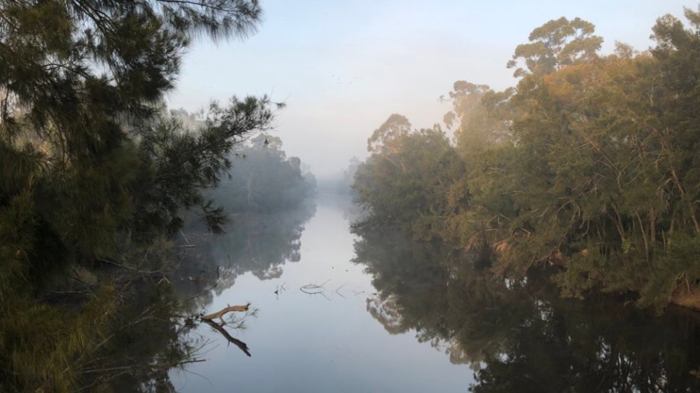
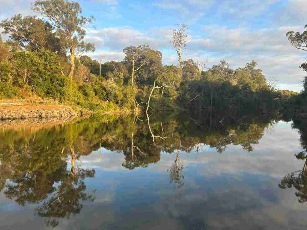
Exploring Little Sandy: Camden’s Hidden Gem
Little Sandy, a cherished location on the Nepean River in Camden, is celebrated for its rich community history and the memories it holds for locals. Enhanced by the Camden Weir, it features a modern footbridge and Aboriginal-inspired artwork, symbolizing its cultural significance as a site of gatherings, swimming, and personal milestones.
Share this:

Share this:

Celebrating Diversity at Camden’s Cultural Concert and Dinner
On March 27, 2026, Camden Civic Centre hosted a Cultural Concert and Dinner, attracting over 200 attendees. The event, part of Multicultural March, showcased diverse performances, promoting inclusion and belonging within the community. Mayor Theresa Fedeli celebrated Camden’s cultural richness, emphasizing the importance of unity and connection among different backgrounds.
Share this:

Share this:
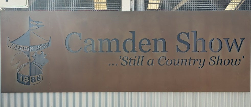
Camden Show 2026: Family Fun and Agricultural Excellence
The Camden Show, established in 1886, is an annual community festival celebrating agriculture, local talent, and heritage in the Macarthur region. Attracting over 48,000 visitors, it features livestock exhibitions, competitions, and entertainment. The event fosters community spirit, showcasing historical traditions and engaging volunteers dedicated to promoting agriculture and youth involvement.
Share this:

Share this:

Exploring the Camden story through collective memory and community history
The Camden story represents a rich tapestry of community history, emphasizing narratives from marginalized voices. It highlights how cultural memory, shaped through oral traditions and historical artifacts, fosters shared identity. Essential sites like museums and monuments facilitate the transmission of collective memories, preserving the community's past and influencing its identity.
Share this:

Share this:
Balancing Heritage and Development in Australia
The Centre for Independent Studies argues that NSW heritage laws exacerbate the housing affordability crisis by preserving unremarkable buildings, thus restricting development. It critiques a narrow economic view of heritage that neglects community values, highlighting that a broader understanding of heritage's social and economic benefits is essential for sustainable urban planning.
Share this:

Share this:
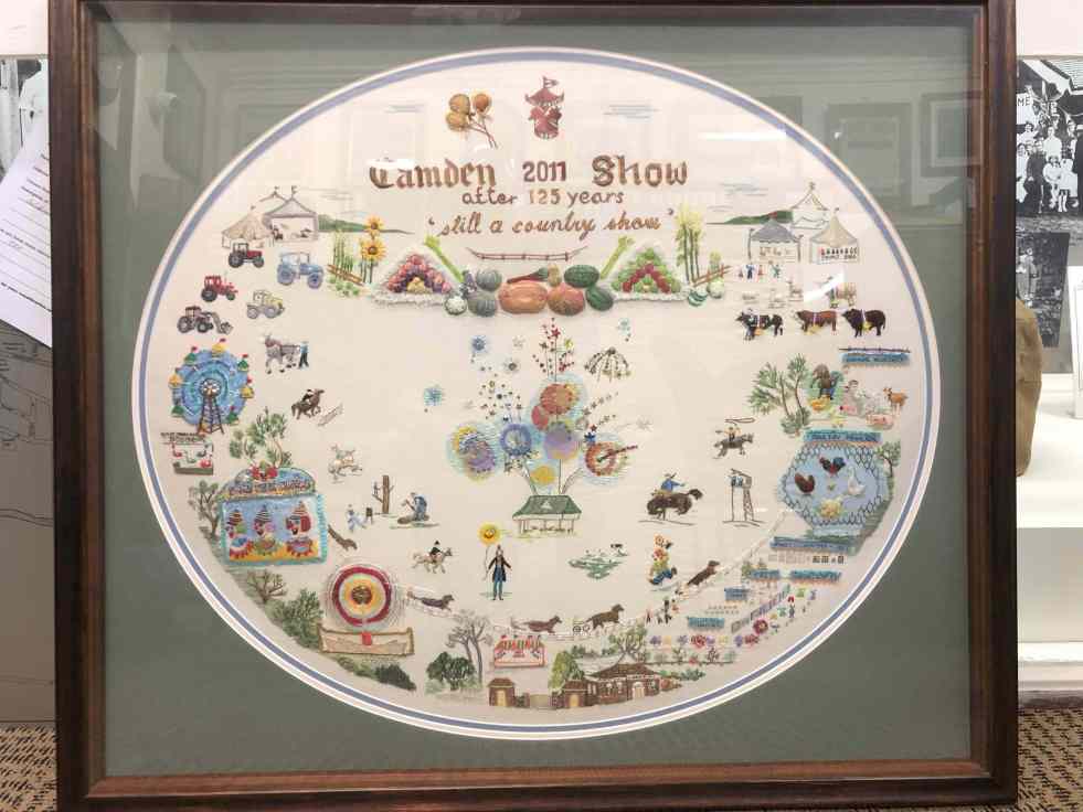
The legacy of embroidery, Elaine Balla’s Camden Show artwork
Elaine Balla, an accomplished embroidery artist, created 'The Camden Show' for the 2011 Camden Show's 125th anniversary, winning a Champion Exhibit Ribbon. Her work, now displayed at the Camden Museum, vividly represents community stories. Balla's contributions span sixty years, illustrating women's expression through the art of embroidery, their agency and telling community stories.
Share this:

Share this:
Discover Camden’s Agricultural Heritage and Legacy
Camden, New South Wales, is recognized as the birthplace of Australian agriculture, boasting significant historical and contemporary agricultural sites. Despite rapid growth and new residents' limited awareness of its agricultural legacy, Camden remains a vital hub for agricultural research and education, blending rural lifestyle with community connections and open spaces.
Share this:

Share this:

Exploring the Penrith Museum of Printing
The Penrith Museum of Printing, part of History Week 2018 in New South Wales, showcases operational printing presses from 1860 to 1970. Visitors learn about traditional printing techniques through live demonstrations. Established in 2001, the museum highlights the evolution of local newspapers and the significant role of printers and compositors.

