
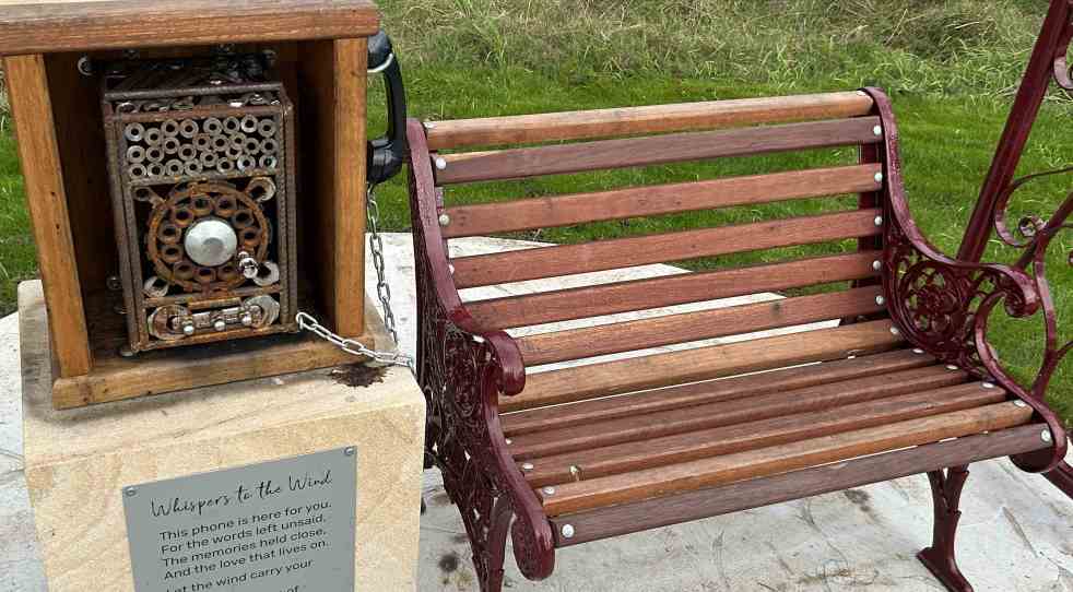
A new art installation, "Whispering in the Wind," has been unveiled along the Nepean River Trail in Camden, NSW. Created by artist Quinton Laws using recycled materials, the wind phone provides a space for reflection and connection for those grieving. Inspired by global installations, it encourages open expression of emotions.
Category: Landscape

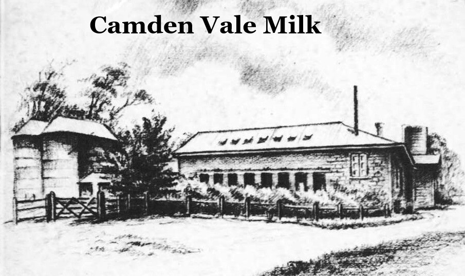
The History of Camden Vale Milk: A 20th Century Legacy
The Camden Museum features a poster detailing the significance of the Camden Vale special milk brand, which emerged from advancements in dairy farming in the area. Established in 1920, the brand was known for high-quality milk, emphasizing health benefits and innovative delivery methods, significantly impacting local agriculture and public health history.
Share this:

Share this:
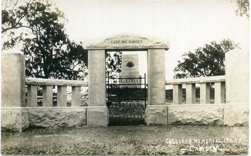
Camden’s Anzac Precinct: A Historical Reflection
Camden’s World War One Anzac precinct, located in Macarthur Park, features a cenotaph, memorial gates, and war trophy guns that commemorate local soldiers' sacrifices. The memorials were completed in 1922 amid mixed community support. Over time, the precinct has become a sacred site, reflecting shifting attitudes toward remembrance and honouring the war dead.
Share this:

Share this:
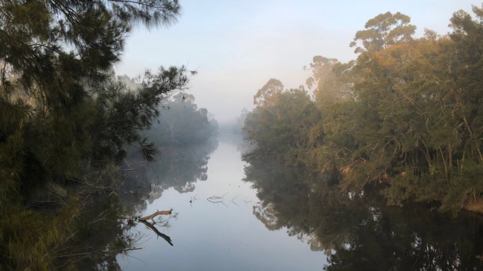
Exploring Little Sandy: Camden’s Hidden Gem
Little Sandy, a cherished location on the Nepean River in Camden, is celebrated for its rich community history and the memories it holds for locals. Enhanced by the Camden Weir, it features a modern footbridge and Aboriginal-inspired artwork, symbolizing its cultural significance as a site of gatherings, swimming, and personal milestones.
Share this:

Share this:
Camden Park Agricultural Research Station: A 1985 Landscape Report Overview
In 1985, the NSW Government released a landscape report on Camden Park Agricultural Research Station, highlighting its cultural significance amid urban encroachment. It described a complex cultural landscape, emphasising conservation needs. The site, now the Elizabeth Macarthur Agricultural Institute, is vital to agriculture and biosecurity, preserving the region's historical and cultural integrity.
Share this:

Share this:
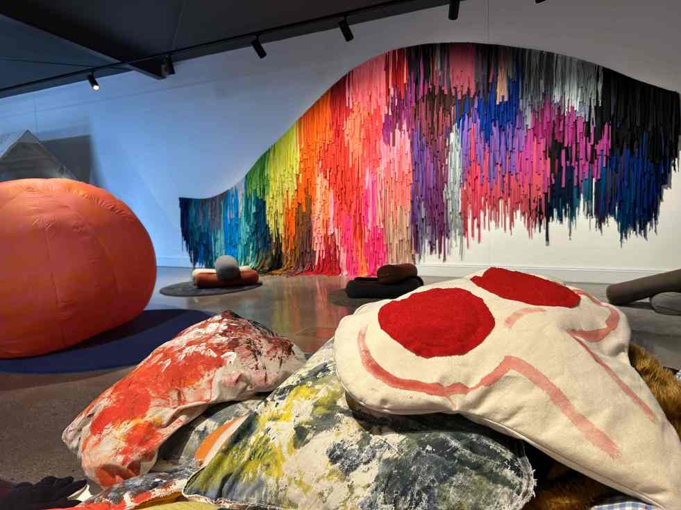
Uncover Artistic Gems in Regional and Suburban Australia
Across regional and suburban Australia, hidden art galleries offer vibrant cultural experiences often overlooked by tourists. These venues provide platforms for local artists and unique exhibitions, showcasing the rich artistic landscape of the country. Visiting these spaces fosters community connection and enriches local economies through art and tourism.
Share this:

Share this:
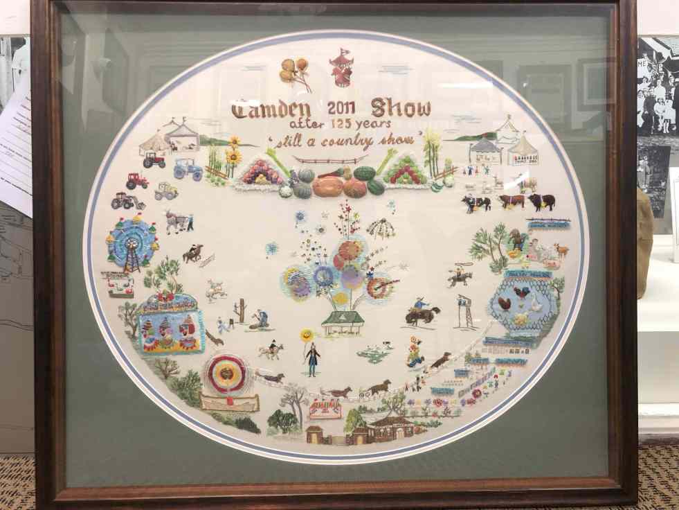
The legacy of embroidery, Elaine Balla’s Camden Show artwork
Elaine Balla, an accomplished embroidery artist, created 'The Camden Show' for the 2011 Camden Show's 125th anniversary, winning a Champion Exhibit Ribbon. Her work, now displayed at the Camden Museum, vividly represents community stories. Balla's contributions span sixty years, illustrating women's expression through the art of embroidery, their agency and telling community stories.
Share this:

Share this:
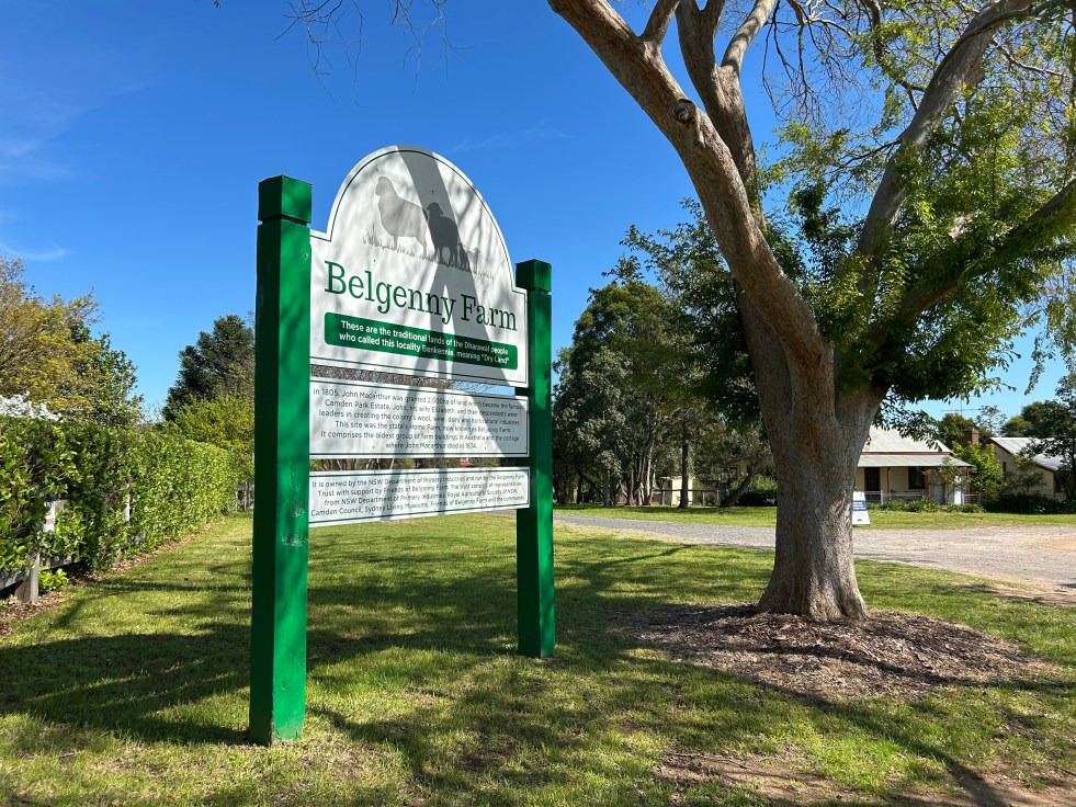
Exploring Belgenny Farm: Australia’s Oldest Farm Complex
Belgenny Farm, located in Camden, NSW, is Australia’s oldest surviving group of farm buildings, dating back to the 1820s. This historical site includes significant structures like stables, a coach house, and a community hall. It holds cultural importance through its association with the Macarthur family and continues to serve educational purposes.
Share this:

Share this:
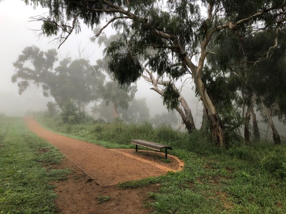
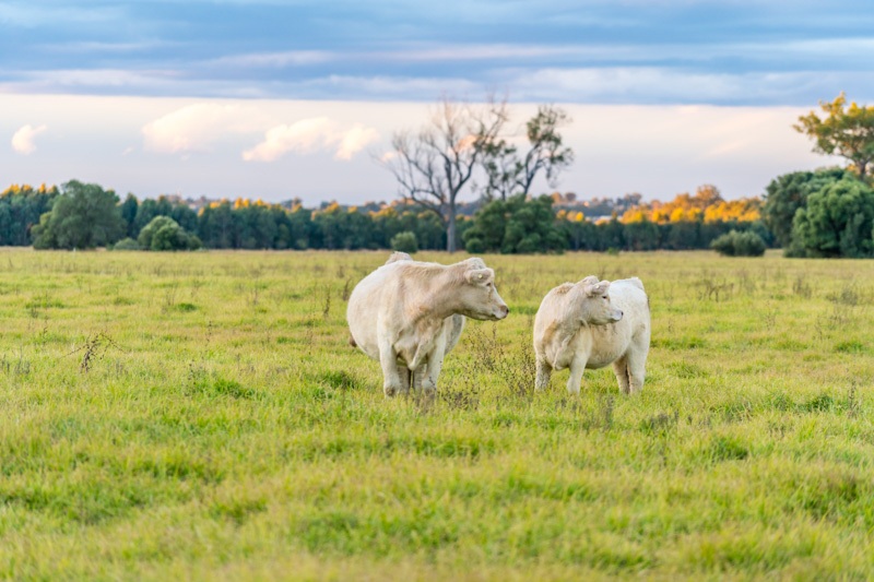
Top Walking Trails in Camden: Experience Walking the Cowpastures
Camden township, located in the historical Cow Pastures, features walking and cycling paths that reflect its Indigenous and colonial history. The Nepean River Trail, integrating various public artworks, enhances the area's historic character, while memorial walkways pay tribute to Australian service members. It's a site for both recreation and cultural immersion.
Share this:

Share this:
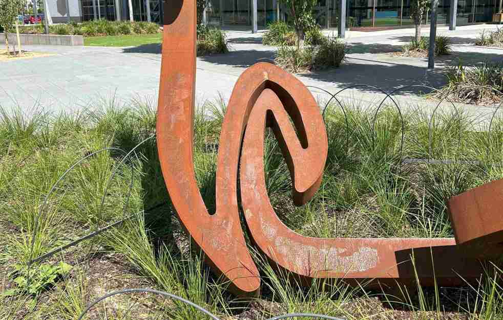
Exploring Greg Johns’s public art installation outside the Oran Park Leisure Centre
At the front of the Oran Park Leisure Centre is Greg Johns' art installation, Vortex Mandala, which was inaugurated on 21 October 2024. This public artwork reflects swirling patterns symbolizing energy flow and consciousness. Johns, influenced by the Adelaide Hills, aims to create significant public sculptures that engage viewers and enhance the local environment.

