
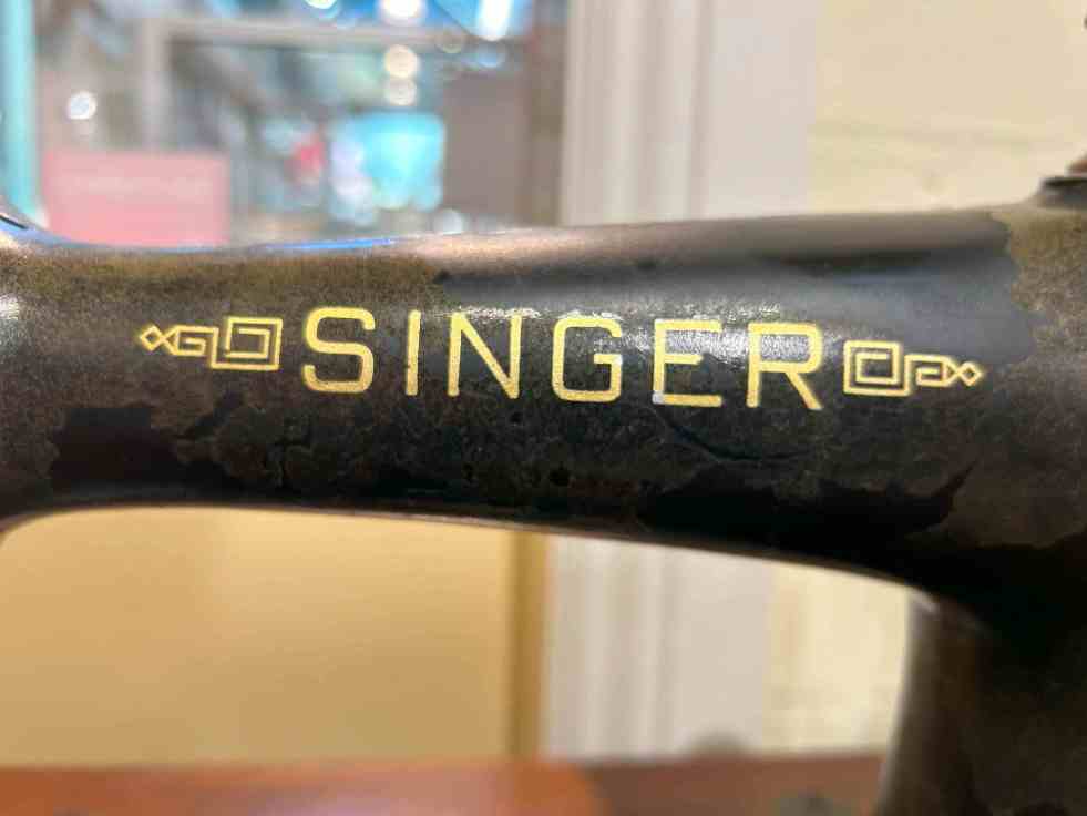
The Camden Museum features a collection of historical sewing machines, highlighting their significance in women's domestic lives and agency since the 19th century. These machines facilitated garment production and enabled some women to establish dressmaking businesses, showcasing their skills while enhancing independence during times of social change, including both World Wars.
Category: Engineering Heritage

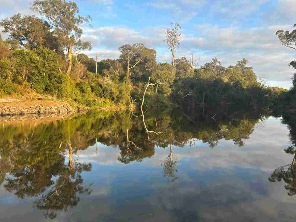
Upper Nepean River: Cultural and Environmental Insights
The Upper Nepean River is the upper catchment of the Hawkesbury-Nepean system, extending over 470 km from Goulburn to the Hunter Valley. Named in 1789, it has a complex history shaped by floods, droughts, and the settlements of Indigenous peoples and Europeans, significantly influencing the region's culture and land use.
Share this:

Share this:
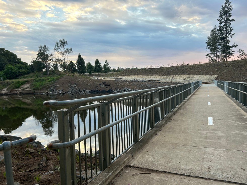
Little Sandy Footbridge Reopens: A Community Treasure
The Little Sandy Footbridge in Camden has reopened, restoring an essential link in the Nepean River Trail after extensive flood-related repairs. Originally constructed during WWII, the bridge has been a beloved community feature, supporting recreational activities for over a century. The project was funded by government sources, totaling $3.7 million.
Share this:

Share this:

Understanding NSW’s 2025 Draft Heritage Strategy
The NSW Government has unveiled the NSW Heritage Strategy, marking a significant update in over twenty years. Aiming to broaden the understanding of heritage, it includes Aboriginal culture, historic structures, and natural heritage. Public feedback is welcomed until July 13, 2025, to shape the final strategy guiding future heritage policies.
Share this:

Share this:
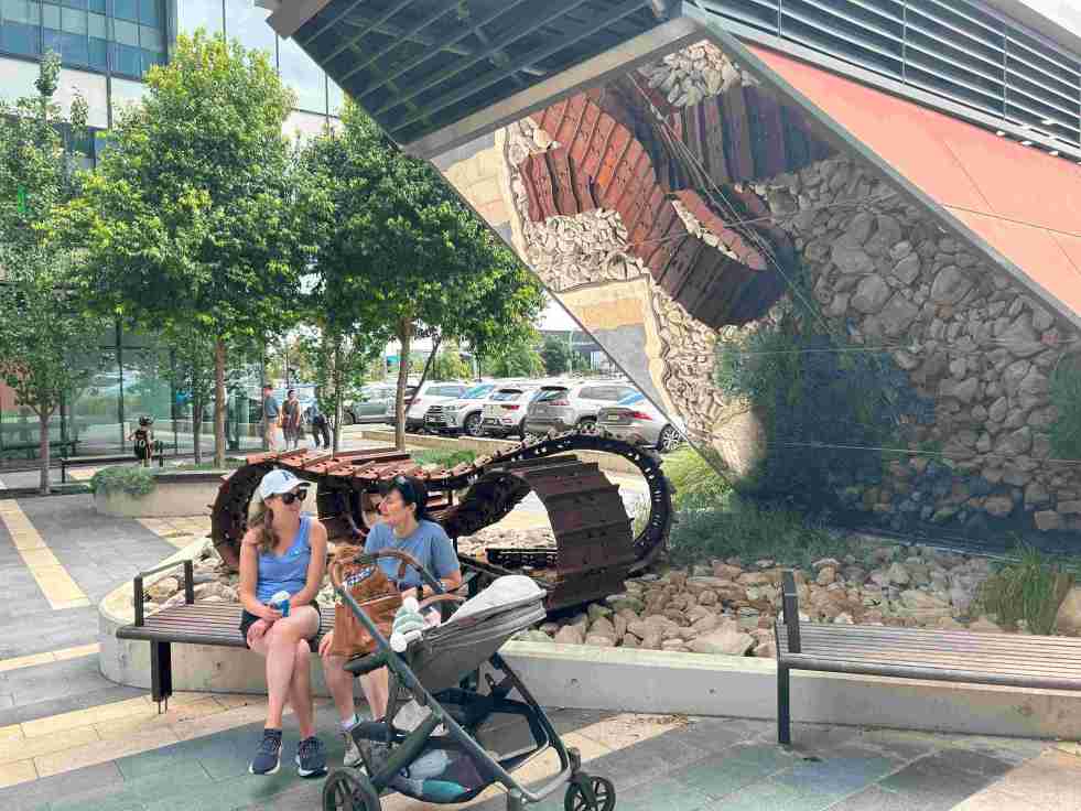
Exploring the ‘Infinity Tracks’ Art Installation in Oran Park
The 'Infinity Tracks' art installation in Oran Park honors the region's heavy haulage industry, highlighting the historical impact of the transport industry and Oran Park Town urban development. Commissioned in 2020 by Greenfields Development Co and TRN House, it enhances the forecourt's aesthetic while reflecting the area's economic growth and employment contributions from the haulage sector and urban development.
Share this:

Share this:
Cultural and Heritage Tourism in Camden: Unveiling a $6.4 Million Per Year Industry
Cultural and heritage tourism adds $6.4 million a year to the local economy. The Camden Museum and the Alan Baker Art Gallery add over $1.7 million annually.
Share this:

Share this:
Exploring Historical Themes: Pictorial History Camden & District Presentation Summary
This presentation examined the role of the historian and researcher and presented the importance of history and the role of a historian. Dr Ian Willis discussed the significance of historical consciousness and collective memory, emphasising the role of a historian as a researcher, analyst, interpreter, and storyteller. The presentation also highlighted "Pictorial History Camden & District," a book by Kingsclear Books, and covered aspects such as structure, select bibliography, index of names, and district maps. Additionally, various related sources and themes, such as the Whiteman and Macarthur families, were explored. The presentation concluded with suggestions for experiencing the past through community festivals, local studies, and living libraries.
Share this:

Share this:
Burragorang Coalfields: From Prosperity to Closure
The Burragorang Valley's coal mining history spans from the early 1800s to the closure of the last operational mine in 2000. The community relied on coal for jobs, but the inevitable end affected the region. International mining companies became involved, and the introduction of electricity transformed mining processes. Many mines opened and closed throughout the years, leaving a rich and complex history documented in various sources.
Share this:

Share this:
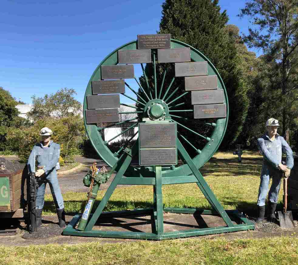
Camden Teamsters Memorial, when the horse was king on the Yerranderie Road
Tribute to mining and industrial heritage If you wander along the John Street heritage precinct, you will come across a quaint monument with a large wagon wheel reminding you of when the horse was king on the Yerranderie Road. The Camden Teamster's Memorial is on John Street, Camden. The memorial is between Macaria, a… Continue reading Camden Teamsters Memorial, when the horse was king on the Yerranderie Road
Share this:

Share this:
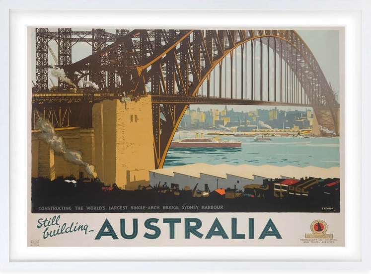
The Sydney Harbour Bridge, an engineering marvel
The Sydney Harbour Bridge is an icon on the Sydney urban landscape. The bridge is an engineering marvel of modernism and the early 20th hope of a new nation.

