

The Airds shopping mall's future encapsulates the decline of mid-century modernism in the midst of urban neglect. Once a symbol of optimism, the area's decay reflects broader global trends in retail. From failed Radburn principles to public housing challenges, the mall's history mirrors the clash of modernism and neoliberalism in Campbelltown. Despite the despair former residents report that they recall happy memories and stories of hope growing up in the area.
Category: 1973 New Cities Campbelltown Camden Appin Structure Plan

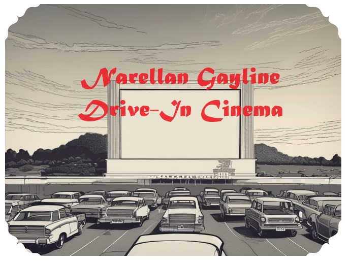
Narellan ‘Gayline’ Drive-In Movie Theatre, a touch of modernism
The Narellan Gayline Drive-In Movie Theatre in Camden was a defining feature of the local 1960s-1980s culture, offering a relaxed, family-friendly movie experience. The drive-in's success peaked in the early 1970s but eventually closed in 1990 due to changing lifestyles and real estate development. It provided a memorable experience for many local residents, offering a nostalgic look back at a bygone era.
Share this:

Share this:

Yearning, Longing and The Remaking of Camden’s Identity: the myths and reality of ‘a country town idyll’.
This article discusses the concept of a "country town idyll" in Camden, an idealised version of a country town from an imagined past that uses history to construct imagery based on Camden's heritage buildings and other material fabrics. The paper delves into the origins of the idyll, examines its development, and investigates its validity in its contemporary context. It shows how its supporters have used history as a community asset to remake Camden's identity and explore how the 'country town idyll' has been used variously as a political weapon, a marketing tool, and a tourist promotion.
Share this:

Share this:
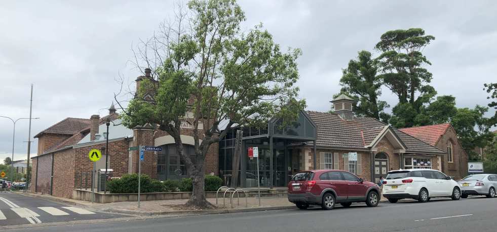
The Camden Library Museum, conservation through adaptative reuse
The Camden Library Museum, located at 40 John Street, has a rich history with numerous additions and occupants, including the Camden Council, Library, Fire Brigade, and Red Cross. The building's conservation through adaptation has retained its cultural significance as a heritage place. The former School of Arts and Temperance Hall have also played important roles in the building's evolution.
Share this:

Share this:
Unlock Camden 2023, a festival celebrating our past
Unlock Camden is a history festival that celebrates the Camden story through walks, art, images, stories, and a host of other activities. Events are centred in historic the John Street precinct around the Alan Baker Art Gallery Macaria.
Share this:
Share this:
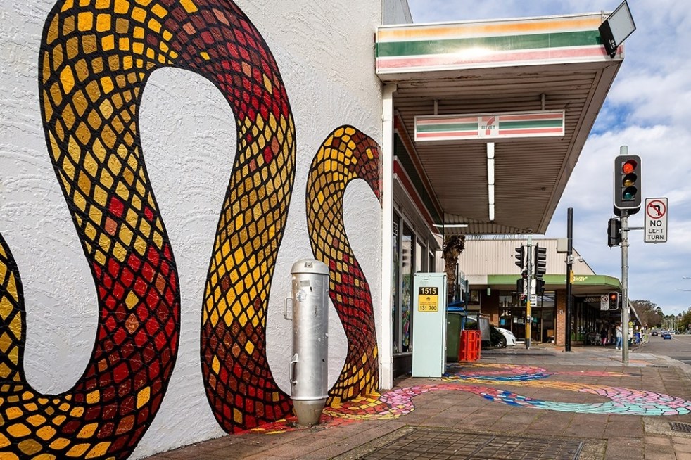
Public art at Campbelltown brightens up the Queen Street precinct
Public art is being used in the Campbelltown town centre to reinvigorate and revitalise the Queen Street precinct that has been subject to urban blight.
Share this:

Share this:
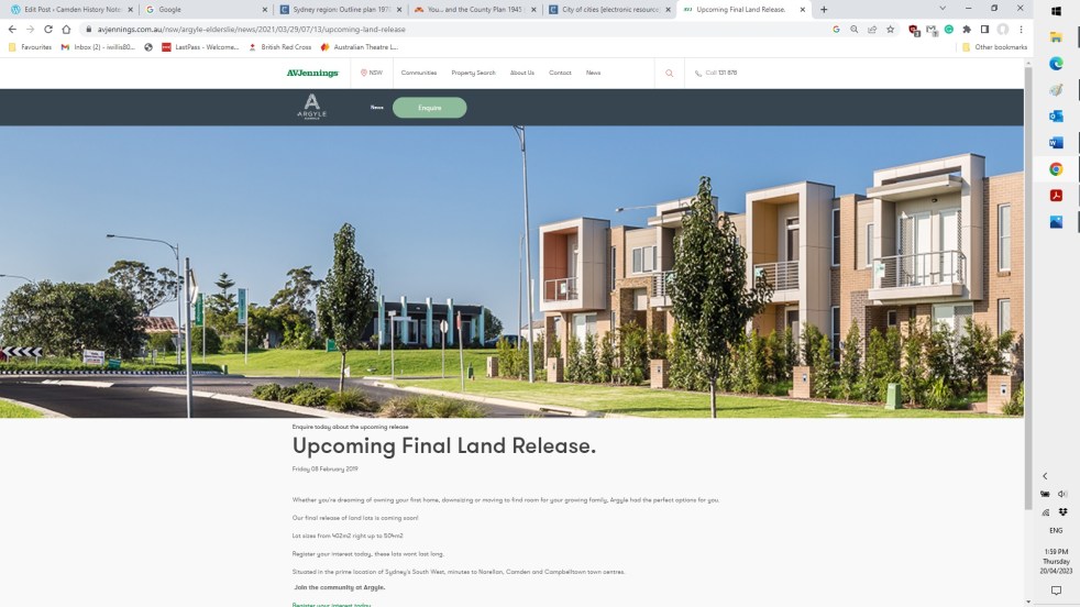
Elderslie land releases 2000-2023, the background and fancy estate names
The Elderslie area has been identified in Sydney’s strategic growth plans for land releases on the metropolitan rural-urban fringe. It is a valuable exercise to see how and when Elderslie was identified as part of Sydney’s planning framework.
Share this:

Share this:
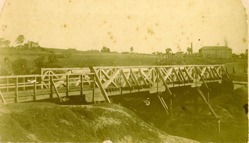
The Cowpastures bridge at the Nepean River crossing
Access across the Nepean River has been an issue since European settlement. The problem was solved by building a bridge with the first in 1826, the next in 1860 followed by 1900 and 1976.
Share this:

Share this:

Campbelltown City Council office extension 1982 – an example of mid-century modernism
In 1982 Campbelltown City Council had the official opening for the brutalist administration building. Combined with the adjacent 1964 modernist office building they are an outstanding example of mid-century modernism in the Macarthur region
Share this:

Share this:
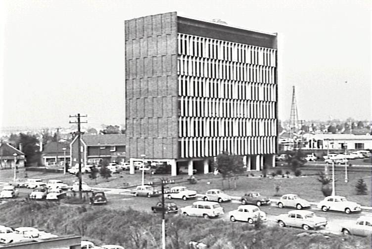
Exploring Campbelltown’s Mid-Century Modern Administration Building
The Campbelltown Council office building, completed in 1964, serves as an unrecognized icon of mid-century modernism, symbolizing the town's optimistic vision as a satellite city. Despite its structural significance and initial hopes for community development, later planning challenges undermined this vision, leaving the building's legacy complex and often overlooked.

