
The 'Camden Village' marketing strategy leverages nostalgia and historical authenticity to promote its charm as a getaway near Sydney. It celebrates Camden's heritage, exploring themes of community and continuity, while questioning the true nature of its village identity. This strategy taps into sentimental longings for simpler times, appealing emotionally to potential visitors.
Tag: Urban development

Navigating Australia’s Housing Crisis: Insights from Sydney’s Urban Fringe
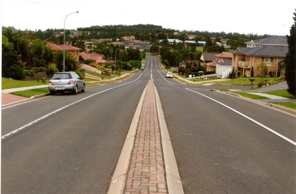
The complexities of addressing Australia's housing challenges, suggests an article from ABC News, on Sydney's urban fringes are not as simple as they might seem. While author Ian Willis explores how the growing population has created demand for housing, the reality often falls short of expectations. Many new residents, he writes, are drawn by promises of suburbia, face disillusionment due to inadequate infrastructure, high density, and unresolved issues like traffic congestion and housing quality. Willis argues that the ongoing crises reflect a disconnect between development aspirations and lived experiences, suggesting the need for improved planning and understanding of community needs.
Share this:

Share this:
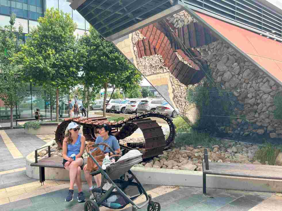
Exploring the ‘Infinity Tracks’ Art Installation in Oran Park
The 'Infinity Tracks' art installation in Oran Park honors the region's heavy haulage industry, highlighting the historical impact of the transport industry and Oran Park Town urban development. Commissioned in 2020 by Greenfields Development Co and TRN House, it enhances the forecourt's aesthetic while reflecting the area's economic growth and employment contributions from the haulage sector and urban development.
Share this:

Share this:

Camden Town Centre Enhancement Strategy: Stakeholder Concerns and Community Engagement
The 2014 Camden Town Centre Enhancement Strategy has faced controversy and distrust from residents and stakeholders, leading to a significant trust deficit. The proposed decked car park and lack of early and robust community engagement have fueled skepticism and discontent. Community consultation principles and the mayor's defense of the process are under scrutiny. Stakeholder concerns about legitimacy align with international practices.
Share this:

Share this:

Airds Shopping Mall demolition, the unmet expectations of mid-century modernism
The Airds shopping mall's future encapsulates the decline of mid-century modernism in the midst of urban neglect. Once a symbol of optimism, the area's decay reflects broader global trends in retail. From failed Radburn principles to public housing challenges, the mall's history mirrors the clash of modernism and neoliberalism in Campbelltown. Despite the despair former residents report that they recall happy memories and stories of hope growing up in the area.
Share this:

Share this:

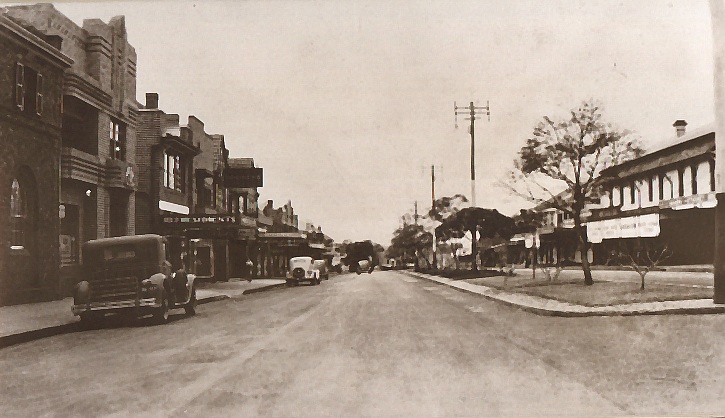
Yearning, Longing and The Remaking of Camden’s Identity: the myths and reality of ‘a country town idyll’.
This article discusses the concept of a "country town idyll" in Camden, an idealised version of a country town from an imagined past that uses history to construct imagery based on Camden's heritage buildings and other material fabrics. The paper delves into the origins of the idyll, examines its development, and investigates its validity in its contemporary context. It shows how its supporters have used history as a community asset to remake Camden's identity and explore how the 'country town idyll' has been used variously as a political weapon, a marketing tool, and a tourist promotion.
Share this:

Share this:
Camden Material and Colour Guide, a heritage building guide
Camden Material and Colour Guide In 2023, Camden Council published the Camden Material and Colour Guide. The guide was the initiative of the Camden Council Heritage Advisory Committee. The aim of the guide The Material and Colour Guide aims to provide a handy guide for owners of heritage buildings with practical tips on working with… Continue reading Camden Material and Colour Guide, a heritage building guide
Share this:

Share this:
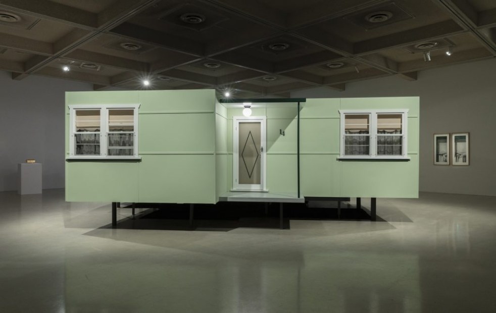
‘Fibro Majestic’: A Celebration of Mid-Century Housing at Campbelltown Arts Centre by Catherine O’Donnell
The "Fibro Majestic" exhibition at Campbelltown Arts Centre celebrates the historical significance of fibro housing in Australia, highlighting its role in post-war society. Artist Catherine O'Donnell's work reflects on the nostalgia, memories, and social contexts surrounding these humble structures, transforming perceptions of an architecture once deemed unattractive.
Share this:

Share this:
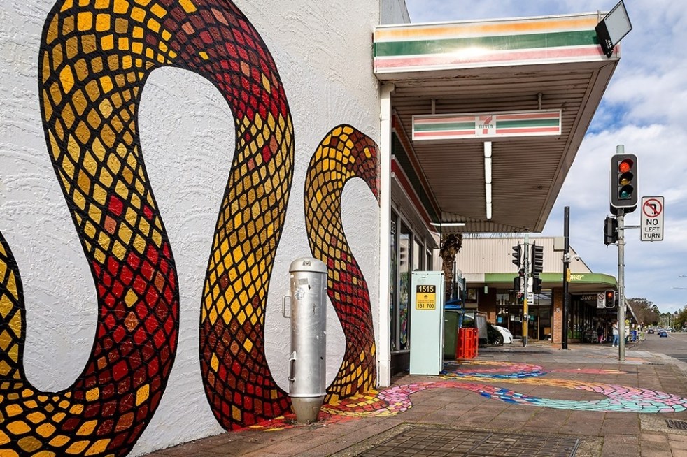
Public art at Campbelltown brightens up the Queen Street precinct
Public art is being used in the Campbelltown town centre to reinvigorate and revitalise the Queen Street precinct that has been subject to urban blight.
Share this:

Share this:
Elderslie land releases 2000-2023, the background and fancy estate names
The Elderslie area has been identified in Sydney’s strategic growth plans for land releases on the metropolitan rural-urban fringe. It is a valuable exercise to see how and when Elderslie was identified as part of Sydney’s planning framework.

