
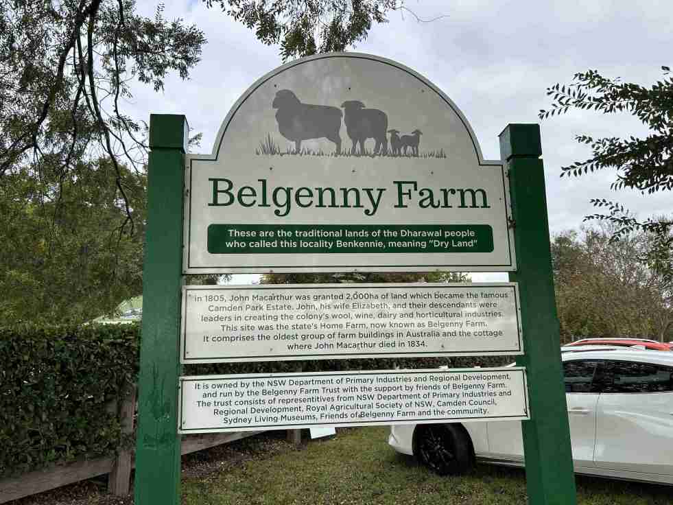
The Belgenny Farm Pioneer Farm Day successfully engaged visitors with Australia’s oldest farming complex, showcasing historical trades, games, and tours despite overcast weather. Families enjoyed activities like croquet and scavenger hunts, emphasizing the site's rich agricultural history and cultural significance. The event highlighted community involvement and fostered appreciation for heritage.
Category: Convicts

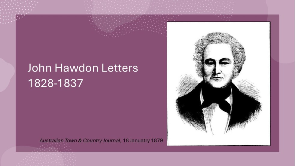
Insights from the Hawdon Letters: Colonial Life in NSW, Part 2, 1831-1833
John Hawdon's letters from New South Wales (1831-1833) reveal colonial life, highlighting farming challenges, isolation from England, and the high costs of communication. These letters provide insights into market conditions, crop successes, and family updates, showcasing the Hawdons' experiences and adaptations in a new land, while retaining original spelling and structure.
Share this:

Share this:
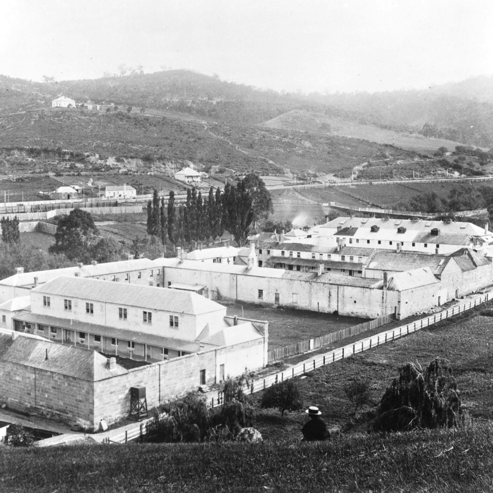
Public art in Hobart tells the story of female convicts in Van Diemen’s Land
Public art has been used in Hobart to reveal stories of female convicts that have been hidden in the shadows for decades on the Hobart waterfront and at the Cascades Female Factory.
Share this:

Share this:

The Camden district, 1840-1973, a field of dreams
The Camden district was historically significant, serving as a social and economic center for over a century. It integrated farming, mining, and community life, shaped by Aboriginal heritage and European settlement. However, modern developments and infrastructural changes led to its decline, transitioning to a regional identity tied to Macarthur area governance and branding.
Share this:

Share this:
Making Camden History
Making Camden History tells the story of how the history of the Camden District has been written from the 19th century. It is the history of the history of the local area.
Share this:

Share this:
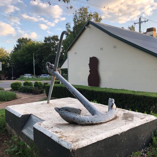
John Oxley’s anchor lost for 34 years
New evidence has emerged challenging previous conclusions about the John Oxley Memorial anchor in Camden. The anchor, a memorial from the British naval authorities, was lost for 34 years before being relocated for public access. John Oxley, an important colonial figure, has multiple commemorations in New South Wales related to his historical significance.
Share this:

Share this:

The Camden story, an evolving project
The Camden story, a continually evolving project that details some of the parts of the local story.
Share this:

Share this:
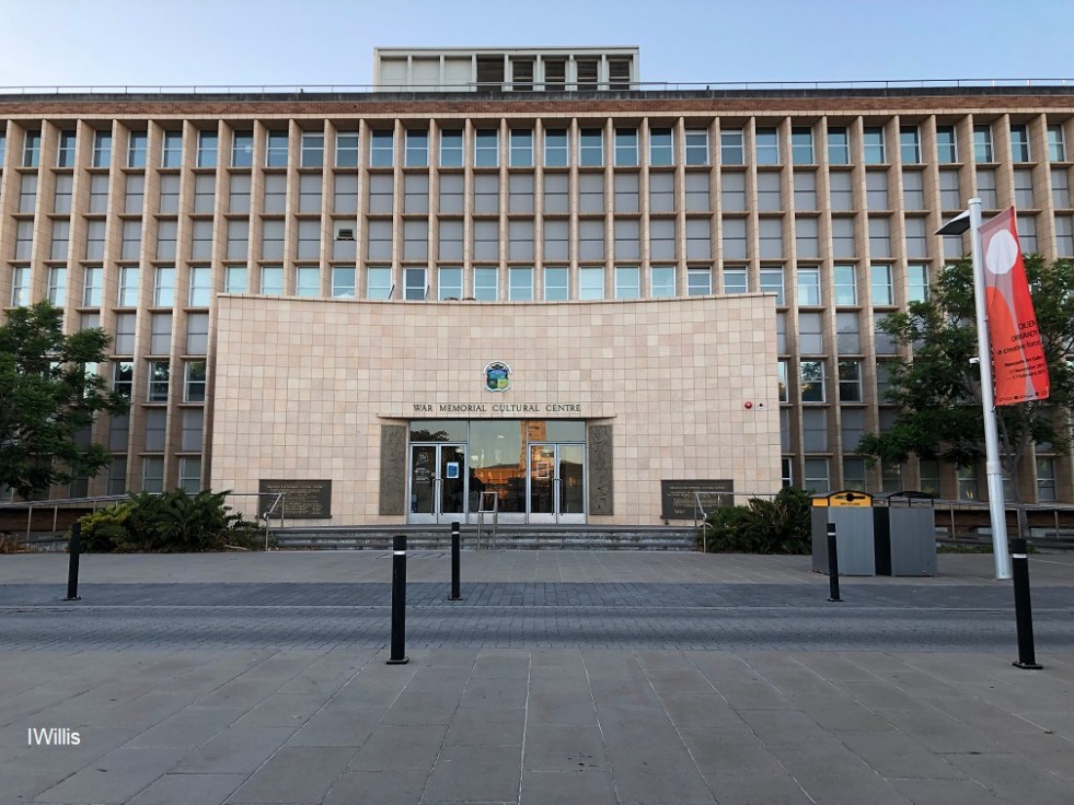
Newcastle modernism delights
Newcastle modernism delights around the Civic Park precinct include the War Memorial Cultural Centre, NESCA House, Northumberland House and the former Salvation Army Men's Hostel.
Share this:

Share this:
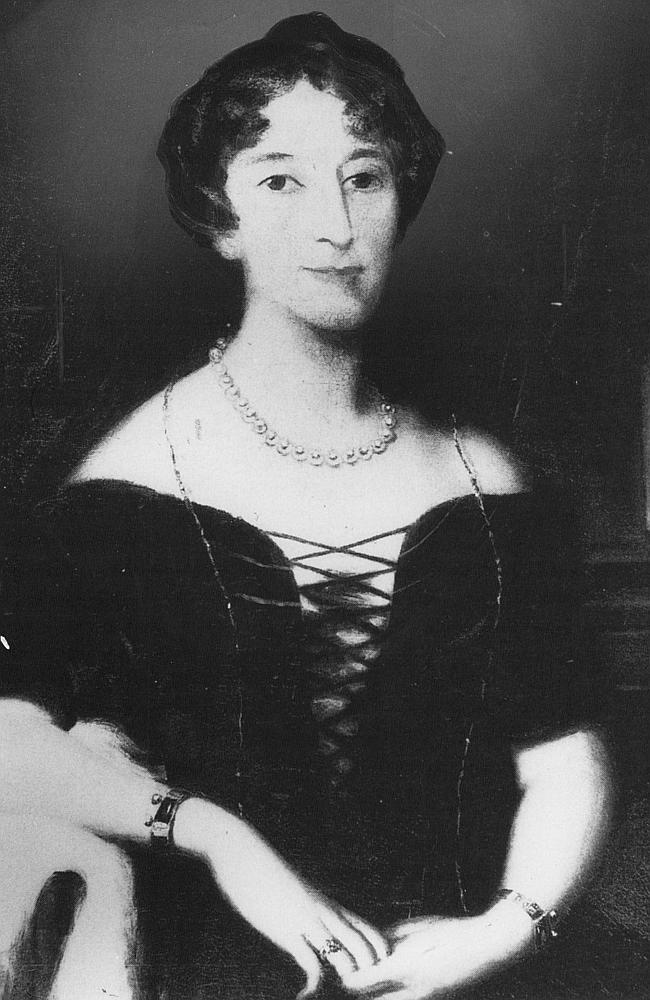
Celebrity author at Camden Museum
Author Michelle Scott Tucker recently spoke at the Camden Museum about her new book Elizabeth Macarthur A Life at the Edge of the World
Share this:

Share this:
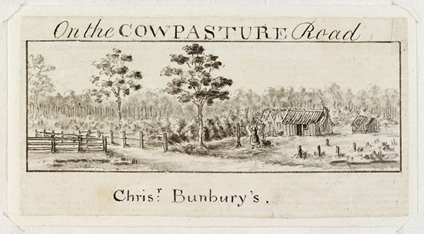
The Cowpastures Project
The Cowpastures was one of the earliest sites of European settlement in Australia

