
The redevelopment of Narellan Town Centre in 2017 enhanced its community space through placemaking, incorporating public art and amenities. Valued at $200 million, the extension nearly doubled its size, accommodating 100+ retailers and encouraging social interactions. The design reflects local history, fostering cultural identity and community engagement, achieving successful early usage by families.
Category: Railway

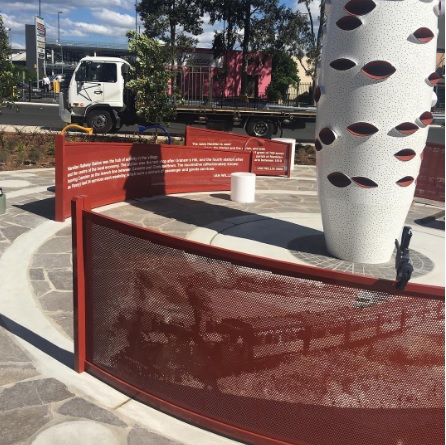
Exploring Camden’s Railway Heritage: Pansy and Its Timeless Stories
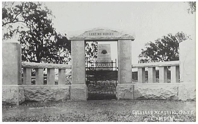
The Camden branch line, with its famous locomotive Pansy, holds a special place in the memories of locals and visitors. Operating from 1882 to 1963, it served as a lifeline for the community, transporting goods, passengers, and even wartime heroes. Despite its eventual closure, remnants of the line can still be seen today.
Share this:

Share this:

Camden, a Macarthur family venture
The establishment of Camden, New South Wales, the town in 1840, was a private venture of James and William Macarthur, sons of colonial patriarch John Macarthur, at the Nepean River crossing on the northern edge of the family’s pastoral property of Camden Park. The town’s site was enclosed on three sides by a sweeping bend in the Nepean River and has regularly flooded the surrounding farmland and lower parts of the town.
Share this:

Share this:
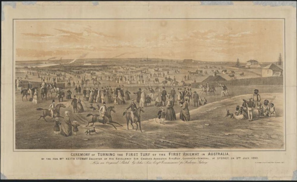
A Camden connection to the first railway line in New South Wales
26 September 1855 A forgotten anniversary of Sydney’s Central Railway Station On 26 September 1855, the first train left the Sydney terminus, a ‘tin shed’, with great pomp and ceremony and thus began the great railways of New South Wales. The ‘tin shed’ was replaced by two further buildings, one opened in 1874, and the current grand Victorian edifice of brick and sandstone in 1906.
Share this:

Share this:
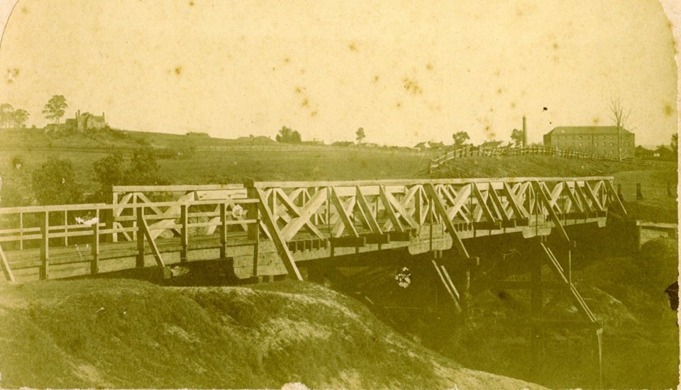
The Cowpastures bridge at the Nepean River crossing
Access across the Nepean River has been an issue since European settlement. The problem was solved by building a bridge with the first in 1826, the next in 1860 followed by 1900 and 1976.
Share this:

Share this:
Camden, the best preserved country town on the Cumberland Plain
The historic town of Camden is hailed by architect Hector Abrahams as the best-preserved country town on the Cumberland Plain. Established in 1840, it offers a glimpse of Victorian and early 20th-century charm. Visitors can explore its heritage precinct, rural landscapes, historic villages, and even relive the town's aviation history.
Share this:

Share this:
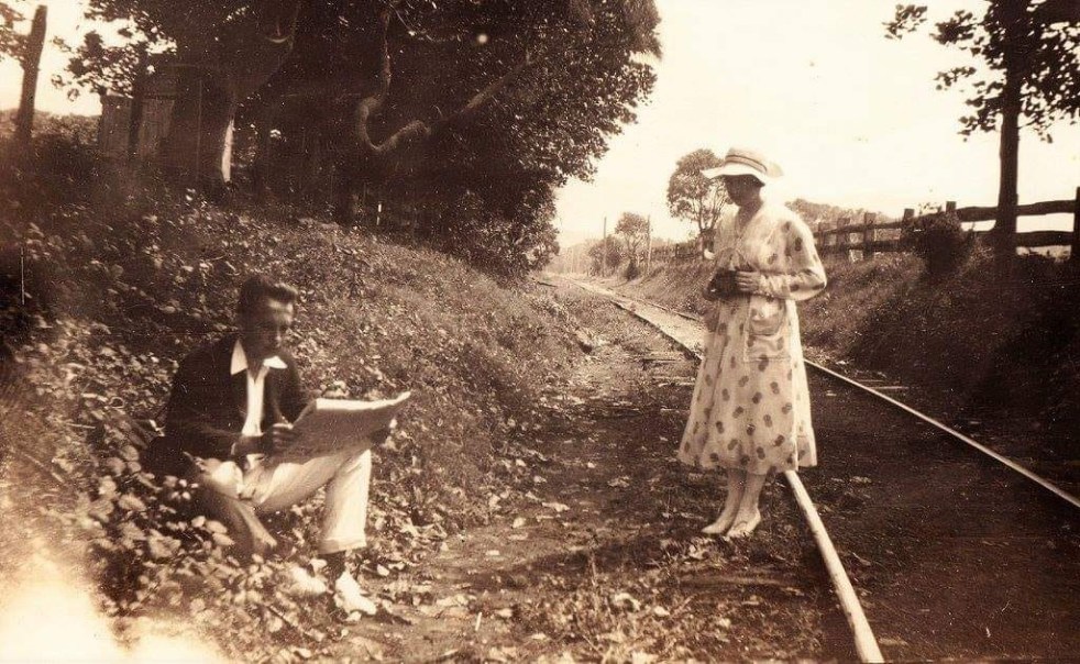
The mysteries of a photograph
How the mysteries of a pretty picture from yesteryear allows you to peel back the layers of the past. Each layer has a meaning and a story that is told by the historian. The stories provide context for the photograph and give it greater meaning.
Share this:

Share this:
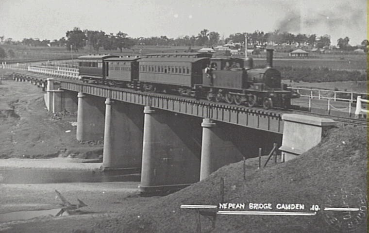
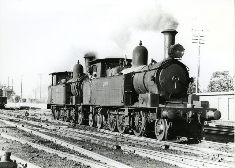
Pansy the Camden locomotive
The Camden train affectionately called Pansy is a distant memory that rekindles many memories and a nostalgia for the past.
Share this:

Share this:

The Camden story, an evolving project
The Camden story, a continually evolving project that details some of the parts of the local story.
Share this:

Share this:

History Magazine photoshoot for RAHS captures a window into the past in Camden
A photo shoot for the History Magazine of the Royal Australia Historical Society at Camden NSW captures a window into the past.

