
The complexities of addressing Australia's housing challenges, suggests an article from ABC News, on Sydney's urban fringes are not as simple as they might seem. While author Ian Willis explores how the growing population has created demand for housing, the reality often falls short of expectations. Many new residents, he writes, are drawn by promises of suburbia, face disillusionment due to inadequate infrastructure, high density, and unresolved issues like traffic congestion and housing quality. Willis argues that the ongoing crises reflect a disconnect between development aspirations and lived experiences, suggesting the need for improved planning and understanding of community needs.
Tag: Urbanism

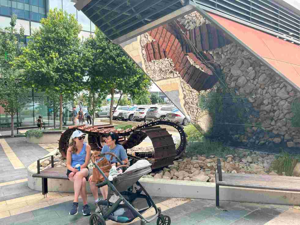
Exploring the ‘Infinity Tracks’ Art Installation in Oran Park
The 'Infinity Tracks' art installation in Oran Park honors the region's heavy haulage industry, highlighting the historical impact of the transport industry and Oran Park Town urban development. Commissioned in 2020 by Greenfields Development Co and TRN House, it enhances the forecourt's aesthetic while reflecting the area's economic growth and employment contributions from the haulage sector and urban development.
Share this:

Share this:

Airds Shopping Mall demolition, the unmet expectations of mid-century modernism
The Airds shopping mall's future encapsulates the decline of mid-century modernism in the midst of urban neglect. Once a symbol of optimism, the area's decay reflects broader global trends in retail. From failed Radburn principles to public housing challenges, the mall's history mirrors the clash of modernism and neoliberalism in Campbelltown. Despite the despair former residents report that they recall happy memories and stories of hope growing up in the area.
Share this:

Share this:
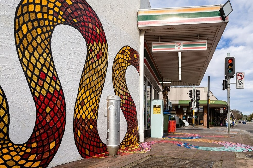
Public art at Campbelltown brightens up the Queen Street precinct
Public art is being used in the Campbelltown town centre to reinvigorate and revitalise the Queen Street precinct that has been subject to urban blight.
Share this:

Share this:
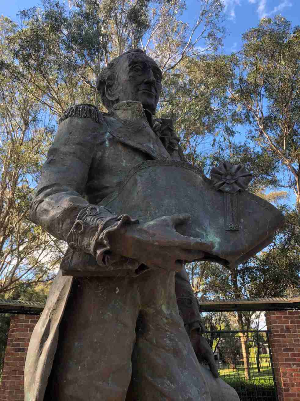
Governor Hunter, a Cowpastures memorial at Mount Annan
The statue of Governor Hunter in the Governors Green Park at Mount Annan is another celebration of the history of the Cowpastures.
Share this:

Share this:
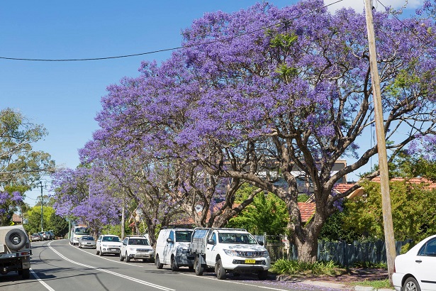
Experience Camden’s Vivid Jacaranda Blooms
Jacaranda trees in bloom create anticipation and excitement in November each year in Camden. The purple haze is an indication that summer and Christmas are not far away. The colours attract locals and visitors to the town centre particularly after a November shower.
Share this:

Share this:

Campbelltown City Council office extension 1982 – an example of mid-century modernism
In 1982 Campbelltown City Council had the official opening for the brutalist administration building. Combined with the adjacent 1964 modernist office building they are an outstanding example of mid-century modernism in the Macarthur region
Share this:

Share this:

The Camden district in 1939
The 1939 Camden district concept was developed in the 1990s by UOW historian Dr Ian Willis as part of his research on the effect of the Second World War on Camden township.
Share this:

Share this:
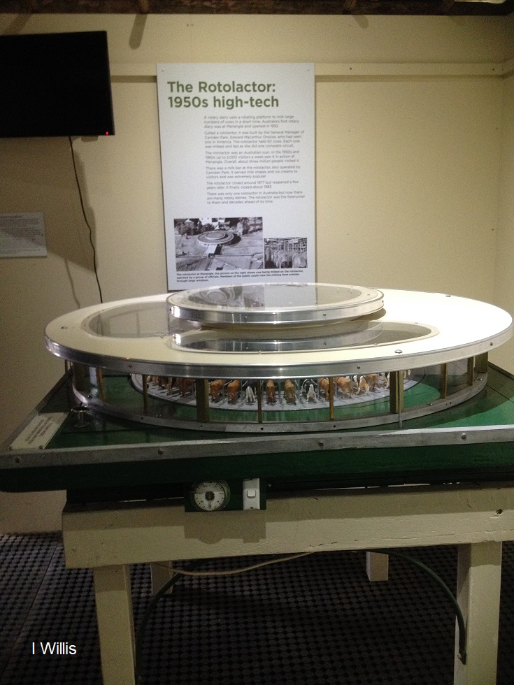
The Rotolactor, a Menangle milking marvel
The Rotolactor was Menangle's milking marvel. A rotating dairy that was a tourism attraction and an example of industrial modernism on the colonial property Camden Park estate.
Share this:

Share this:

Going to London
Going to London was an experience for thousands of young single Australian born women in the 20th century.

