
The Centre for Independent Studies argues that NSW heritage laws exacerbate the housing affordability crisis by preserving unremarkable buildings, thus restricting development. It critiques a narrow economic view of heritage that neglects community values, highlighting that a broader understanding of heritage's social and economic benefits is essential for sustainable urban planning.
Tag: Camden Town Centre


Camden Council vote on listing the Camden Township on the State Heritage Register
On 11 March 2025, Camden Council discussed a motion by Councillor Peter McLean to list Camden Township on the State Heritage Register, citing its significant historical and cultural value. Despite support from the Camden Historical Society and several councillors, the motion was ultimately defeated in a 6-3 vote, with concerns raised about its impact on businesses.
Share this:

Share this:
Camden Cottage Hospital – foundation and early days
By the 1890s, Camden's economy depended on dairy, but health concerns arose due to contaminated water and infectious diseases like scarlet fever. In response, the community pushed for a cottage hospital, leading to its opening in 1899. Local efforts highlighted the crucial link between health and the dairy industry's sustainability.
Share this:

Share this:
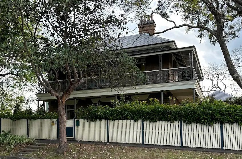
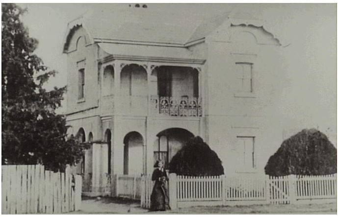
Dr Crookston’s Estate: A New Chapter in Camden’s Heritage
Dr Crookston's house and garden in Camden has been revitalized into an entertainment venue, preserving its rich history. New owners Shane and Rhiannon Smith manage this adaptive reuse, offering various activities that enhance heritage tourism. The estate now fosters local pride while contributing to economic growth, transforming the once-closed site into a vibrant community asset.
Share this:

Share this:

Camden Town Centre Enhancement Strategy: Stakeholder Concerns and Community Engagement
The 2014 Camden Town Centre Enhancement Strategy has faced controversy and distrust from residents and stakeholders, leading to a significant trust deficit. The proposed decked car park and lack of early and robust community engagement have fueled skepticism and discontent. Community consultation principles and the mayor's defense of the process are under scrutiny. Stakeholder concerns about legitimacy align with international practices.
Share this:

Share this:

Camden, a Macarthur family venture
The establishment of Camden, New South Wales, the town in 1840, was a private venture of James and William Macarthur, sons of colonial patriarch John Macarthur, at the Nepean River crossing on the northern edge of the family’s pastoral property of Camden Park. The town’s site was enclosed on three sides by a sweeping bend in the Nepean River and has regularly flooded the surrounding farmland and lower parts of the town.
Share this:

Share this:
Camden Heritage Conservation Area – an English-style village in the Cowpastures
The Macarthur private village of Camden was located in the English style countryside of the Cowpastures countryside with its gentry estates and villages. Founded in 1840 it was all part the British imperial imperative and the settler colonial project that came with it.
Share this:

Share this:
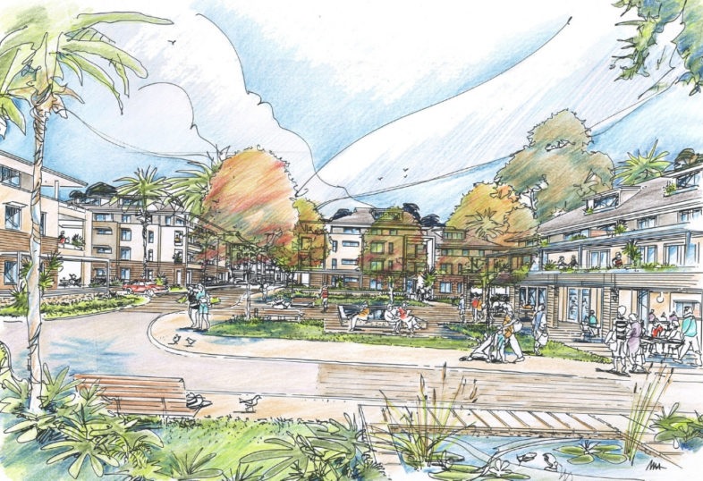
Former Camden High school site has a new retirement village development
The old Camden High site will be reborn as a retirement village

