
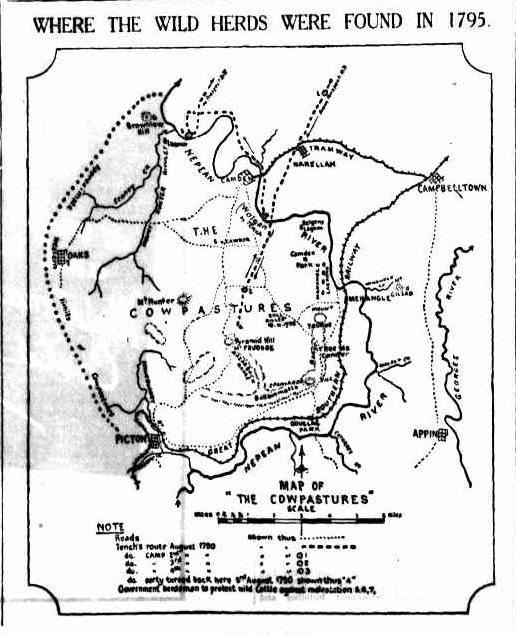
A cultural landscape
The Cowpastures emerged as a regional concept in the late 18th century. It started with the story of the cattle of the First Fleet that escaped their captivity at the Sydney settlement.
The Cowpastures region was a culturally constructed landscape that ebbed and flowed with European activity. Initially, it grew around the government reserve established by Governor King and then developed into a locality name.
Regionalism in the Cowpastures
Geographers call this type of area a functional region. A functional region is based on horizontal linkages within a particular area that are, to some extent, self-contained. It is usually an identifiable cohesive unit with external linkages to neighbouring regions. The regional boundaries can be either natural features, cultural characteristics, or boundaries used for ad hoc administrative arrangements.
Environmental history, a multidisciplinary approach, is a useful way into a regional study like the Cowpastures. This would cover the physical and cultural landscapes.
The boundaries of the Cowpastures region were both culturally derived and natural, where the landforms restricted and constrained European activity. The story of the Cowpastures region has many layers that can be peeled back to reveal its complexities and interactions over time and space.
The evidence makes it possible to identify and construct a functional region around the Cowpastures from 1793 to 1840. The Cowpastures region was a colonial administrative area, a locality, and a geographic area. It was the fourth locality of European occupation in the colony of New South Wales.
The story of the wild cows and more, a cultural landscape
The story of the Cowpastures begins with the wild cows. The First Fleet left England in 1787 and HMS Sirius and collected 4 cows and 2 bulls at the Cape of Good Hope on the way out to New South Wales. They were Cape cattle.
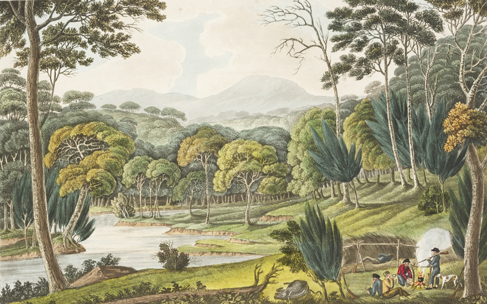
The cattle did not think much of their new home and after their arrival, they took off within 5 months of being landed and disappeared. The cattle escaped and found heaven on the Aboriginal-managed pastures of the Nepean River floodplain. The cattle occupied and seized the territory of the Aboriginal people who were wary of these horned beasts.
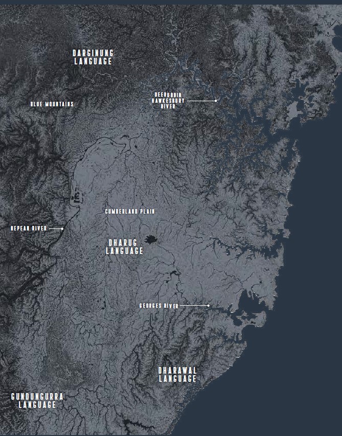
Before the Cowpastures district was even an idea, the area was the home for ancient Aboriginal culture based on Dreamtime stories. It was the land of the Dharawal, Gandangara, and Dharug Aboriginal language groups.
Governor Macquarie referred to the Murringong clan of the Dharawal language group as the ‘Cow-Pastures Tribe’ in 1810. (Atkinson, 228)
In 1795, an Aboriginal told a convict hunter the story of the cattle. The Aboriginal then told an officer and informed Governor Hunter. Hunter sent Henry Hacking, an old seaman, to investigate the story.
After confirmation Governor John Hunter and Captain Waterhouse, George Bass and David Collins head off from Parramatta, crossing the Nepean River on 17 November 1795.
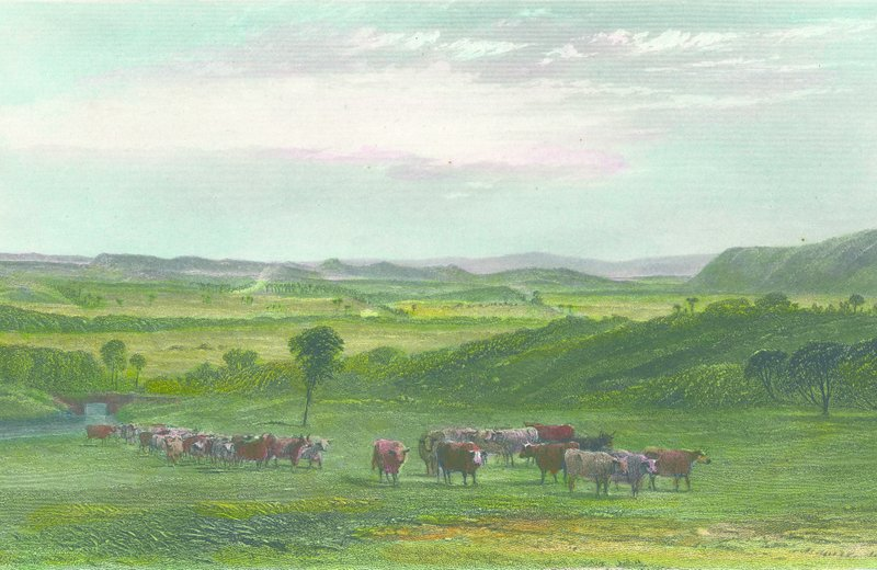
The party climbed a hill (Mt Taurus), spotted the cattle, and named the Cowpastures area. Governor John Hunter marked area on maps ‘Cow Pasture Plains’ in the region of Menangle and elsewhere on maps south of Nepean. By 1806 the herd had grown to 3,000.
The Europeans seized the territory occupied by the wild cattle, allocated land grants, and displaced the Indigenous occupants. In their occupation, they created a new land in their own vision of the world.
A countryside made up of large pseudo-English-style-estates, an English-style common called The Cowpasture Reserve and government men to work it called convicts. The route that Governor Hunter took became the track to the area became known as the Cowpastures Road, starting at Prospect Hill and progressing to the crossing of the Nepean River.

In 1803 Governor King issued a proclamation in July 1803 banning any unauthorised entry south of the Nepean River to stop poaching of the wild cattle. (The Sydney Gazette and New South Wales Advertiser, Sunday 10 July 1803 page 1)
Governor King ordered that a constable be placed at the Cowpasture crossing of the Nepean River and that a small hut be built to house them on what would become the Elderslie side of river, the right bank. (Historic Records NSW Vol 5, pp. 719-720) The government reserve for the wild cattle was strengthened under the Macquarie administration.
Government Cowpastures Reserve
Bigge Report 1822-1823
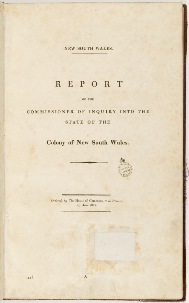
The government reserve was never really defined and just a vague area occupied by the Wild Cattle. The 1822 Bigge report described the Cowpastures this way:
The county of Camden contains the extensive tracts known by the name of the Cow Pasture, which which five of the cattle that were landed from His Majesty’s ship Sirius, soon after the first arrival of Governor Phillip, had strayed from their place of confinement. They were discovered in these tracts in the year 1795 by a convict, and appear to have been attracted to the spot, and to have continued there, from the superior quality of the herbage. Since that period their numbers have greatly increased: and they have latterly occupied the hilly ranges by which the Cow Pastures are backed on the south, and have been found in the deeper ravines of the hills of Nattai, and on the banks of the Bargo River. It does not appear, however, that they have penetrated beyond the Blue Mountains, or the barren tract that is called the Bargo Brush. The Cow Pastures extend northwards from the river Bargo to the junction of the river Warragumba and the Nepean. To the west they are bounded by some of the branches of the latter river and the hills of Nattai. They contain by computation about sixty thousand acres; and the soil, through varying in fertility, but always deepening and improving on the banks and margin of the Nepean, consists of a light sandy loam, resting upon a substratum of clay.
(JT Bigge, Report of the Commissioner of Inquiry on the state of agriculture and trade in the colony of NSW, 1823, Vol 3)
Public Buildings 1822 Bigge Report
Cawdor the centre of the government reserve
An extract from the 1822 Bigge Report described the Cawdor village at the northern end of the Cowpastures reserve. (Quote)
AT “CAWDOR”
A Brick Built House for the residence and accommodation of the Superintendant and principal Overseer of Government Stock in the Cow Pastures, reserving two rooms for the occasional accommodation of the Governor, with Kitchen and other necessary Out Offices, together with a good Kitchen Garden, well enclosed.
A Weather-boarded House for the accommodation of the Subordinate Overseers and Stockmen.
Four large paddock of 100 acres each enclosed with a strong Fence for the grazing of the Tame Cattle and Taming of the Wild Cattle, and cleared of the standing and dead Timber.
A Tanning House and Tan Yard for Tanning the Hides of the Wild Bulls for the use of Government.
Several other Paddocks and Stock-Yards enclosed for the Government Horses, Homed Cattle, and Sheep, grazing in other parts of the Government Grounds in the Cow Pastures. N.B.—Cawdor is the principal Run or Grazing Ground for the Government Horned Cattle and Sheep in the Cow Pastures on the western side of the Nepean River, consisting of about Fifteen thousand acresof land, and ought never to be alienated as long as it may be deemed expedient and advisable for the Government to possess and maintain Herds and Flocks.
(JT Bigge, Report of the Commissioner of Inquiry on the state of agriculture and trade in the colony of NSW, 1822, Vol 1)
End of Government Reserve
A regional identity had emerged by the time the government reserve was dissolved in the early 1820s and the land was sold off.
The usage of the Cowpastures as an identity extended into the second half of the 19th century.
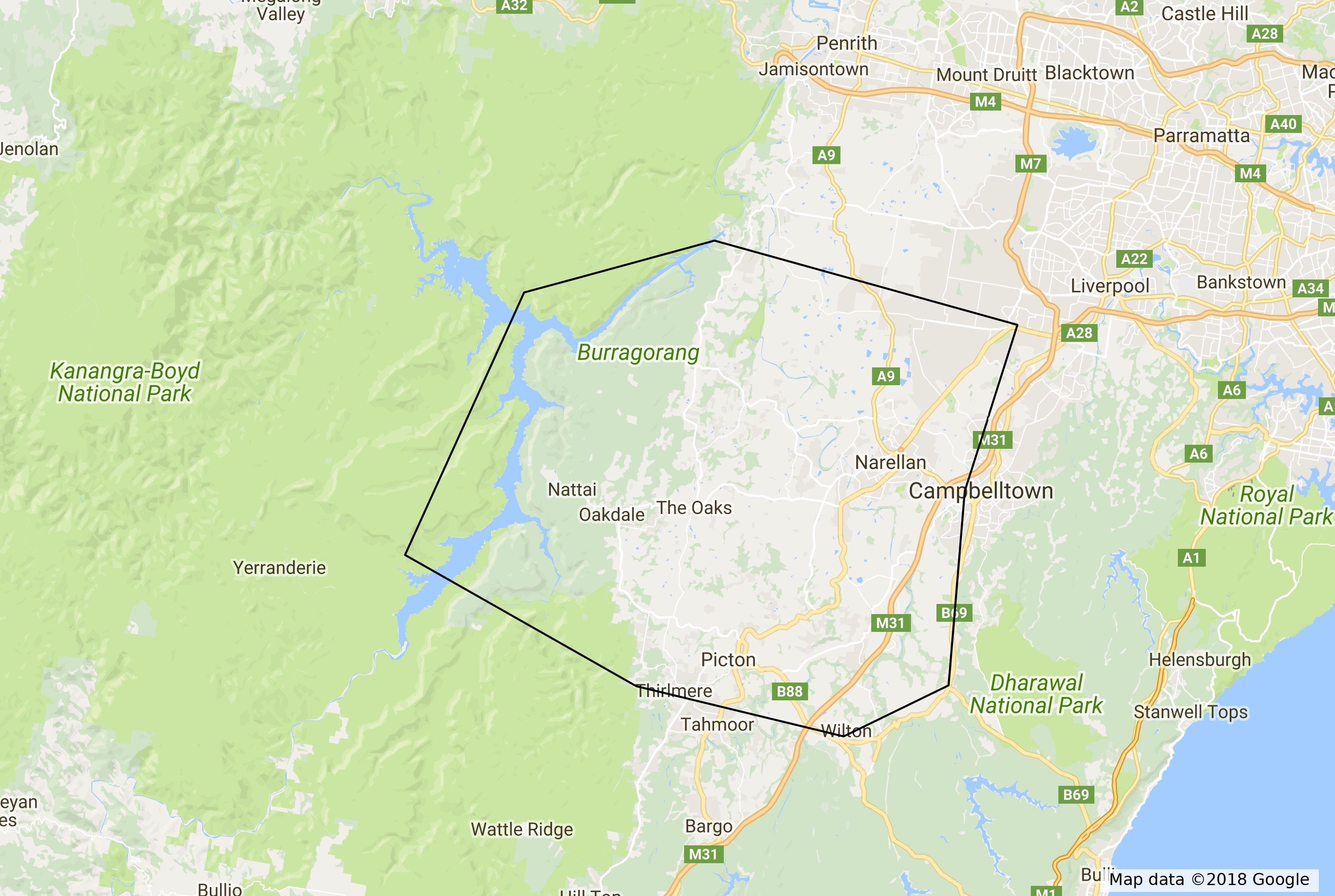
The extent of the Cowpastures region by the 1840s
The extent of the Cowpastures by the 1840s was:
- North – Bringelly Road – taking in the upper South Creek Catchment – west to Bents Basin and Warragamba River
- East – Wilton Road north through Appin – ridge dividing Nepean and Georges River catchments – generally the Appin Road – following ridgeline north dividing Bow Bowing Creek and South Creek.
- South – Stonequarry Creek catchment – bordering Bargo Brush – line following Wilton Road in the east – through Thirlmere – ridge line between Stonequarry Creek and Bargo River – west to Burragorang Valley
- West – Burragorang Valley
Cowpastures as a regional identity
The graph below shows the usage of the locality name Cowpastures in newspapers listed on the National Library of Australia Trove Database in 2017 using QueryPic.
Usage of the locality name ‘Cowpastures’

The usage of the Cowpastures regional identity persisted into the late 19th century.
1836 Glendiver Estate
In 1836, the Glendiver Estate at The Oaks was advertised for sale, with the given address listed as The Cowpastures. The sale notice boasted that the estate was one of the finest dairy farms in the colony of New South Wales, with ‘the finest soil’ and ‘abundance of water’.
The notice claimed that the owner could run ‘double the stock’ of any other part of the colony because of the ‘beautiful district’. The estate for sale comprised 2,390 acres. The estate had 70 acres under wheat; the property suited a ‘wealthy grazier, horse or cattle-dealer’. (Australian (Sydney, NSW: 1824 – 1848), Friday 5 August 1836, page 4 (4))
1838, the estate of Narellan
In 1838, the estate of Narellan in the Cowpastures was advertised for sale on behalf of Francis Mowatt, consisting of a desirable homestead and 800 acres of ‘rich productive’ land. The property was fenced with 12 miles of fencing and watered by Narellan Creek. The property fronted the Cowpastures Road for ¾ of a mile.
The ‘commodious and comfortable’ cottage has ‘out-offices’, ‘excellent stables in good repair’. The garden has extensive fruit trees and a ‘grapery’. The sale also included household furniture, harnesses, saddlery, and ten horses. (Sydney Gazette and New South Wales Advertiser (NSW: 1803 – 1842), Saturday 3 February 1838, page 3)
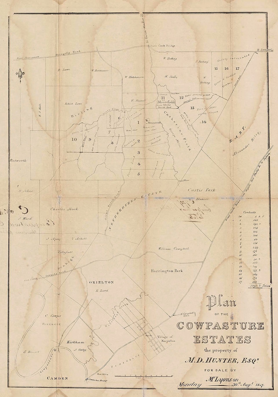
The Cowpasture Estates of 1840
In 1840, MD Hunter released the Cowpasture Estates on former properties owned by Sydney businessman John Dickson in the Sydney Monitor and Commercial Advertiser for auction by The Australian Auction Company. The properties offered were Orielton, Nonorrah, Moorfield, Eastwood, and Netherbyres, with a total of 7000 acres.
The properties were offered in lots ranging from 300 to 30 acres. The sale notice stated that Orielton had a ‘substantial Stone Barn, Threshing Mill, and Offices’, Nonorrah boasted a ‘spacious and elegant Cottage with Gardens, Stables, and Offices’. (Sydney Monitor and Commercial Advertiser (NSW: 1838 – 1841), Friday 5 June 1840, page 4 (4))
The northern extremity of the Cowpasture Estates
The northern extremity of the Cowpasture Estates was the Bringelly Road. (Sydney Monitor and Commercial Advertiser, 16 July 1840)
1843 Charles Cowper in the Cowpastures district
In 1843, the Sydney Morning Herald announced the presence of Charles Cowper in the Cowpasture district. Mr Cowper arrived at Mr James Chisholm’s Gledswood and joined a procession of horses followed by carriages and gigs of around 150 men and women. Mr Cowper took a seat in Mr Hassall’s carriage.
The procession was headed by Mr Hovel of Macquarie Grove. With Mr John Wild of Picton bringing up the rear of the carriages. The procession then moved to Mr Chisholm’s house on his property, Wivenhoe. (Sydney Morning Herald (NSW: 1842 – 1954), Tuesday 11 July 1843, page 2)
1843 GCP Living of Raby in the Cowpastures
In 1843, auctioneer Mr Stubbs announced the sale of the household effects, stock and farming implements for the insolvent estate of GCP Living of Raby in the Cowpastures.
The stock included heifers, bullocks, calves, dairy cows, steers, totalling 165 beasts and five horses. The farm equipment included dairy utensils and transportation equipment, such as carts, drays, and wagons. (Sydney Morning Herald (NSW: 1842 – 1954), Monday 6 November 1843, page 4 (3))
1843 SR Swaine of Narellan of the Cowpastures
In 1843, Mr Beck advertised the sale of furniture of the late Mr SR Swaine of Narellan of the Cowpastures. (Sydney Morning Herald (NSW: 1842 – 1954), Friday 15 December 1843, page 3)
1845 Bridge repairs in the Cowpastures
The Camden District Council meeting in 1845 reported on the state of repair of the bridge across the Cowpasture River. (Weekly Register of Politics, Facts and General Literature (Sydney, NSW: 1843 – 1845), Saturday 14 June 1845)
1847 Cowpastures population
In 1847, the Sydney Morning Herald reported on the population growth of the Cowpastures district, which had nearly reached 3,000 people. The press reports described the schools in the villages of Narellan, Cobbitty, and Camden, with the reporter visiting The Razorback and the properties of Raby, Gledswood, and Harrington Park.
The beauty of other properties mentioned in the story included Orielton, Wivenhoe, Denbigh, Matavai and Brownlow Hill. (Sydney Morning Herald (NSW: 1842 – 1954), Thursday 23 September 1847, page 2)
1870 shepherd Hugh McGuire in the Cowpastures
In 1870, the Australian Town and Country Journal reported a claim for compensation by the colonial government against a shepherd, Hugh McGuire, for services in supervising a team of men in the Cowpastures district. (Australian Town and Country Journal (Sydney, NSW: 1870 – 1907), Saturday 2 April 1870, page 10 (4))
1870 Camden flood in the Cowpastures
In 1870, the Sydney Morning Herald reported on a flood in Camden, located in the Cowpastures district. There was a heavy downpour with a violent gale that continued through Wednesday night on the 26 April. The lowlands presented a ‘uniform sheet of floodwater’ and were just below the ‘tow great floods of 1860’. (Sydney Morning Herald (NSW: 1842 – 1954), Wednesday 18 May 1870, page 7)
1877 Cowpastures River
In 1877, the Sydney Morning Herald featured a letter writer who, in the late 1870s, stated that the Nepean River was still commonly referred to as the Cowpastures River. (Sydney Morning Herald (NSW: 1842 – 1954), Saturday 24 March 1877, page 8)
1878 Campbelltown, next to the Cowpastures
In 1878, the Australian Town and Country Journal reported on the state of the town of Campbelltown and the surrounding area. This area was adjacent to the ‘fertile flats and alluvials’ of the Cowpastures. (Australian Town and Country Journal (Sydney, NSW: 1870 – 1907), Saturday 16 March 1878, page 20)
1882 wheat growing in the Cowpastures
The Australian Town and Country Journal reported on the state of the wheat growing in the colony in 1882. The story stated that wheat for bread making was grown in the ‘Camden, the Cowpastures, Hawkesbury, Hunter, etc’. In this area, hay production had replaced former wheat growing. (Australian Town and Country Journal (Sydney, NSW: 1870 – 1907), Saturday 2 September 1882, page 20)
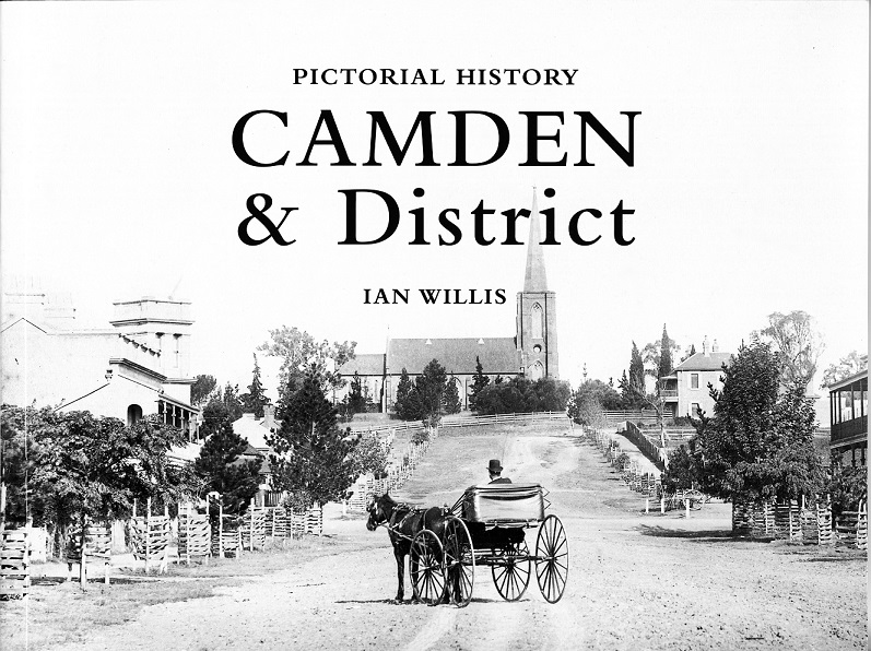
The end of the Cowpastures region, and a village is born
The beginning of the end of the Cowpastures region was the development of the Camden village in 1840 by the Macarthur family on their estate of Camden Park
The Camden district eventually replaced the Cowpastures regional identity.
Revival of the Cowpastures during the Interwar period
The sesquicentenary of the colonial settlement of New South Wales occurred in the early 1930s. It sparked a resurgence of the story of the Cowpastures.
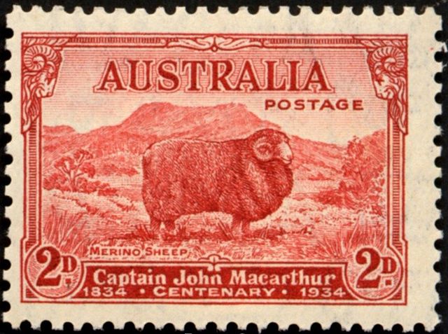
There was also the revival of national pioneering heroes. People felt they provided a sound basis for the story of a new nation. One of those heroes was John Macarthur of the Cowpastures.
Macarthur was the ultimate Cowpastures oligarch, and he had many colleagues who also fitted this description.
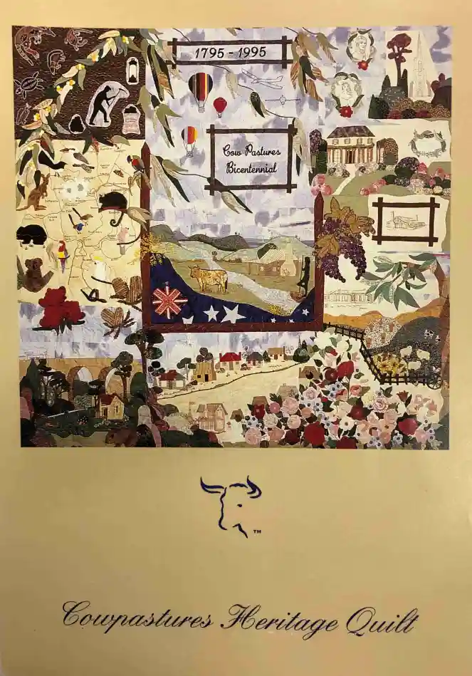
The Cowpastures Bicentenary
Following the success of the 1988 Australian Bicentenary and the publication of histories of Camden and Campbelltown, local officialdom decided that the anniversary of finding the ‘wild cattle’ deserved greater recognition.
Camden Mayor HR Brooking stated that a festival of events would’ highlight the historic and scenic significance of the area’ and called The Cowpastures Bicentenary.
A bicentenary committee of local dignitaries was formed, with the governor of New South Wales serving as patron, and representatives from local government, universities, and community organisations.
In the end, only 10% of all festival events were directly related to the history of the Cowpastures.
Golf tournaments, cycle races and music concerts were rebadged and marketed as bicentenary events, while Indigenous participation was limited to a few lines in the official programme and bicentennial documentation.
The legacy of the bicentenary is limited to records in the Camden Museum archives, a quilt, a statue, a park and a book. (Cowpasture Review 1995)
What is the significance of the Cowpastures today?
The Cowpastures is the fourth location of European occupation in the colony of New South Wales, with the naming of ‘Cow Pasture Plains’ by Governor Hunter in 1795.
The region plays a significant role in the cultural landscape of colonial New South Wales and the early Australian settler society project.
The Cowpastures area is now part of the Camden district and retains historical significance, with places like Belgenny Farm preserving the area’s history. (Belgenny Farm 2025)
The cows have developed a mythology all of their own and are part of the historiography of the dispossession of Indigenous people from their country. (Belgenny Farm 2025; O’Connell 2025; Probyn-Rapsey 2023)
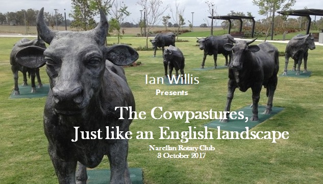
The Macarthur region hides the remnants of the Cowpastures in the form of monuments, memorials and artworks in plain sight. There is a diverse range of cultural heritage items and events, including memorials, parks, roads, artworks, exhibitions, and conferences.
I have begun compiling a list of cultural heritage items by documenting artworks and other items that reflect the Cowpastures theme.
More than this, I have drawn together other written work I have completed in a blog post called The Cowpastures Project.
References
Alan Atkinson (1988), Camden, Farm and Village Life in Early New South Wales. Oxford University Press, Melbourne.
Cowpastures Review and 1995 Calendar, Bicentennial Edition. Vol 1, 1995,
Belgenny Farm (2025). The Cowpastures and its wild cattle. [online] http://www.belgennyfarm.com.au. Available at: https://www.belgennyfarm.com.au/history/site-history/the-cowpastures-and-its-wild-cattle [Accessed 25 Jul. 2025].
Fiona Probyn-Rapsy 2023, Cattle Cowpastures and Country. Poster, ANU, Canberra. Online at https://archanth.cass.anu.edu.au/files/docs/2025/3/Fiona_Probyn-Rapsey_6_MArch_2023.pdf
Jan O’Connell 2025, 1795 Escaped cattle discovered at Cowpastures. Australian Food Timeline. https://australianfoodtimeline.com.au/escaped-cattle-cowpastures/
Updated 25 July 2025. Revised title to ‘Exploring the Cowpastures: A History of Settlement’ on 2 October 2024. Originally posted on 27 April 2018 as ‘The Cowpastures Region 1793-1840’.
Discover more from Camden History Notes
Subscribe to get the latest posts sent to your email.


21 thoughts on “Exploring the Cowpastures region: the early history of a settler society”
Comments are closed.