The township was established near the Government Hut that was as the accommodation used by the constables who were employed to guard the entrance of Cowpastures Reserve for the wild cattle in 1804 near the ford across the Nepean River. State Library of NSW SSV1B / Cowp D / 1
Carinya Cottage c.1890 is typical of brick Edwardian cottages across the district that was closely associated with the Paxton and Cross family. The cottage was unfortunately demolished in 2010 to make way for a new housing estate. (Camden Historical Society)
Little Sandy footbridge across the Nepean River at Camden c.1950 with a diving board in foreground. The location was a popular spot for swimming and other water activities. In the 1920s and 1930s this part of the river was the location of the Camden Swimming Club. The footbridge was constructed during the Second World War as a training exercise for troops from the Narellan Military Camp. (Camden Images)
The Nepean River has shaped the Camden’s sense of place and the image shows Nepean River below the Cowpasture Bridge in 1900 in the vicinity of the ford mentioned by Governor Macquarie. The low state of the river indicates the effect of the Federation drought (mid 1890s-1902) on the local area. (Camden Images/CA Poole)
Camden’s Argyle Street (the Hume Highway) in 1938 with the Rural Bank and Bank of New South Wales on the left. The setback and height of the buildings in Argyle has not changed in 70 years. The key buildings are still identifiable from the same location at the John Street round-about. (Camden Images)
The Georgian Revival style Bank of New South Wales building was constructed in 1936 at 121-123 Argyle St, Camden. The bank manager and his family lived on the upper level in a self-contained flat. (I Willis)
Central Camden in the early 1930s with the Woolpack Inn on the corner of John and Argyle Streets and the Commercial Banking Co building is on the opposite side of John Street. (Camden Images)
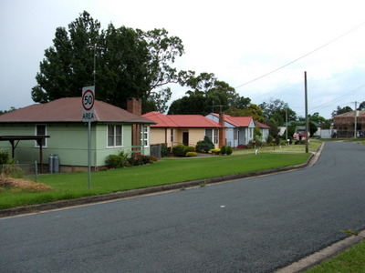
An Edwardian weatherboard cottage at 64 John Street Camden is typical of domestic architecture of the town and surrounding district in the early 20th century. At this time John Street was still unpaved, while guttering was constructed on block stone. ( J Riley)
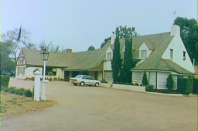
Located on the Hume Highway the Tudor style Camden Valley Inn was built in 1938 as a milk bar to sell the Gold Top Camden Vale milk brand from Camden Park. Designed by architect Cyral Ruwald and constructed by builder Herb English. (Camden Images)
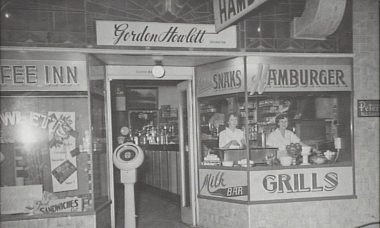
Cafes were a popular stop on the Hume Highway in central Camden serving milk shakes, hamburgers and mixed grills. Howlett’s Cafe was located at 159 Argyle Street show in this 1954 image. (Camden Images)
During the Second World War a number of airmen were killed in flying accidents in squadrons that statioed at RAAF Base at Camden Airfield. They are buried at Camden War Cemetery on a rise on Cawdor Road. (I Willis)Camden Airfield was the location of the RAAF Central Flying School at the beginning of the Second World War training pilots and air crew for the Empire Training Scheme.
Coal mining added wealth in the post-war years and quite a few fibro cottages were constructed at Elderslie to provide accommodation for mine workers. They are an identifiable part of Camden modernism. (I Willis)Local identity Llewella Davies was a member of the Camden Voluntary Aid Detachment, the paramilitary auxiliary of the Red Cross, that was part of the Second World War homefront war effort. (CHS0614)St John’s Church has been the moral heart of Camden’s sense of place since the church was constructed during the 1840s. It is located at the top of John Street which was unsealed in this image from the 1890s. (Camden Images)
The Hume Highway brought all aspects of modernism to the town from Sydney including motoring and consumerism at the Spanish Mission style Cooks Garage at the corner of Elizabeth and Argyle Street Camden in 1936 (Camden Images)


")

")
")
")


